Beech Island in Aiken County, South Carolina — The American South (South Atlantic)
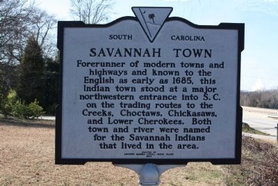
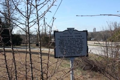
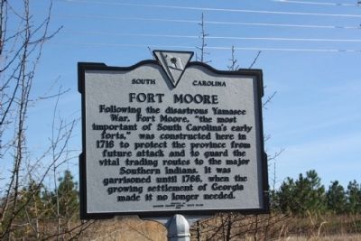
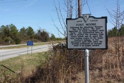
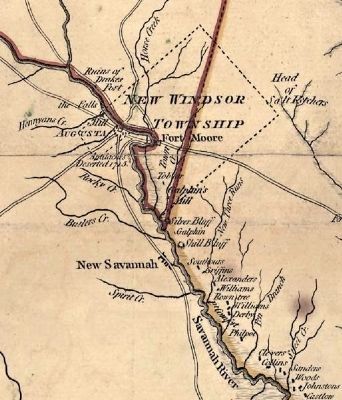
Savannah Town / Fort Moore
Inscription.
Erected 1985 by Andrews Masonic Lodge, Beech Island. (Marker Number 2-9.)
Topics. This historical marker is listed in these topic lists: Colonial Era • Forts and Castles • Native Americans • Settlements & Settlers. A significant historical year for this entry is 1685.
Location. 33° 26.359′ N, 81° 54.607′ W. Marker is on Beech Island, South Carolina, in Aiken County. Marker is on Sandbar Ferry Road (State Highway 28). Located at the East bank of the Savannah River. Touch for map. Marker is in this post office area: Beech Island SC 29842, United States of America. Touch for directions.
Other nearby markers. At least 10 other markers are within 4 miles of this marker, measured as the crow flies. Silver Bluff Baptist Church (approx. 2.3 miles away); Beech Island Baptist Church (approx. 2˝ miles away); Signal Corps Aviation School (approx. 2˝ miles away in Georgia); Historic Church (approx. 3 miles away); Home of Governor Telfair (approx. 3 miles away in Georgia); Redcliffe Plantation (approx. 3 miles away); Downer Institute & School / Downer School, 1924–1986 (approx. 3.1 miles away); This Memorial (approx. 3.1 miles away in Georgia); Prisoners Of War Memorial (approx. 3.1 miles away in Georgia); Georgia’s First School of Medicine (approx. 3.1 miles away in Georgia). Touch for a list and map of all markers in Beech Island.
Regarding Savannah Town / Fort Moore. National Register of Historic Places:
Fort Moore-Savano Town Site *** (added 1973 - Site - #73001670) •
Address Restricted, Beech Island
♦ Historic Significance: Event, Information Potential
♦ Area of Significance: Military, Historic - Aboriginal, Commerce
♦ Cultural Affiliation: Creek, Cherokee, Savano
♦ Period of Significance: 1650-1699, 1700-1749
♦ Owner: Private
♦ Historic Function: Defense
♦ Historic Sub-function: Fortification
♦ Current Function: Landscape
♦ Current Sub-function:
Underwater
Also see . . .
1. Savannah Town, South Carolina , Wikipedia entry. A thriving business developed around Indian traders ...Savannah Town gained a competitor with the 1735 founding of Augusta, five river miles upstream on the Georgia side of the river... (Submitted on March 2, 2010, by Mike Stroud of Bluffton, South Carolina.)
2. Fort Moore-Savano Town Site. The site of Fort Moore-Savano Town was strategic in the relations between the government of the Colony of South Carolina and a number of powerful Indian groups located along and west of the Savannah River. (Submitted on January 9, 2011, by Brian Scott of Anderson, South Carolina.)
3. Muscogee (Creek). The Muscogee (or Muskogee), also known as the Creek or Creeks, are a Native American people traditionally from the southeastern United States. (Submitted on January 9, 2011, by Brian Scott of Anderson, South Carolina.)
4. Choctaw. The Choctaw (alternatively spelt as Chahta, Chactas, Chato, Tchakta, Chocktaw, and Chactaw) are a Native American people originally from the Southeastern United States (Mississippi, Florida, Alabama, and Louisiana). (Submitted on January 9, 2011, by Brian Scott of Anderson, South Carolina.)
5. Chickasaw. The Chickasaw are Native American people originally from the region that would become the Southeastern United States (Mississippi, Alabama, Tennessee). (Submitted on January 9, 2011, by Brian Scott of Anderson, South Carolina.)
6. Cherokee. The Cherokee (Cherokee: ᏣᎳᎩ, Tsalagi) are a Native American people historically settled in the Southeastern United States (principally Georgia, the Carolinas and East Tennessee). (Submitted on January 9, 2011, by Brian Scott of Anderson, South Carolina.)
7. Yamasee War. The Yamasee War (also spelled Yemassee War) (1715–1717) was a conflict between British settlers of colonial South Carolina and various Native American Indian tribes, including the Yamasee, Creek, Cherokee, Chickasaw, Catawba, Apalachee, Apalachicola, Yuchi, Savannah River Shawnee, Congaree, Waxhaws, Pee Dee, Cape Fear, Cheraw, and others. (Submitted on January 9, 2011, by Brian Scott of Anderson, South Carolina.)
Additional commentary.
1. Fort Moore-Savano Town Site
Original Physical Appearance: Little is known of the original appearance of the Fort Moore-Savano Town other than the limited view provided by the archaeologist from the soil, supplemented by a few oblique documentary references to construction or conditions present during the period of occupation. There are no extant descriptions of a Savano Indian town to indicate the appearance of the site from about 1680 until the construction of Fort Moore in 1716 except to indicate the presence of one or more traders of factories in the town prior to 1716. Excavations by the Institute of Archeology and Anthropology have exposed one half of such a factory in use from about 1710 to the late 1740s. The factory consisted of a square of rectangular palisaded enclosure, 185 feet wide on a side, surrounding a number of timber and clay structures situated parallel to the walls. The trade house, as indicated by associated artifacts and an extension in the palisade wall with a narrow gate, was of timber construction with a timber and clay chimney. The central portion of the structure contained a full cellar, flanked on the east and west sides by later additions consisting of porches of lean-to type rooms. Other structures in the compound were constructed of logs of puncheons set vertically in trenches.
A description of Fort Moore was written in 1763 by George Johnson, shortly before it was abandoned:
"...on a beautiful and commanding situation, is another fort, named Fortmore, about one hundred and fifty miles west from Charles-town; it is built of six-inch planks nailed to posts of light wood, with four towers or bations on the angels, on which are small cannon mounted; on the inside is a banquet, with loop holes in the couttines for small-arms; it had neither ditch nor glacis, but very good barracks for one hundred men."
The remains of this fort have not been as yet identified, but more extensive archaeological work in the undisturbed portions of the site may disclose them.
Significance
The site of Fort Moore-Savano Town was strategic in the relations between the government of the Colony of South Carolina and a number of powerful Indian groups located along and west of the Savannah River. Indian groups associated with Fort Moore-Savano Town include the Savano, Creek, Yuchi, Cherokee, and Chickasaw. The Savano Indians occupied the bluff prior to the arrival of the traders, and remained until shortly after 1716. The Chickasaw Indians were used by the government of South Carolina to settle at Savano Town during the first half of the 18th century to serve as a buffer group between the Creek nation and the English settlements. The Creek, Yuchi, and Cherokee are mentioned in connection with the skin trade but only ceramics attributed to the Creek were found during excavation.
The construction of Fort Moore at Savano Town, along with construction of the Congaree Fort near the present city of Columbia, South Carolina, was a step toward not only the control of Indian groups in the interior, but toward the attempted monopoly of the southern skin trade. Although the actual position of Fort Moore has not been pinpointed on the bluff top, the location and excavation of a contemporary trade house or factory has provided valuable information concerning not only the type and variety of goods traded but insight into the lifestyle of the traders. The architectural information acquired from this sire will provide comparative data for locating and interpreting other sites in the state, such as the Congaree Fort.
Fort Moore served as a military deterrent even though no battles took place. Its presence may have prevented intervention by French or Spanish controlled Indian groups. A single shard of Spanish Majolica, found in an Indian pit, indicates some contact with the Spanish. The settlement of Augusta on the west side of the Savannah River marked the end of Fort Moore as a controlling factor in the skin trade and the fort was abandoned by late 1763. (Source: National Register nomination form.)
— Submitted January 9, 2011, by Brian Scott of Anderson, South Carolina.
Credits. This page was last revised on October 13, 2020. It was originally submitted on March 2, 2010, by Mike Stroud of Bluffton, South Carolina. This page has been viewed 3,924 times since then and 188 times this year. Photos: 1, 2, 3, 4, 5. submitted on March 3, 2010, by Mike Stroud of Bluffton, South Carolina. • Bill Pfingsten was the editor who published this page.
