Near Hereford in Cochise County, Arizona — The American Mountains (Southwest)
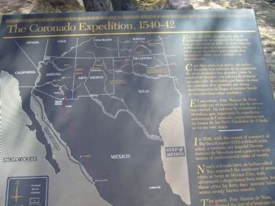
The Coronado Expedition, 1540-42
Inscription.
Spanish:
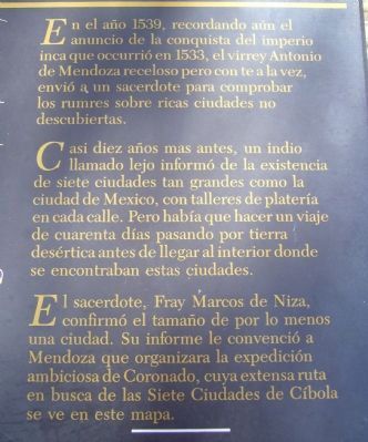
En el año 1539, recordando aún el anuncio de la conquista del imperio inca que occurrió en 1533, el virrey Antonio de Mendoza receloso pero con te a la vez, envió a un sacerdote para comprobar los rumres [rumores] sobre ricas ciudades no descubiertas.
Casi diez años mas antes, un indio llamadó lejo [Tejo] informó de la existencia de siete ciudades tan grandes como la ciudad de Mexico, con talleres de platería en cada calle. Pero había que hacer un viaje de cuarenta días pasando por tierra desértica antes de llegar al interior donde se encontraban estas ciudades.
El sacerdote, Fray Marcos de Niza, confirmó el tamaño de por lo menos una ciudad. Su informe le convenció a Mendoza que organizara la expedición ambiciosa de Coronado, cuya extensa ruta en busca de las Siete Ciudades de Cíbola se ve en este mapa.
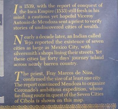
In 1539, with the report of conquest of the Inca Empire (1533) still fresh in his mind, a cautious yet hopeful Viceroy Antonio de Mendoza sent a priest to verify stories of undiscovered cities of wealth.
Nearly a decade later, an Indian called Tejo reported the existence of seven cities as large as Mexico City, with silversmith's shops lining their streets. Yet these cities lay forty days' journey inland across nearly barren country.
The priest, Fray Marcos de Niza, confirmed the size of at least one city. The report convinced Mendoza to organize Coronado's ambitious expedition, whose far-flung route in quest of the Seven Cities of Cibola is shown on this map.
Topics. This historical marker is listed in these topic lists: Exploration • Notable Events. A significant historical year for this entry is 1539.
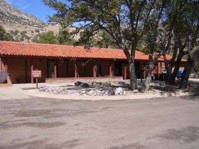
Location. 31° 20.774′ N, 110° 15.206′ W. Marker is near Hereford, Arizona, in Cochise County. Marker can be reached from East Montezuma Canyon Road.. Marker is in front of the visitor center at the Coronado National Memorial. Touch for map. Marker is at or near this postal address: 4101 East Montezuma Canyon Road, Hereford AZ 85615, United States of America. Touch for directions.
Other nearby markers. At least 8 other markers are within 16 miles of this marker, measured as the crow flies. Mormon Battalion (approx. 8½ miles away); Lehner Mammoth Kill Site (approx. 9.8 miles away); Wheel of Progress (approx. 13½ miles away); POW/MIA Monument (approx. 13.7 miles away); Union Soldiers Buried in Historic Cemetery (approx. 13.8 miles away); "Unknown Soldiers" (approx. 13.8 miles away); Arizona Confederate Veterans Memorial (approx. 13.8 miles away); Fort Huachuca (approx. 15.6 miles away).
Additional commentary.
1. Marker has been removed
I searched around the area and asked a Ranger in the visitor center about the location of the marker. She told me it was removed about 2 years ago and didn't have any other information about it.
Thank you for this updated information.
— Submitted March 31, 2013, by Roger Studley of Benson, Arizona.
Credits. This page was last revised on June 16, 2016. It was originally submitted on March 6, 2010, by Bill Kirchner of Tucson, Arizona. This page has been viewed 2,125 times since then and 34 times this year. Photos: 1, 2, 3, 4. submitted on March 6, 2010, by Bill Kirchner of Tucson, Arizona. • Syd Whittle was the editor who published this page.


