Brentsville in Prince William County, Virginia — The American South (Mid-Atlantic)
The Public Lot
Brentsville
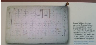
Prince William County Deed Book #8, 1820-1823, page 348
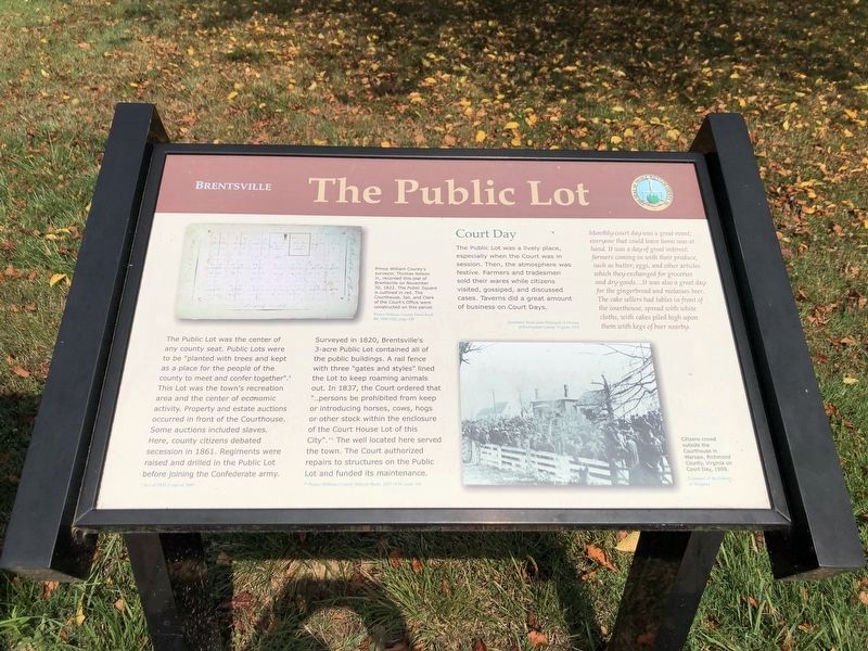
The Public Lot was the center of any county seat. Public Lots were to be “planted with trees and kept as a place for the people of the county to meet and confer together”.* The Lot was the town’s recreation area and the center of economic activity. Property and estate auctions occurred in front of the Courthouse. Some auctions included slaves. Here, county citizens debated secession in 1861. Regiments were raised and drilled in the Public Lot before joining the Confederate army.
* Acto of 1833, Code of 1849
Surveyed in 1820, Brentsville’s 3-acre Public Lot contained all of the public buildings. A rail fence with three “gates and styles” lined the Lot to keep roaming animals out. In 1837, the Court ordered that “…persons be prohibited from keep or introducing horses, cows, hogs or other stock within the enclosure of the Court House Lot of this City”.** The well located here served the town. The Court authorized repairs to structures on the Public Lot and funded its maintenance.
** Prince William County Minute Book, 1833-1836, page 106
Court Day
The Public Lot was a lively place, especially when the Court was in session. Then, the atmosphere was festive. Farmers and tradesmen sold their wares while citizens visited, gossiped, and discussed cases. Taverns did a great amount of business on Court Days.
Monthly court day was a great event; everyone that could leave home was at hand. It was a day of great interest; farmers coming in with their produce, such as butter, egs, and other articles which they exchanged for groceries and dry goods…It was also a great day for the gingerbread and molasses beer. The cake sellers had tables in front of the courthouse, spread with white cloths, with cakes piled high upon them with kegs of beer nearby.
Quotation: From John Wayland, A History of Rockingham County Virginia, 1912
(caption
Courtesy of the Library of Virginia
Erected 2007 by Prince William County and the Friends of Brentsville Courthouse Historic Centre.
Topics. This historical marker is listed in these topic lists: Colonial Era • Industry & Commerce • Settlements & Settlers. A significant historical month for this entry is November 1940.
Location. 38° 41.38′ N, 77° 29.981′ W. Marker is in Brentsville, Virginia, in Prince William County. Marker is on Bristow Road (County Route 806), on the right when traveling west. Touch for map. Marker is at or near this postal address: 12235 Bristow Road, Bristow VA 20136, United States of America. Touch for directions.
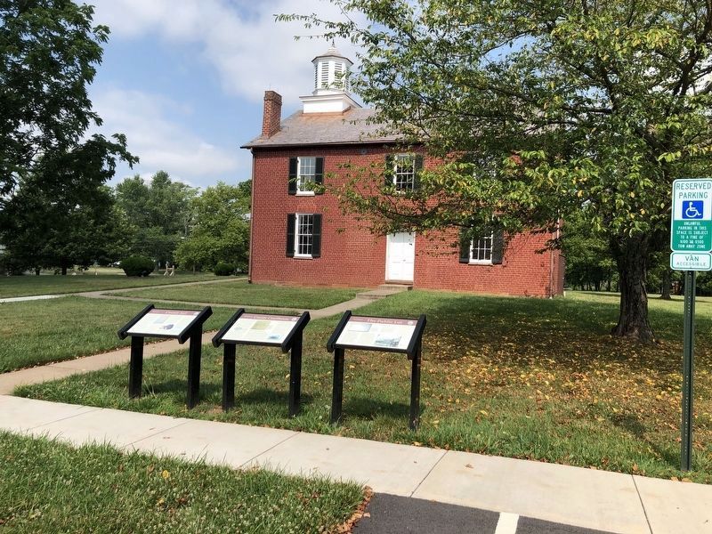
Other nearby markers. At least 14 other markers are within walking distance of this marker. County Courthouse (here, next to this marker); County Jail (here, next to this marker); Brentsville Courthouse (here, next to this marker); Brentsville Jail (here, next to this marker); Brentsville Courthouse Historic Centre (a few steps from this marker); Brentsville (a few steps from this marker);
a different marker also named Brentsville (within shouting distance of this marker); One-Room School (within shouting distance of this marker); The Town (within shouting distance of this marker); Clerk's Office (within shouting distance of this marker); Haislip-Hall House (within shouting distance of this marker); Tavern Square (within shouting distance of this marker); The Gallows (about 300 feet away, measured in a direct line); Tavern Cellar (about 300 feet away). Touch for a list and map of all markers in Brentsville.
Credits. This page was last revised on July 5, 2020. It was originally submitted on October 8, 2007, by Kevin W. of Stafford, Virginia. This page has been viewed 1,190 times since then and 13 times this year. Photos: 1, 2. submitted on July 5, 2020, by Devry Becker Jones of Washington, District of Columbia. 3, 4. submitted on October 8, 2007, by Kevin W. of Stafford, Virginia.


