Phoneton in Miami County, Ohio — The American Midwest (Great Lakes)
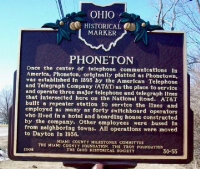
Phoneton
Once the center of telephone communications in America, Phoneton, originally platted as Phonetown, was established in 1893 by the American Telephone and Telegraph Company (AT&T) as the place to service and operate three major telephone and telegraph lines that intersected here on the National Road. AT&T built a repeater station to service the lines and employed as many as forty switchboard operators who lived in a hotel and boarding house constructed by the company. Other employees were bused in from neighboring towns. All operations were moved to Dayton in 1936.
Erected 2008 by Miami County Milestones Committee, The Miami County Foundation, The Troy Foundation, and The Ohio Historical Society. (Marker Number 30-55.)
Topics and series. This historical marker is listed in these topic lists: Communications • Industry & Commerce • Man-Made Features • Notable Places • Settlements & Settlers. In addition, it is included in the Ohio Historical Society / The Ohio History Connection series list. A significant historical year for this entry is 1893.
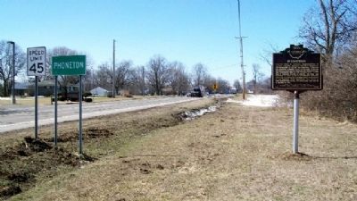
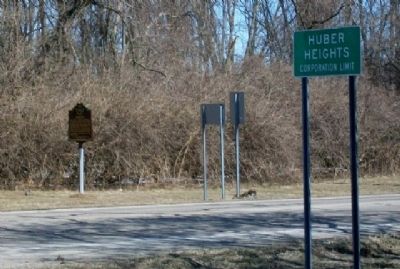
Location. 39° 53.859′ N, 84° 7.877′ W. Marker is in Phoneton, Ohio, in Miami County. Marker is on U.S. 40, ¼ mile east of Ohio Route 202, on the left when traveling east. Marker is about two miles north of I-70 Exit 36. Touch for map. Marker is at or near this postal address: 4620 E US Route 40, Tipp City OH 45371, United States of America. Touch for directions.
Other nearby markers. At least 8 other markers are within 5 miles of this marker, measured as the crow flies. A different marker also named Phoneton (approx. ¼ mile away); The Village of Tadmor / The National Road (approx. 1.8 miles away); Taylorsville (approx. 2.2 miles away); The Old National Road (approx. 2.4 miles away); Tadmor - Taylorsville (approx. 2½ miles away); The Crossroads of America (approx. 3.7 miles away); Miami and Erie Canal Lock 15 (approx. 4.8 miles away); Joseph Calvin Paul Memorial Boulevard (approx. 5 miles away).
Also see . . . Phoneton - The Village Founded by a Phone Company. My Miami County website entry (Submitted on July 11, 2022, by Larry Gertner of New York, New York.)
Credits. This page was last revised on July 11, 2022. It was originally submitted on March 8, 2010, by William Fischer, Jr. of Scranton, Pennsylvania. This page has been viewed 1,163 times since then and 68 times this year. Photos: 1, 2, 3. submitted on March 8, 2010, by William Fischer, Jr. of Scranton, Pennsylvania.


