Burlington in Alamance County, North Carolina — The American South (South Atlantic)
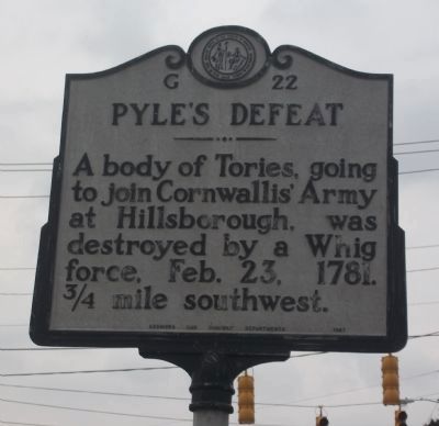
Pyle's Defeat
Erected 1967 by Archives and Highway Departments. (Marker Number G-22.)
Topics and series. This historical marker is listed in this topic list: War, US Revolutionary. In addition, it is included in the North Carolina Division of Archives and History series list. A significant historical date for this entry is February 23, 1865.
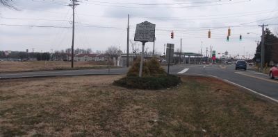
Location. This marker has been replaced by another marker nearby. It was located near 36° 3.626′ N, 79° 26.014′ W. Marker was in Burlington, North Carolina, in Alamance County. Marker was on Maple Avenue near Anthony Road, on the right when traveling south. From Interstate 85/40, exit 145. Travel south two blocks on Maple Avenue (also NC Hwy 49 South). Marker is on the right, in the fork in the road, where Anthony Road meets Maple Avenue. Touch for map. Marker was at or near this postal address: 2647 Maple Avenue, Burlington NC 27215, United States of America. Touch for directions.
Other nearby markers. At least 8 other markers are within 2 miles of this location, measured as the crow flies. A different marker also named Pyle's Defeat (a few steps from this marker); Michael Holt II (approx. 0.7 miles away); a different marker also named Pyle's Defeat (approx. 1.2 miles away); Alamance County War Memorial (approx. 1.8 miles away); Pine Hill Cemetery - Veterans Memorial (approx. 1.8 miles away); Graham College (approx. 1.9 miles away); Captain James W. White House (approx. 1.9 miles away); Kirk-Holden War (approx. 1.9 miles away). Touch for a list and map of all markers in Burlington.
Related marker. Click here for another marker that is related to this marker. This marker has been replaced with the linked marker which has different content.
Also see . . . myrevolutionarywar.com. (Submitted on March 11, 2010, by Paul Jordan of Burlington, N. C., U. S. A..)
Credits. This page was last revised on June 19, 2021. It was originally submitted on March 11, 2010, by Paul Jordan of Burlington, N. C., U. S. A.. This page has been viewed 1,853 times since then and 26 times this year. Photos: 1, 2. submitted on March 11, 2010, by Paul Jordan of Burlington, N. C., U. S. A.. • Bill Pfingsten was the editor who published this page.

