Penn Quarter in Northwest Washington in Washington, District of Columbia — The American Northeast (Mid-Atlantic)
Freedom Plaza
Civil War to Civil Rights
— Downtown Heritage Trail —
“I have a dream.”
Martin Luther King, Jr. August 1963
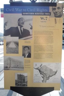
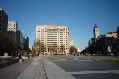
The block-long plaza at 13th and Pennsylvania Avenue just ahead to your left honors civil rights leader Martin Luther King with the name Freedom Plaza. King completed his historic “I Have a Dream” speech in the Willard Hotel adjacent to the plaza, before delivering it to a crowd of 200,000 at the Lincoln Memorial.
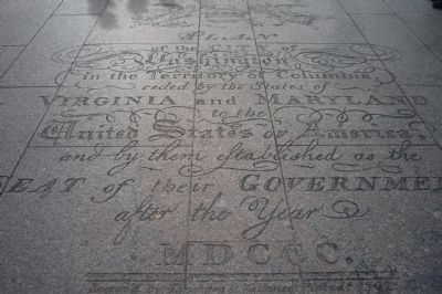
Freedom Plaza also recalls Washington’s first city planner, Major Pierre L’Enfant, with a partial image of his 1791 plan for the city inscribed on its surface. L’Enfant envisioned Pennsylvania Avenue as a great ceremonial street, the symbolic link between the Capitol (which he called the Congress’s House) and the White House (which he called the President’s House). Freedom Plaza’s Open space reinforces this symbolic connection, despite the fact that the Treasury Building blocks the view of the White House, the site a result of a questionable decision in 1836 by President Andrew Jackson.
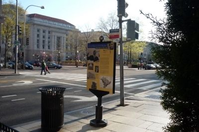
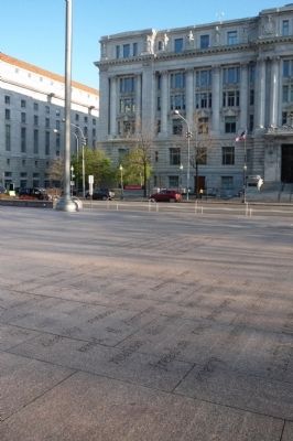
Directly across Freedom Plaza is the John A. Wilson Building, home of the government of the District of Columbia. The building was constructed in 1904 when the city was governed by three presidentially appointed commissioners. In 1974, the city regained the elected mayor and city council it had had before the Civil War, the result of a vigorous local campaign for “home rule.” The building is named for the late council chair, John A. Wilson, a champion of equal rights for D.C. citizens.
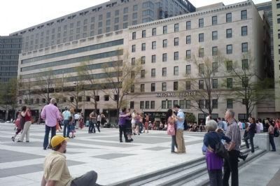
The National Theater whose marquee is visible straight ahead, has presented live theater on this spot since 1835. Rebuilt to meet the tastes of each generation, the historic “Theater of the Presidents” has entertained every First Family since its doors first opened. President Lincoln and his family attended this theater many times, and on the evening of the President’s assassination at Ford’s Theater, his son, Tad, was attending a performance here.
Erected by Cultural Tourism DC. (Marker Number W.7.)
Topics and series. This historical marker is listed in these topic lists: African Americans • Civil Rights • Entertainment • Government & Politics. In addition, it is included in the Downtown Heritage Trail, the Former U.S. Presidents: #07 Andrew Jackson, the Former U.S. Presidents: #16 Abraham Lincoln, and the Martin Luther King, Jr. series lists. A significant historical year for this entry is 1963.
Location. This marker has been replaced by another marker nearby. It was located near 38° 53.773′ N, 77° 1.762′
W. Marker was in Northwest Washington in Washington, District of Columbia. It was in the Penn Quarter. Marker was at the intersection of E Street Northwest and 13th Street Northwest, on the right when traveling west on E Street Northwest. Touch for map. Marker was at or near this postal address: 1299 Pennsylvania Avenue Northwest, Washington DC 20004, United States of America. Touch for directions.
Other nearby markers. At least 8 other markers are within walking distance of this location. A different marker also named Freedom Plaza (here, next to this marker); Brigadier General Casimir Pulaski (within shouting distance of this marker); Western Plaza, Pennsylvania Avenue (about 300 feet away, measured in a direct line); Daniel Patrick Moynihan Place (about 400 feet away); The Great Seal of the United States (about 400 feet away); The Washington Post (about 400 feet away); Discover DC / Metro Center (about 500 feet away); Marion Barry, Jr. (about 500 feet away). Touch for a list and map of all markers in Northwest Washington.
More about this marker. [Photo Captions]
above and left: Martin Luther King, Jr. completed his famous speech near here at the Willard Hotel, before delivering it to the crowds at the Lincoln Memorial in August 1963.
left and above: The District of Columbia Government is housed in the Beaux-Arts building across the avenue. Seen here in an aearly 20th-century photo, the structure was for years known as the District Building
until it was renamed the John A. Wilson Building in honor of the city's late council chairman, above.
right: Pierre L'Enfant's grand plan for the new federal city. A partial replica is embedded in the paving of Freedom Plaza.
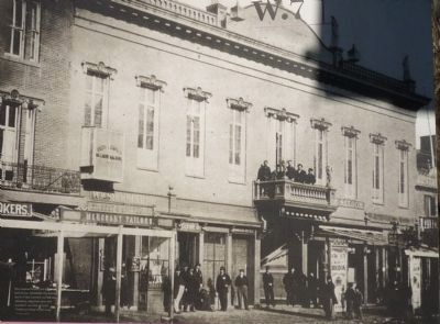
below: The Washington Post , seen here about 1917, once stood in the 1300 block of E Street.
Related marker. Click here for another marker that is related to this marker. This marker has been replaced with the linked marker which has slightly different text.
Also see . . .
1. Freedom Plaza. (Submitted on April 14, 2009, by Richard E. Miller of Oxon Hill, Maryland.)
2. Anne Brown - the original 'Bess' in Porgy and Bess - at the National Theater:. ... Following the show's run on Broadway, a United States tour started on January 27, 1936 in Philadelphia and traveled to Pittsburgh and Chicago before ending in Washington, D.C. on March 21, 1936. During the Washington run, the cast—as led by Todd Duncan—protested segregation at the theater. Brown said of her role in the protest, "I told them: 'I will not sing at the National. If my mother, my father, my friends, if Black people cannot come hear me sing, then count me out.' I remember Gershwin saying to me, 'You're not going to sing?' And I said to him, 'I can't sing!'." Eventually management gave in to the
demands, resulting in the first integrated audience for a performance of any show at the National Theatre. When the curtain came down on the final performance of Porgy and Bess, segregation was reinstated. ... (Submitted on March 11, 2010, by Richard E. Miller of Oxon Hill, Maryland.)
Additional keywords. Todd Duncan; Anne Brown; Porgy and Bess.
Photographed By Richard E. Miller, April 12, 2009
5. Freedom Plaza
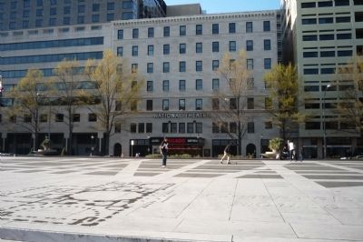
View from the north toward the John A. Wilson Building, across inscriptions on the plaza terrace that include tributes to Martin Luther King, Jr. and the spot where a commemorative time capsule was placed by the MLK National Holiday Commission on January 13, 1988.
Photographed By Richard E. Miller, April 4, 2010
7. Freedom Plaza - inscription at east end
"Plan of the City of Washington in the Territory of Columbia ceded by the States of Virginia and Maryland to the United States of America and by them established as the Seat of their Government after the Year MDCCC..."
Credits. This page was last revised on January 30, 2023. It was originally submitted on April 13, 2009, by Richard E. Miller of Oxon Hill, Maryland. This page has been viewed 5,041 times since then and 55 times this year. Last updated on March 11, 2010, by Richard E. Miller of Oxon Hill, Maryland. Photos: 1. submitted on April 13, 2009, by Richard E. Miller of Oxon Hill, Maryland. 2, 3, 4, 5. submitted on April 14, 2009, by Richard E. Miller of Oxon Hill, Maryland. 6. submitted on April 15, 2009, by Richard E. Miller of Oxon Hill, Maryland. 7, 8. submitted on April 8, 2010, by Richard E. Miller of Oxon Hill, Maryland. 9. submitted on November 19, 2011, by Richard E. Miller of Oxon Hill, Maryland. • Syd Whittle was the editor who published this page.
Editor’s want-list for this marker. Photo of marker reverse • Can you help?
