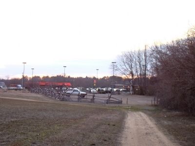
Near Goldsboro in Wayne County, North Carolina — The American South (South Atlantic)
Confederate Counterattack
— Battle of Goldsborough Bridge —
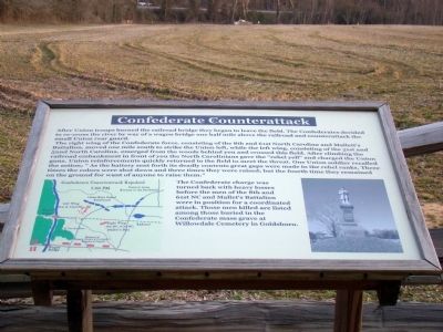
The right wing of the Confederate force, consisting of the 8th and 61st North Carolina and Mallett’s Battalion, moved one mile south to strike the Union left, while the left wing, consisting of the 51st and 52nd North Carolina, emerged from the woods behind you and crossed this field. After climbing the railroad embankment in front of you the North Carolinians gave the “rebel yell” and charged the Union guns. Union reinforcements quickly returned to the field to meet the threat. One Union soldier recalled the action; “As the battery sent forth its deadly contents great gaps were made in the rebel ranks. Three times the colors were shot down and three times they were raised; but the fourth time they remained on the ground for want of anyone to raise them.”
The Confederate charge was turned back with heavy losses before the men of the 8th and 61st NC and Mallet’s Battalion were in position for a coordinated attack. Those men killed are listed among those buried in the Confederate mass grave at Willowdale Cemetery in Goldsboro.
Erected by the Goldsborough Bridge Battlefield Association.
Topics. This historical marker is listed in this topic list: War, US Civil.
Location. 35° 20.406′ N, 78° 1.579′ W. Marker is near Goldsboro, North Carolina, in Wayne County. Marker is on Old Mt. Olive Highway near U.S. 117, on the left when traveling south. Touch for map. Marker is in this post office area: Goldsboro NC 27530, United States of America. Touch for directions.
Other nearby markers. At least 8 other markers are within 4 miles of this marker, measured as the crow flies. Union Assault on the Bridge (about 600 feet away, measured in a direct line); Attack of the 17th Massachusetts (about 700 feet away); Battle of Goldsboro Bridge (about 700 feet away); Battle of Goldsborough Bridge (about 700 feet away); Waynesborough (approx. 2˝ miles away); General Baptist State Convention (approx. 3.1 miles away); Gertrude Weil (approx. 3.3 miles away); First Pentecostal Holiness Church Congregation (approx. 3.4 miles away). Touch for a list and map of all markers in Goldsboro.
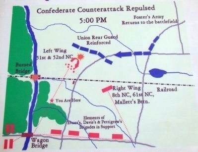
More about this marker. This is stop 4 on The Battle of Goldsborough Bridge Battlefield walking tour. Marker has a map of the battlefield as of 5 p.m., which is reproduced in photograph 3, on the lower left. A photograph on the lower right shows the monument at the Confederate mass grave at Willowdale Cemetery in Goldsboro.
Photographed By J. J. Prats, February 27, 2010
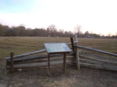
2. Confederate Counterattack Marker
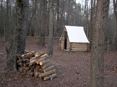
The woods and earthworks are behind the photographer with the large open field of the park in front of the marker. The railroad embankment can be seen in the distance on the left, the roof of the barn on the right and wooden cabins with the white canvas roofs of the confederate camp in the distance directly beyond the marker.
Credits. This page was last revised on June 16, 2016. It was originally submitted on March 13, 2010, by J. J. Prats of Powell, Ohio. This page has been viewed 1,101 times since then and 16 times this year. Photos: 1, 2, 3, 4, 5, 6. submitted on March 13, 2010, by J. J. Prats of Powell, Ohio. • Craig Swain was the editor who published this page.
