Kure Beach in New Hanover County, North Carolina — The American South (South Atlantic)
Battery Buchanan
Fort Fisher’s Last Stand
— Confederate Lifeline —
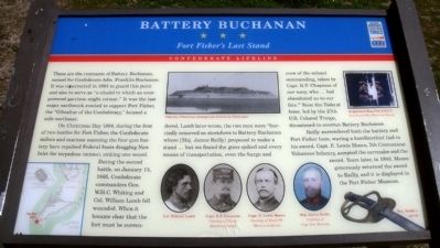
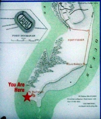
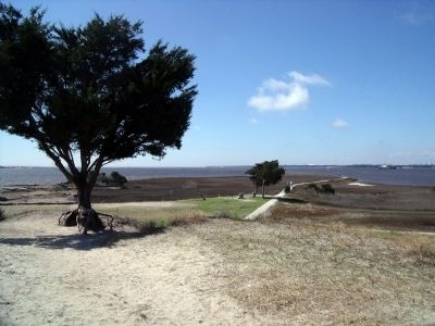
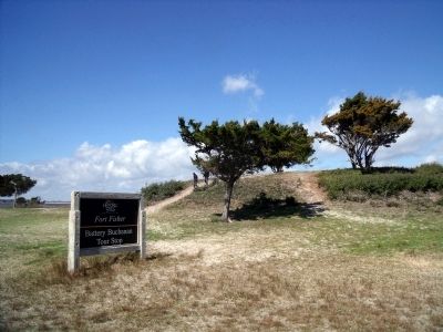
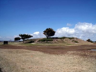
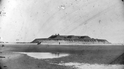
These are the remnants of Battery Buchanan, named for Confederate Adm. Franklin Buchanan. It was constructed in 1864 to guard this point and also to serve as “a citadel to which an overpowered garrison might retreat.” It was the last major earthwork erected to support Fort Fisher, the “Gibraltar of the Confederacy,” located a mile northeast.
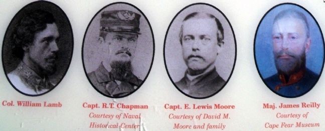
On Christmas Day 1864, during the first of two battles for Fort Fisher, the Confederate sailors and marines manning the four-gun battery here repulsed Federal boats dragging New Inlet for torpedoes (mines), sinking one vessel. During the second battle, on January 15, 1865, Confederate commanders Gen. W.H.C. Whiting and Col. William Lamb fell wounded. When it became clear that the fort must be surrendered, Lamb later wrote, the two men were “hurriedly removed on stretchers to Battery Buchanan where [Maj. James Reilly] proposed to make a stand ... but we found the guns spiked and every means of transportation, even the barge and crew of the colonel commanding, taken by Capt. R.T. Chapman of our navy, who ... had abandoned us to our fate.” Soon the Federal force, led by the 27th U.S. Colored Troops, threatened to overrun Battery Buchanan.
Reilly surrendered both the battery and Fort Fisher here, waving a handkerchief tied to his sword. Capt. E. Lewis Moore, 7th Connecticut Volunteer Infantry, accepted the surrender and the sword. Years later, in 1893, Moore generously returned the sword to Reilly, and it is displayed in the Fort Fisher Museum.
Erected by North Carolina Civil War Trails.
Topics and series. This historical marker is listed in these topic lists: African Americans • Forts and Castles • War, US Civil. In addition, it is included in the North Carolina Civil War Trails series list. A significant historical month for this entry is January 1861.
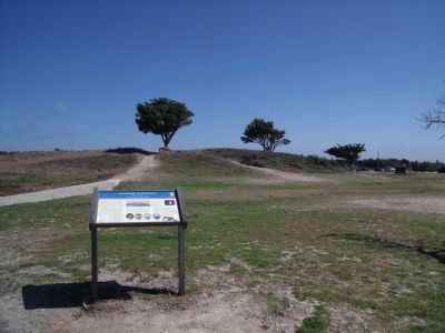
Location. 33° 57.59′ N, 77° 56.516′ W. Marker is in Kure Beach, North Carolina, in New Hanover County. Marker can be reached from Fort Fisher Boulevard South (U.S. 421) 1.4 miles south of Loggerhead Road. The marker is located at the south end of Fort Fisher Boulevard near the Fort Fisher - Southport Ferry terminal. Touch for map. Marker is in this post office area: Kure Beach NC 28449, United States of America. Touch for directions.
Other nearby markers. At least 8 other markers are within 2 miles of this marker, measured as the crow flies. Blockade-Running (approx. 1.4 miles away); Fighting the Sea - Saving the Fort (approx. 1.4 miles away); Union Fiasco - The First Battle (approx. 1½ miles away); Fort Fisher Monument (approx. 1½ miles away); W.H.C. Whiting (approx. 1½ miles away); Shepherd’s Bombproof (approx. 1½ miles away); Restoration of Shepherd’s Battery (approx. 1½ miles away); Shepherd’s Battery (approx. 1½ miles away). Touch for a list and map of all markers in Kure Beach.
More about this marker. On the lower right is a wartime map of the area.
On the upper center is a “Timothy O’Sullivan photograph of Battery Buchanan”
On the lower center are portraits of battle participants: “Col. William Lamb”; “Capt. R.T. Chapman” Courtesy of Naval Historical Center; “Capt. E. Lewis Moore” Courtesy of David M. Moore and family; “Maj. James Reilly” Courtesy of Cape Fear Museum
On the upper right is a photo of the “Regimental flag, 27th U.S.C.T.” Courtesy of Ohio Historical Society
On the lower right is a photo of “Maj. Reilly’s sword”
Also see . . .
1. Fort Fisher. North Carolina Historic Sites (Submitted on March 15, 2010, by Bernard Fisher of Richmond, Virginia.)
2. The North Carolina Civil War Trails. PDF of all Civil War Trail Site locations, including Fort Fisher (Submitted on February 13, 2021, by Larry Gertner of New York, New York.)
Credits. This page was last revised on June 4, 2021. It was originally submitted on March 15, 2010, by Bernard Fisher of Richmond, Virginia. This page has been viewed 2,763 times since then and 108 times this year. Photos: 1, 2, 3, 4, 5, 6, 7, 8. submitted on March 15, 2010, by Bernard Fisher of Richmond, Virginia.
