Mount Pleasant in Maury County, Tennessee — The American South (East South Central)
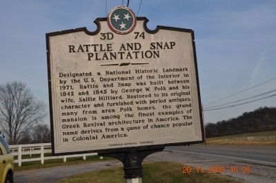
Rattle and Snap Plantation
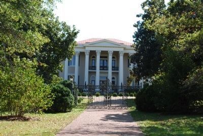
Designated a National Historic Landmark by the U.S. Department of Interior in 1971. Rattle and Snap was built between 1842 and 1845 by George W. Polk and his wife, Sallie Hilliard. Restored to its original character and furnished with period antiques, many from area Polk homes, the grand mansion is among the finest examples of Greek Revival architecture in America. The name derives from a game of chance popular in Colonial America.
Erected by Tennessee Historical Commission. (Marker Number 3D-74.)
Topics and series. This historical marker is listed in these topic lists: Agriculture • Architecture • Settlements & Settlers. In addition, it is included in the National Historic Landmarks series list. A significant historical year for this entry is 1971.
Location. 35° 34.03′ N, 87° 9.428′ W. Marker is in Mount Pleasant, Tennessee, in Maury County. Marker is on North Main Street (Tennessee Route 243) east of Rattle and Snap Drive, on the left when traveling north. The marker is located in a pull-off near Rattle and Snap Drive. Touch for map. Marker is at or near this postal address: 1522 N Main Street, Mount Pleasant TN 38474, United States of America. Touch for directions.
Other nearby markers. At least 8 other markers are within 4 miles of this marker, measured as the crow flies. Delaying Forrest (approx. 1.1 miles away); St. John's Episcopal Church (approx. 1.1 miles away); St. John's (approx. 1.1 miles away); Forrest and Capron (approx. 1.2 miles away); Sam Watkins (approx. 2.3 miles away); Zion (approx. 3.3 miles away); Hood's Maneuver (approx. 3.4 miles away); Clarke Training School (approx. 3˝ miles away).
Also see . . . Rattle and Snap Plantation. Rattle and Snap is on a hilltop a little over 8 miles southwest of Columbia, Tennessee on State Highway 243 in Maury County. It is a fine example of the lavish scale on which many Southern homes were built between 1845-1860. (Submitted on March 15, 2010, by Sandra Hughes Tidwell of Killen, Alabama, USA.)
Credits. This page was last revised on April 24, 2021. It was originally submitted on March 15, 2010, by Sandra Hughes Tidwell of Killen, Alabama, USA. This page has been viewed 1,938 times since then and 40 times this year. Photos: 1. submitted on March 15, 2010, by Sandra Hughes Tidwell of Killen, Alabama, USA. 2, 3. submitted on July 21, 2015, by Brandon Fletcher of Chattanooga, Tennessee. • Bill Pfingsten was the editor who published this page.


