San Mateo in San Mateo County, California — The American West (Pacific Coastal)
History of San Mateo’s Bridges
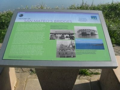
In 1923, the cities of San Mateo, Burlingame, and Hillsborough began planning for a bridge to link the San Francisco Bay peninsula cities with East Bay and Central Valley communities. Even after the Dumbarton Bridge opened, in 1927, these municipalities continued pursuing construction of a bridge for the San Mateo area.
In 1928, bridge construction began. Cement for the piles and deck slabs for the bridge came from Redwood City. Oyster shells dredged from the Bay in the Redwood City area were also used as part of the cement mix. In 1929, after only fourteen months of construction, the bridge was finished ahead of schedule. The City of San Mateo then celebrated the opening of the new $7.5 million, 7 mile-long “San Francisco Bay Toll Bridge”. During that period of time, it was considered the longest continual vertical lift highway bridge in the world.
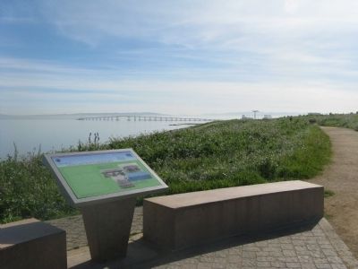
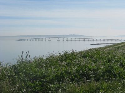
During the 1930’s fewer than 2,000 vehicles crossed the bridge daily. The number of vehicles crossing the bridge increased to 9,000 within the the next 20 years, prompting civic leaders to consider the need for a new bridge. In 1967, construction for the new San Mateo Bridge was completed. The new bridge did away with the need for a drawbridge since it was constructed high to allow ships to pass under.
[At the top of the marker the question is asked:]
“Did you know?
In 1929 the original bridge toll was 45 cents for a five passenger car and 80 cents for a horse drawn wagon.”
Erected by San Mateo Parks and Recreation.
Topics. This historical marker is listed in this topic list: Bridges & Viaducts. A significant historical year for this entry is 1923.
Location. 37° 34.48′ N, 122° 18.037′ W. Marker is in San Mateo, California, in San Mateo County. Marker can be reached from South Hart Clinton Drive. Marker is located at the top of the hill above the Seal Point Park entrance and parking area. Access is also available from the Ryder Park entrance and parking area. Touch for map. Marker is in this post office area: San Mateo CA 94401, United States of America. Touch for directions.
Other nearby markers. At least 8 other markers are within 2 miles of this marker, measured as the crow flies. San Mateo’s First Residents (approx. 0.3 miles away); Morse’s Corners (approx. 1.4 miles away); Central Park Veterans Memorial – Japanese American Combat Team (approx. 1½ miles away); Central Park Veterans Memorial (approx. 1½ miles away); Central Park and The Kohl Pumphouse (approx. 1½ miles away); Central Park Veterans Memorial - Screaming Eagles Grove (approx. 1½ miles away); Central Park Veterans Memorial – World War I
(approx. 1½ miles away); a different marker also named Central Park Veterans Memorial (approx. 1½ miles away). Touch for a list and map of all markers in San Mateo.
Regarding History of San Mateo’s Bridges. The current toll is $4.00 for a passenger car payable westbound. There is no toll eastbound. At this time there is talk of raising the toll to $5.00. There is no toll for “horse drawn wagons”

Photos Courtesy of the San Mateo County History Museum
3. Photos Displayed on Marker
Left Side Photos:
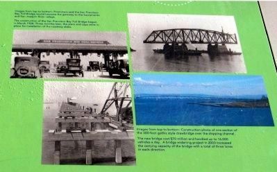
Images from top to bottom: Promoters said the San Francisco Bay Toll Bridge would become the gateway to the Sacramento and San Joaquin River valleys.
The construction of the San Francisco Bay Toll Bridge began in March 1928. Three months later, piers and caps were in place for installation of the roadway slabs.
Right Side Photos:
Images from top to bottom: Construction photo of one section of the 300-foot gothic style drawbridge over the shipping channel.
The new bridge cost $70 million and handled up to 16,000 vehicles a day. A bridge widening project in 2003 increased the carrying capacity of the bridge with a total of three lanes in each directions.
Credits. This page was last revised on August 18, 2020. It was originally submitted on March 17, 2010, by Syd Whittle of Mesa, Arizona. This page has been viewed 3,322 times since then and 40 times this year. Photos: 1, 2, 3, 4. submitted on March 17, 2010, by Syd Whittle of Mesa, Arizona.


