Atkins Park in Atlanta in Fulton County, Georgia — The American South (South Atlantic)
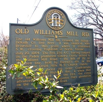
Old Williams Mill Rd.
July 20, 1864. The Fed. 23d A.C., having camped on the Paden plantation (Emory Univ.), moved to the Williams Mill Road -- the left of its intrenched line, held by Hascall’s div. in the area where Druid Hills M.E. Church stands.
The 23d A.C. faced the outer Confederate defense line along Highland Ave., & when that line was abandoned early the 22d, the corps advanced S.W. to the Augustus Hurt plantation on the old Williams Mill Road.
Erected 1956 by Georgia Historical Commission. (Marker Number 060-78.)
Topics and series. This historical marker is listed in these topic lists: Roads & Vehicles • War, US Civil. In addition, it is included in the Georgia Historical Society series list. A significant historical month for this entry is July 1800.
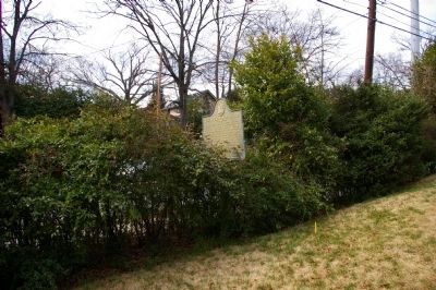
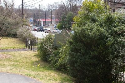
Location. 33° 46.487′ N, 84° 20.933′ W. Marker is in Atlanta, Georgia, in Fulton County. It is in Atkins Park. Marker is at the intersection of Briaicliff Road (U.S. 23) and St. Augustine Place, on the right when traveling north on Briaicliff Road. The marker is in heavy shrubbery and extremely difficult to see from the street. Touch for map. Marker is in this post office area: Atlanta GA 30306, United States of America. Touch for directions.
Other nearby markers. At least 8 other markers are within walking distance of this marker. The March to the Sea (approx. 0.3 miles away); Alpha Delta Pi (approx. 0.4 miles away); Lynching in America / The Lynching of Porter Turner (approx. 0.4 miles away); Stanley's Sector (approx. 0.6 miles away); The Battles for Atlanta (approx. 0.7 miles away); Augustus Hurt Plantation (approx. 0.7 miles away); Augustus Hurt House (approx. 0.7 miles away); Sightless Among Miracles (approx. 0.7 miles away). Touch for a list and map of all markers in Atlanta.
Credits. This page was last revised on February 8, 2023. It was originally submitted on March 22, 2010, by David Seibert of Sandy Springs, Georgia. This page has been viewed 1,262 times since then and 24 times this year. Photos: 1, 2, 3. submitted on March 22, 2010, by David Seibert of Sandy Springs, Georgia. • Craig Swain was the editor who published this page.


