Falls Church, Virginia — The American South (Mid-Atlantic)
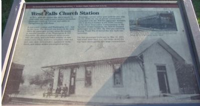
West Falls Church Station
It was a new century and Washington, D.C., was on the move. The demand was heavy in the early 1900s for passenger service along the mostly residential corridor of the Washington & Old Dominion. Its owners replaced steam power with electricity and scheduled dozens of commuter runs. Often, however, schedules were not met, cars were overcrowded, equipment broke down, and union strikes interrupted service.
Passenger service never quite paid its own way. In the 1920s the use of private automobiles competed with the W&OD's passenger business, which declined further in the 1930s because of the Great Depression. Concentrating on the lucrative freight business, the W&OD stopped passenger runs in 1941. By 1943 gas rationing during World War II forced the line back into operation.
The last passenger train ran on May 31, 1951. And what were once tiny rail stops along the way have since grown into large communities.
Erected by The Washington & Old Dominion Railroad Regional Park, Northern Virginia Regional Park Authority.
Topics and series. This historical marker is listed in this topic list: Railroads & Streetcars . In addition, it is included in the NOVA Parks, and the Washington and Old Dominion (W&OD) Railroad series lists. A significant historical month for this entry is May 1876.
Location. 38° 53.5′ N, 77° 11.045′ W. Marker is in Falls Church, Virginia. Marker is on Grove Avenue, on the right when traveling south. Located just west of the Grove Avenue crossing of the W&OD Railroad Trail. Touch for map. Marker is in this post office area: Falls Church VA 22046, United States of America. Touch for directions.
Other nearby markers. At least 8 other markers are within walking distance of this marker. Tracks into History (within shouting distance of this marker); This is the W&OD Trail! (within shouting distance of this marker); Citizens' Bridge (about 300 feet away, measured in a direct line); History of "Gravel Bank" (approx. 0.3 miles away); Mt. Hope (approx. 0.4 miles away); David F. Strickler (approx. 0.4 miles away); Vietnam Memorial (approx. 0.4 miles away); Original Site of Saint James Church (approx. 0.4 miles away). Touch for a list and map of all markers in Falls Church.
More about this marker. An inset picture shows "The Blue Ridge parlor car, complete with wicker seats and a white-jacket porter, ran from July 1929 until November 1932." The background photo is "The West Falls Church station, 1890s."
Also see . . .

Photographed By Craig Swain, September 12, 2007
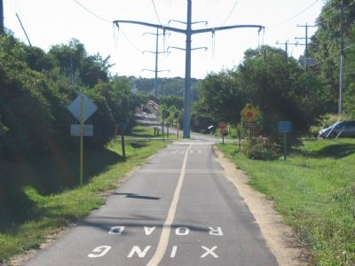
2. Just Past Grove Avenue is the Broad Street Overpass
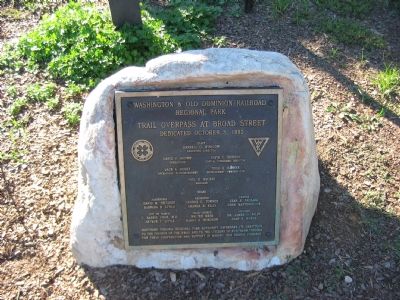
Broad Street was an "at-grade" crossing when the railroad was active. An overpass was built for the railroad trail to allow safe crossing of the busy Broad Street (Virginia Highway 7) for bicycle and foot traffic. Note the power lines which use the old railroad right of way.
1. West Falls Church Station. (Submitted on October 10, 2007, by Craig Swain of Leesburg, Virginia.)
2. The Washington and Old Dominion Railroad. Book by Ames Williams available on Amazon.com (Submitted on May 7, 2008, by Tom Fuchs of Greenbelt, Maryland.)
3. Rails to the Blue Ridge: The Washington and Old Dominion Railroad, 1847 - 1968. (Submitted on May 7, 2008, by Tom Fuchs of Greenbelt, Maryland.)
Credits. This page was last revised on November 5, 2018. It was originally submitted on October 10, 2007, by Craig Swain of Leesburg, Virginia. This page has been viewed 3,044 times since then and 36 times this year. Photos: 1, 2, 3. submitted on October 10, 2007, by Craig Swain of Leesburg, Virginia.

