Upper Merion Township near King of Prussia in Montgomery County, Pennsylvania — The American Northeast (Mid-Atlantic)
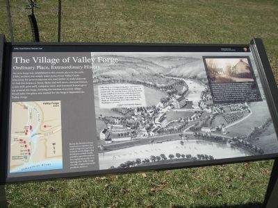
The Village of Valley Forge
Ordinary Place, Extraordinary History
— Valley Forge National Historical Park —
“Valley Forge is a manufacturing place, and there is a constant hum of machinery from the paper, flour and woolen mills. The neat little houses of the factory hands are gay with flowers and vines, while the handsome residence of the mill-owner towers castle-like above them. Past all these dwellings, at the end of the street, stands the old-fashioned stone edifice hallowed by Washington’s presence.”
Before the British raid and American occupation, this small village was typical of isolated, rural villages that developed around readily available natural resources. In a region known for iron making, tiny Valley Forge was not a highly important producer, however.
Valley Forge recovered from the devastation of the encampment and grew into a busy manufacturing community. Wharves at the foot of Valley Creek enabled loading of products onto the new canal. A railroad built in the 1840s provided even faster transportation to Philadelphia and beyond. But as industry moved to the cities in the late 19th century, the village declined. After Pennsylvania established a park here in 1893, most buildings that post-dated the encampment were demolished, creating a park landscape that while beautiful, obscures many layers of history.
Erected by National Park Service.
Topics. This historical marker is listed in these topic lists: Colonial Era • Settlements & Settlers • War, US Revolutionary. A significant historical year for this entry is 1893.
Location. 40° 6.065′ N, 75° 27.632′ W. Marker is near King of Prussia, Pennsylvania, in Montgomery County. It is in Upper Merion Township. Marker can be reached from Valley Forge Road (Pennsylvania Route 23), on the left when traveling east. Marker is on the tour road in Valley Forge National Historical Park at stop 5, Washington's Headquartes complex. Touch for map. Marker is in this post office area: King of Prussia PA 19406, United States of America. Touch for directions.
Other nearby markers. At least 8 other markers are within walking distance of this marker. American Icon (within shouting distance of this marker); Headquarters Complex (within shouting distance of this marker); Valley Creek (about 300 feet away, measured in a direct line); Commander in Chief’s Guards
(about 300 feet away); Washington’s Headquarters (about 400 feet away); Did You Know? (about 500 feet away); Remembering Valley Forge (about 500 feet away); War Comes to Valley Forge (about 500 feet away). Touch for a list and map of all markers in King of Prussia.
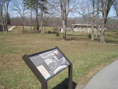
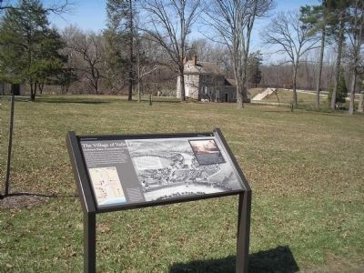
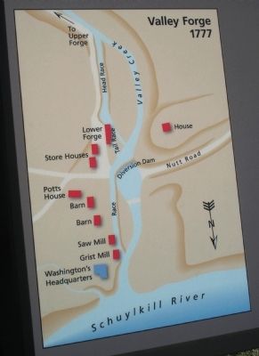
More about this marker. The background of the marker features a picture of the village of Valley Forge on the bank of the Schuylkill River. The bottom left of the marker contains a map of Valley Forge in 1777, indicating the locations of the forge, saw mill, grist mill, Washington’s Headquarters and other structures in the area. Also present is a photo of Valley Forge before the park was established.
Also see . . . Valley Forge National Historical Park. National Park Service website. (Submitted on March 23, 2010, by Bill Coughlin of Woodland Park, New Jersey.)
Credits. This page was last revised on February 7, 2023. It was originally submitted on March 23, 2010, by Bill Coughlin of Woodland Park, New Jersey. This page has been viewed 2,049 times since then and 47 times this year. Photos: 1, 2, 3, 4, 5. submitted on March 23, 2010, by Bill Coughlin of Woodland Park, New Jersey.
