Bozeman in Gallatin County, Montana — The American West (Mountains)
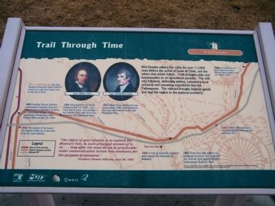
Trail Through Time
To the Headwaters
Over 11,000 years ago The First Peoples moving into North America across an ice age land bridge came to this area to hunt.
1803 - President Thomas Jefferson commissioned Captains Lewis and Clark to lead an expedition in search of a Northwest Passage. They reached the Headwaters of the Missouri River on July 25, 1805.
1806 - Returning from the Pacific Ocean on July 13, 1806, Capt. Clark and his party rode through the Gallatin Valley with 50 horses enroute to the Yellowstone River.
1808 - The streams of the beaver-rich Gallatin Valley lay at the heart of the fur trade industry.
1833 - William Clark publishes his map of the Gallatin Valley and Yellowstone River that will be known as the Clark Maximillian Map.
1860s - Homesteaders followed gold discoveries, blazing trails, bringing cattle and raiding crops.
1862 - A hub of economic endeavor grew around the settlement of Bozeman.
1867 - From Fort Ellis military expeditions surveyed and explored the marvels that would become Yellowstone National Park.
Today - Visitors follow the same route through this landscape on Interstate 90.
Erected by Montana Department of Transportation (MDT) & Qwest.
Topics and series. This historical marker is listed in these topic lists: Agriculture • Animals • Exploration • Roads & Vehicles • Settlements & Settlers. In addition, it is included in the Former U.S. Presidents: #03 Thomas Jefferson, and the Lewis & Clark Expedition series lists. A significant historical month for this entry is July 1851.
Location. 45° 42.726′ N, 111° 3.834′ W. Marker is in Bozeman, Montana, in Gallatin County. Marker is on N. 19th Avenue near I-90 eastbound entrance ramp (at milepost 305), 0.1 miles east of N. 19th Ave. and E. Valley Center Rd., on the left when traveling south. Located at Bozeman Rest Area along I-90 along with several other historic markers. Touch for map. Marker is in this post office area: Bozeman MT 59718, United States of America. Touch for directions.
Other nearby markers. At least 8 other markers are within walking distance of this marker. Pioneer Museum (a few steps from this marker); First People in the Gallatin Valley (a few steps from this marker); Gallatin History Museum (a few steps from this marker); Lewis and Clark (a few steps from this marker); Fort Ellis (within shouting distance of this marker); Bozeman Veterans Memorial (within shouting distance of this marker); Valley of Opportunity (within shouting distance of this marker); Fur Trade (within shouting distance of this marker). Touch for a list and map of all markers in Bozeman.
More about this marker. This marker is included in the Lewis & Clark Expedition marker series. It is one of six illustrated interpretive signs known as "One Trail Through Time: The Bozeman Rest Area signs" according to Montana's Historical Highway Markers book (Revised and Expanded by Axline 2008)
Marker is cracked down the middle.
Regarding Trail Through Time. Marker Quotation: "The object of your mission is to explore the Missouri river, & such principal stream of it, as...may offer the most direct & practicable water communication across this continent for the purposes of commerce." - President Thomas Jefferson, June 20, 1803
Portraits of Meriweather Lewis and William Clark used by permission of Independence National Historical Park (PA) Collection, Clark Maximillian Map courtesy of Joslyn Museum of Art, Omaha, Nebraska
Credits. This page was last revised on November 24, 2019. It was originally submitted on March 25, 2010, by Rich Pfingsten of Forest Hill, Maryland. This page has been viewed 1,187 times since then and 10 times this year. Photo 1. submitted on March 25, 2010, by Rich Pfingsten of Forest Hill, Maryland. • Bill Pfingsten was the editor who published this page.
