Corinth in Alcorn County, Mississippi — The American South (East South Central)
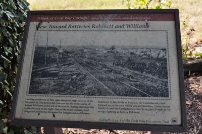
View Toward Batteries Robinett and Williams
A Look at Civil War Corinth
— --through the eyes of wartime artists and photographers. —
Inscription.
Looking northwest in this view along the right-of-way of the Memphis & Charleston RR, you can see the earthworks of Battery Williams to the left of the tracks. Battery Robinett lies in the distance to the right. One of the many military tent camps in Corinth lies between the foreground and Battery Robinett. In the Battle of Corinth, the Confederate attack focused upon the area where you are standing. Union forces finally halted the Confederate effort to regain Corinth in the savage fighting at Battery Robinett.
Erected by Civil War Discovery Trail.
Topics. This historical marker is listed in this topic list: War, US Civil.
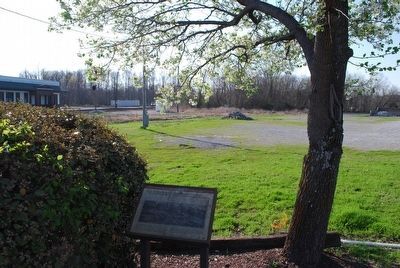
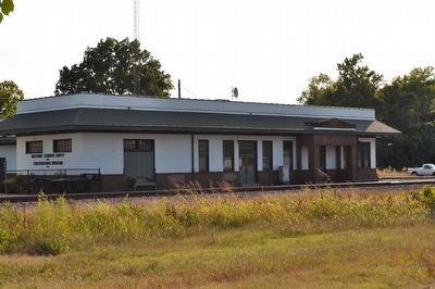
Location. 34° 56.055′ N, 88° 31.299′ W. Marker is in Corinth, Mississippi, in Alcorn County. Marker is on North Fillmore Street, on the right when traveling south. Located end of (backside) parking lot that is between Crusie Street, North Fillmore Street, Norfolk Southern railroad, and Jackson Street It is among three trees facing the railroad tracks. Touch for map. Marker is in this post office area: Corinth MS 38834, United States of America. Touch for directions.
Other nearby markers. At least 8 other markers are within walking distance of this marker. "A beehive of activity..." (within shouting distance of this marker); The Old Tishomingo Hotel (within shouting distance of this marker); Decision at the Crossroads (within shouting distance of this marker); Trailhead Park (within shouting distance of this marker); 1942 American LaFrance Fire Engine (within shouting distance of this marker); a different marker also named "Decision at the Crossroads" (within shouting distance of this marker); War in a Railroad Town (within shouting distance of this marker); Union Troops at Corinth (within shouting distance of this marker). Touch for a list and map of all markers in Corinth.
Also see . . .
1. Battery Robinette. National Park Planner website entry (Submitted on January 12, 2024, by Larry Gertner of New York, New York.)
2. Second Battle of Corinth. Wikipedia entry:
The Second Battle of Corinth (which, in the context of the American Civil War, is usually referred to as the Battle of Corinth, to differentiate it from the Siege of Corinth earlier the same year) was fought October 3–4, 1862, in Corinth, Mississippi. For the second time in the Iuka-Corinth Campaign, Union Maj. Gen. William S. Rosecrans defeated a Confederate army, this time one under Maj. Gen. Earl Van Dorn. (Submitted on March 16, 2010, by Sandra Hughes Tidwell of Killen, Alabama, USA.)

Photographed By Sandra Hughes, September 1, 2009
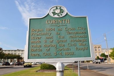
4. Corinth Historic Marker
View Toward Batteries Robinett and Williams marker is located on the backside of this parking lot where this Corinth Marker is standing. This marker is used only for location purposes only. N. Fillmore is the street right of the sign. It runs through the downtown area of Corinth.
Credits. This page was last revised on January 12, 2024. It was originally submitted on March 16, 2010, by Sandra Hughes Tidwell of Killen, Alabama, USA. This page has been viewed 2,031 times since then and 65 times this year. Last updated on March 29, 2010, by Sandra Hughes Tidwell of Killen, Alabama, USA. Photos: 1. submitted on March 16, 2010, by Sandra Hughes Tidwell of Killen, Alabama, USA. 2. submitted on September 24, 2015, by Brandon Fletcher of Chattanooga, Tennessee. 3, 4. submitted on March 22, 2010, by Sandra Hughes Tidwell of Killen, Alabama, USA. • Kevin W. was the editor who published this page.


