St. Stephen in Berkeley County, South Carolina — The American South (South Atlantic)
St. Stephen's Episcopal Church
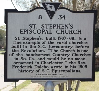
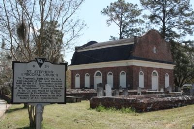
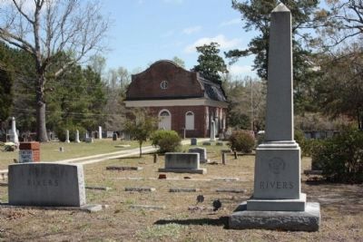
St. Stephen’s, built 1767-69, is a fine example of the rural churches built in the S.C. lowcountry before the Revolution. “The Church is one of the handsomest Country Churches in So. Ca. and would be no mean ornament in Charleston,” the Rev. Frederick Dalcho wrote in his 1808 history of S.C. Episcopalians.
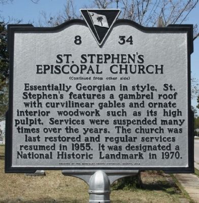
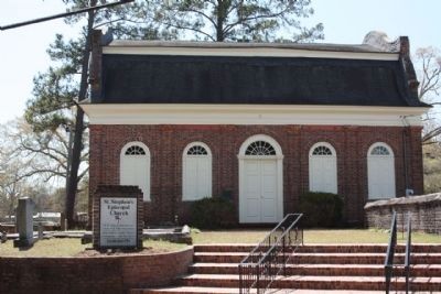
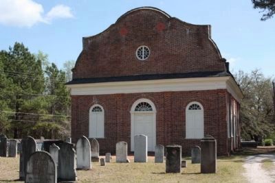
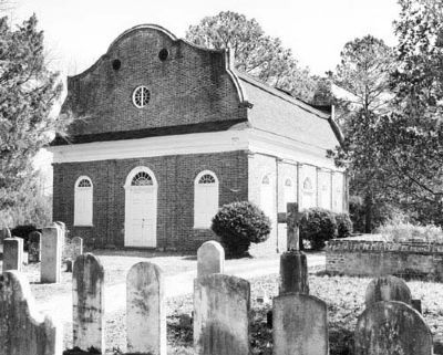
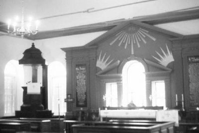
Essentially Georgian in style, St. Stephen’s features a gambrel roof with curvilinear gables and ornate interior woodwork such as its high pulpit. Services were suspended many times over the years. The church was last restored and regular services resumed in 1955. It was designated a National Historic Landmark in 1970.
Erected 2004 by The Berkeley County Historical Society. (Marker Number 8-34.)
Topics and series. This historical marker is listed in this topic list: Churches & Religion. In addition, it is included in the National Historic Landmarks series list. A significant historical year for this entry is 1808.
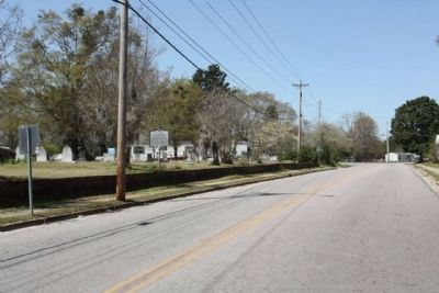
Location. 33° 24.346′ N, 79° 55.011′ W. Marker is in St. Stephen, South Carolina, in Berkeley County. Marker is on Church Road (State Highway 45) near Brick Church Circle Drive, on the right when traveling west. Touch for map. Marker is in this post office area: Saint Stephen SC 29479, United States of America. Touch for directions.
Other nearby markers. At least 8 other markers are within 7 miles of this marker, measured as the crow flies. L. Mendel Rivers House (about 500 feet away, measured in a direct line); St. Stephen Colored School / St. Stephen High School (approx. 0.7 miles away); St. Stephens Veterans Monument (approx. 0.9 miles away); DeWitt Williams Bridge (approx. 2.3 miles away); Thomas Walter (approx. 4.6 miles away); Maham Plantation (approx. 6.2 miles away); Berkeley County (approx. 6˝ miles away); Village of Pineville (approx. 6.6 miles away). Touch for a list and map of all markers in St. Stephen.
Regarding St. Stephen's Episcopal Church. St. Stephen’s Church, erected in 1767-1769, is an excellent and well-preserved example of a small Georgian brick country parish church constructed on a rectangular plan. The structure exhibits unusual architectural pretensions, because it includes a high gambrel roof with Jacobean curvilinear gables, exterior Doric pilasters, and an ornamented tray ceiling. In order to incorporate an ornamented tray ceiling, the high gambrel roof used here is uncommonly heavy and the Palladian window over the altar is too small. The walls are laid in Flemish bond. Doors and windows have fanlights above and are topped by segmental brick arches.
Francis Villepontoux and A. Howard provided the brick and acted as architects; William Axson was the master mason. The initials of these men are cut into the brickwork. St. Stephen’s was incorporated in 1788 and regular services were discontinued in 1808. Twice, however, the building was repaired during the 19th century and thus saved from destruction. In 1932 the church was again reopened for regular worship. Listed in the National Register April 15, 1970. Designated a National Historic Landmark April 15, 1970. (South Carolina Department of Archives and History)
Photographed By Mike Stroud, March 30, 2010
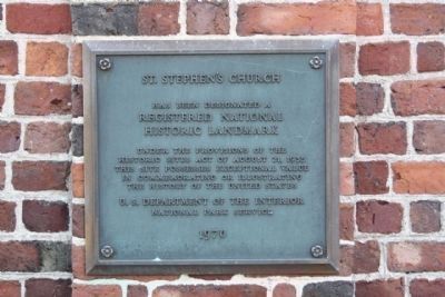
3. St. Stephen's Church
National Register of Historic Places:
St. Stephen's Episcopal Church *** (added 1970 - Building - #70000570)
Under the provisions of the
Historic Sites Act of August 21,1935,
this site possesses exceptional value
in commemorating or illustrating
the history of the United States
U.S. Department of the Interior
National Park Service
1970
Under the provisions of the
Historic Sites Act of August 21,1935,
this site possesses exceptional value
in commemorating or illustrating
the history of the United States
U.S. Department of the Interior
National Park Service
1970
Credits. This page was last revised on February 15, 2022. It was originally submitted on March 30, 2010, by Mike Stroud of Bluffton, South Carolina. This page has been viewed 2,532 times since then and 180 times this year. Photos: 1, 2, 3, 4, 5, 6, 7, 8, 9, 10, 11, 12. submitted on March 31, 2010, by Mike Stroud of Bluffton, South Carolina. • Kevin W. was the editor who published this page.
