Bullhead City in Mohave County, Arizona — The American Mountains (Southwest)
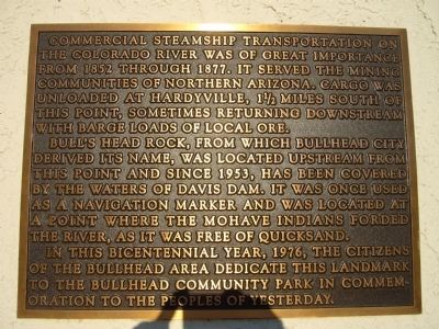
Commercial Steamship Transportation and Bullhead Community Park
Bull's Head Rock, from which Bullhead City derived its name, was located upstream from this point and since 1953, has been covered by the waters of Davis Dam. It was once used as a navigation marker and was located at a point where the Mohave Indians forded the river, as it was free of quicksand.
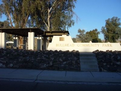
In this bicentennial year, 1976, the citizens of the Bullhead area dedicate this landmark to the Bullhead Community Park in commemoration to the peoples of yesterday.
Erected 1976 by Citizens of Bullhead City.
Topics. This historical marker is listed in these topic lists: Notable Places • Waterways & Vessels. A significant historical year for this entry is 1852.
Location. 35° 8.442′ N, 114° 34.179′ W. Marker is in Bullhead City, Arizona, in Mohave County. Marker is on Arizona Route 95 at milepost 247 north of Silver Creek Road, on the right when traveling south. Touch for map. Marker is in this post office area: Bullhead City AZ 86442, United States of America. Touch for directions.
Other nearby markers. At least 8 other markers are within 5 miles of this marker, measured as the crow flies. Camels and Commerce (approx. 1˝ miles away in Nevada); Hardyville Pioneer Cemetery (approx. 1.7 miles away); Laughlin, an Oasis on the Colorado (approx. 1.8 miles away in Nevada); Avenue of Flags (approx. 2.1 miles away in Nevada); Donald (Don) J. Laughlin (approx. 2.1 miles away in Nevada); Old Fort Mohave (approx. 2.6 miles away); Arizona Veterans Memorial (approx. 4.8 miles away); Arizona Medal of Honor (approx. 4.9 miles away). Touch for a list and map of all markers in Bullhead City.
Credits. This page was last revised on June 16, 2016. It was originally submitted on March 30, 2010, by Bill Kirchner of Tucson, Arizona. This page has been viewed 1,467 times since then and 22 times this year. Photos: 1, 2. submitted on March 30, 2010, by Bill Kirchner of Tucson, Arizona. • Syd Whittle was the editor who published this page.

