Harpers Ferry in Jefferson County, West Virginia — The American South (Appalachia)
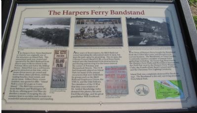
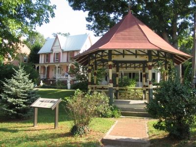
The Harpers Ferry Bandstand
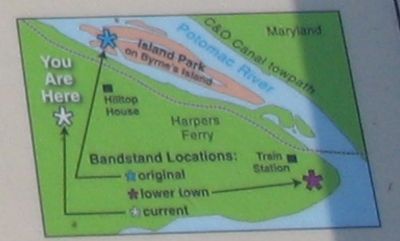
After years of flood repairs, the B&O Railroad ceased operating the amusement park in 1909, but kept the park open for picnicking. Also in 1909, the Citizens Concert Band (CCB), a local brass band, helped save the bandstand from destruction by purchasing and moving it to the lower town at the corner of Potomac and Shenandoah Streets. The CCB had frequently played on Island Park for many of the annual excursions that were held there by groups such as the B&O Railroad Employees Union, the YMCA, and the Odd Fellows. Two members of the CCB at that time were relatives of Dr. Anthol Shewbridge (who donated this photo), his uncle Ewell Shewbridge, and his great grandfather Will Everheart.
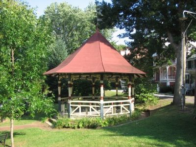
The town of Harpers Ferry bought the bandstand from the CCB in later years, and moved it to its current location. The Bandstand, or Town Gazebo, is currently used for a number of annual Town gatherings including: the Easter Egg Hunt (run by the Harpers Ferry Parks and Recreation Association), the Herb Fair (run by the Harpers Ferry Woman's Club), the Fourth of July Band Concert and Picnic, and the Christmas Tree Lighting Ceremony.
Island Park was completely destroyed by floods in 1942. The Bandstand is the only surviving structure from Island Park.
Topics. This historical marker is listed in these topic lists: Arts, Letters, Music • Entertainment. A significant historical year for this entry is 1879.
Location. 39° 19.517′ N, 77° 44.296′ W. Marker is in Harpers Ferry, West Virginia, in Jefferson County. Marker is at the intersection of Washington Street (Business U.S. 340) and Gilmore Street, on the right when traveling east on Washington Street. Located in the town center park alongside Washington Street. Touch for map. Marker is in this post office area: Harpers Ferry WV 25425, United States of America. Touch for directions.
Other nearby markers. At least 8 other markers are within walking distance of this marker. Prize of War (a few steps from this marker); Morrell House (about 400 feet away, measured in a direct line); Harpers Ferry / John Brown’s Fort (about 700 feet away); The Niagara Movement (about 700 feet away); The Appalachian Trail and Benton MacKaye (about 700 feet away); Virginia Lodge No. 1 (about 700 feet away); Storer College Veterans Memorial Gate (about 700 feet away); Foundations of Freedom (about 700 feet away). Touch for a list and map of all markers in Harpers Ferry.
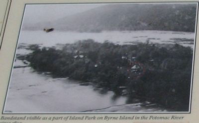
More about this marker. On the upper left, the marker displays a photograph of Island park, "Bandstand visible as part of Island Park on Byrne Island in the Potomac River." Below the photo is a "Poster advertising picnic and political gathering in 1892."
The upper center displays the photograph of the "Citizen's Concert Band (CCB)in front of a pavilion on Island Park circa 1885," mentioned in the text of the marker. Below it is a "poster advertising a picnic for local farmers in 1878."
On the upper right is a photo showing "The Bandstand stood at the intersection of Potomac and Shenandoah Streets, in the lower town for several years after it was saved from Island Park." Below the photo is a map detailing the locations the bandstand has stood.
Credits. This page was last revised on June 27, 2019. It was originally submitted on October 13, 2007, by Craig Swain of Leesburg, Virginia. This page has been viewed 2,850 times since then and 88 times this year. Photos: 1, 2, 3, 4, 5. submitted on October 13, 2007, by Craig Swain of Leesburg, Virginia.
