Near Goose Creek in Berkeley County, South Carolina — The American South (South Atlantic)
Casey (Caice)
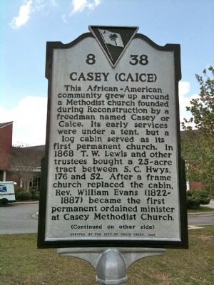
This African-American community grew up around a Methodist church founded during Reconstruction by a freedman named Casey or Caice. Its early services were under a tent, but a log cabin served as its first permanent church. In 1868 T.W. Lewis and other trustees bought a 25-acre tract between S.C. Hwys. 176 and 52. After a frame church replaced the cabin, Rev. William Evans (1822-1887) became the first permanent ordained minister at Casey Methodist Church.
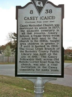
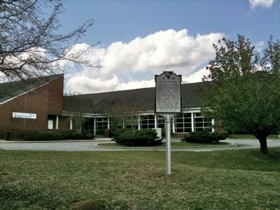
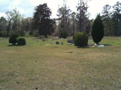
Casey Methodist Church was destroyed by arson in 1977; the adjacent cemetery is all that remains. Casey School, a three-room frame school built next to the church in the 1930s, taught area children in grades 1-7 until it burned in 1966. The Goose Creek Branch of the Berkeley County Public Library was built on the site in 1991. The Casey Fellowship Hall, across Moncks Corner Road from the church, was also a vital institution in the Casey community for many years.
Erected 2006 by the City of Goose Creek. (Marker Number 8-38.)
Topics. This historical marker is listed in this topic list: African Americans. A significant historical year for this entry is 1868.
Location. 33° 1.193′ N, 80° 2.573′ W. Marker is near Goose Creek, South Carolina, in Berkeley County. Marker is located at the Berkeley County Library, 325 Old Moncks Corner Rd. at Thurgood Dr., Goose Creek. Touch for map. Marker is in this post office area: Goose Creek SC 29445, United States of America. Touch for directions.
Other nearby markers. At least 8 other markers are within 2 miles of this marker, measured as the crow flies. Early Indian Trading Paths / The Goose Creek Men (approx. 0.7 miles away); Mount Holly Station • Mount Holly (approx. 0.8 miles away); Springfield Plantation (approx. one mile away); Eighteen Mile House Tavern (approx. 1.2 miles away); Button Hall (approx. 1.2 miles away); Medway Plantation (approx. 1.3 miles away); Thorogood Plantation / Mount Holly Plantation (approx. 1.4 miles away); Goose Creek / City of Goose Creek (approx. 1.4 miles away). Touch for a list and map of all markers in Goose Creek.
Credits. This page was last revised on February 20, 2022. It was originally submitted on April 4, 2010, by David Bullard of Seneca, South Carolina. This page has been viewed 1,735 times since then and 160 times this year. Photos: 1, 2, 3, 4. submitted on April 4, 2010, by David Bullard of Seneca, South Carolina. • Kevin W. was the editor who published this page.


