Near Goose Creek in Berkeley County, South Carolina — The American South (South Atlantic)
Springfield Plantation
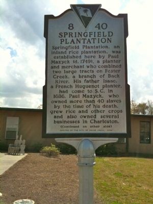
Springfield Plantation, an inland rice plantation, was established here by Paul Mazyck (d. 1749), a planter and merchant who combined two large tracts on Foster Creek, a branch of Back River. His father Isaac, a French Huguenot planter, had come to S.C. in 1686. Paul Mazyck, who owned more than 40 slaves by the time of his death, grew rice and other crops here and also owned several businesses in Charleston.
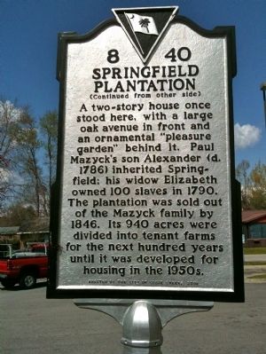
Marker Reverse:
A two-story house once stood here, with a large oak avenue in front and an ornamental “pleasure garden” behind it. Paul Mazyck’s son Alexander (d. 1786) inherited Springfield; his widow Elizabeth owned 100 slaves in 1790. The plantation was sold out of the Mazyck family by 1846. Its 940 acres were divided into tenant farms for the next hundred years until it was developed for housing in the 1950s.
Erected 2007 by the City of Goose Creek. (Marker Number 8-40.)
Topics. This historical marker is listed in these topic lists: Colonial Era • Settlements & Settlers. A significant historical year for this entry is 1686.
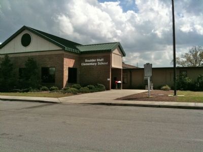
Location. 33° 1.438′ N, 80° 1.599′ W. Marker is near Goose Creek, South Carolina, in Berkeley County. Marker is on Judy Drive. Marker is located beside the flagpole at Boulder Bluff Elementary School in Goose Creek. Touch for map. Marker is at or near this postal address: 400 Judy Dr, Goose Creek SC 29445, United States of America. Touch for directions.
Other nearby markers. At least 8 other markers are within 2 miles of this marker, measured as the crow flies. Early Indian Trading Paths / The Goose Creek Men (approx. 0.6 miles away); Mount Holly Station • Mount Holly (approx. 0.6 miles away); Casey (Caice) (approx. one mile away); Medway Plantation (approx. one mile away); Thorogood Plantation / Mount Holly Plantation (approx. 1.1 miles away); Button Hall (approx. 1˝ miles away); Eighteen Mile House Tavern (approx. 1.7 miles away); Howe Hall Plantation / Howe Hall (approx. 1.9 miles away). Touch for a list and map of all markers in Goose Creek.
Credits. This page was last revised on June 16, 2016. It was originally submitted on April 4, 2010, by David Bullard of Seneca, South Carolina. This page has been viewed 2,299 times since then and 192 times this year. Photos: 1, 2, 3. submitted on April 4, 2010, by David Bullard of Seneca, South Carolina. • Kevin W. was the editor who published this page.


