Tabb near Newport News, Virginia — The American South (Mid-Atlantic)
York County / Warwick County
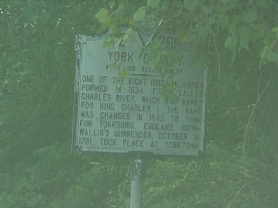
York County. Area 186 square miles. One of the eight original shires formed in 1634. First called Charles River, which was named for King Charles I. The name was changed in 1643 to York for Yorkshire, England. Cornwallis’s surrender, October 19, 1781, took place at Yorktown.
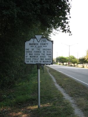
Warwick County. Area 69 square miles. One of the original shires formed in 1634, it was given the name of Warwick River. The river itself was named for the Earl of Warwick.
Erected 1946 by Virginia Conservation Commission. (Marker Number Z-265.)
Topics and series. This historical marker is listed in this topic list: Political Subdivisions. In addition, it is included in the Virginia Department of Historic Resources (DHR) series list. A significant historical date for this entry is October 19, 1868.
Location. Marker has been reported missing. It was located near 37° 6.095′ N, 76° 27.479′ W. Marker was near Newport News, Virginia. It was in Tabb. Marker was on George Washington Memorial Highway (U.S. 17) south of Commerce Circle, on the right when traveling north. Touch for map. Marker was at or near this postal address: 1108 George Washington Memorial Hwy, Yorktown VA 23693, United States of America. Touch for directions.
Other nearby markers. At least 8 other markers are within 2 miles of this location, measured as the crow flies. Charles Church (approx. 1.7 miles away); Big Bethel Church and Cemetery (approx. 1.9 miles away); Battle of Big Bethel (approx. 1.9 miles away); a different marker also named Battle of Big Bethel (approx. 1.9 miles away); a different marker also named Battle of Big Bethel (approx. 1.9 miles away); a different marker also named Battle of Big Bethel (approx. 1.9 miles away); Battle of Big Bethel Union Monument (approx. 1.9 miles away); Big Bethel UDC Monument (approx. 1.9 miles away).
Regarding York County / Warwick County. Warwick County is an extinct Virginia county. Originally Warwick River Shire in colonial times, it lost a significant portion of its territory with the creation of the independent city of Newport News in 1896, ceeded 4 square miles to York County in 1949, became the independent City of Warwick in 1952, and was consolidated into Newport News in 1958.
Credits. This page was last revised on February 1, 2023. It was originally submitted on October 14, 2007, by Laura Troy of Burke, Virginia. This page has been viewed 1,356 times since then and 11 times this year. Photos: 1, 2. submitted on October 14, 2007, by Laura Troy of Burke, Virginia. • J. J. Prats was the editor who published this page.

