Pulaski in Giles County, Tennessee — The American South (East South Central)
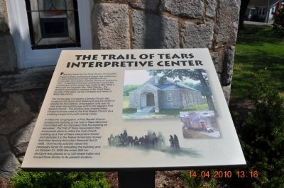
The Trail of Tears Interpretive Center
The Immaculate Conception Catholic Church was located at 416 South First Street and was the center of worship for the Catholic congregation until July 10, 1984 when the building was sold to the adjacent First Baptist Church. The building was renamed Mars Chapel and was used by the First Baptist Church as a wedding chapel and youth activity center.
In 2002 the congregation of First Baptist Church donated the building to the Trail of Tears Memorial Committee with the stipulation that the building be relocated. The Trail of Tears Association then announced plans to utilize the rock church building as a Trail of Tears Interpretive Center and dedicate it to the Native Americans moved from their land by the Indian Removal Act of 1830. Community activists raised the necessary funds for relocating the building and on October 31, 2002 the entire 300 ton structure was placed on a 122-wheel trailer and moved three blocks to its present location.
Topics and series. This historical marker is listed in these topic lists: Government & Politics • Man-Made Features • Native Americans • Notable Events. In addition, it is included in the Trail of Tears series list. A significant historical date for this entry is July 10, 1863.
Location. 35° 11.739′ N, 87° 1.796′ W. Marker is in Pulaski, Tennessee, in Giles County. Marker is on Stadium Street near East College Street. Near Elkton Elementary School. Touch for map. Marker is at or near this postal address: 229 Stadium Street, Pulaski TN 38478, United States of America. Touch for directions.
Other nearby markers. At least 8 other markers are within walking distance of this marker. The Benge Route (a few steps from this marker); The Bell Route (a few steps from this marker); Giles County Trail of Tears Memorial (a few steps from this marker); Nunahi-Duna-Dlo-Hily-I (within shouting distance of this marker); Trail of Tears (within shouting distance of this marker); Giles County Courthouses (about 400 feet away, measured in a direct line); Count Casimir Pulaski (1747-1779) (about 400 feet away); Native Americans in Giles County (about 400 feet away). Touch for a list and map of all markers in Pulaski.
Credits. This page was last revised on June 16, 2016. It was originally submitted on April 15, 2010, by Sandra Hughes Tidwell of Killen, Alabama, USA. This page has been viewed 1,286 times since then and 31 times this year. Photos: 1, 2. submitted on April 15, 2010, by Sandra Hughes Tidwell of Killen, Alabama, USA. • Kevin W. was the editor who published this page.

