Pulaski in Giles County, Tennessee — The American South (East South Central)
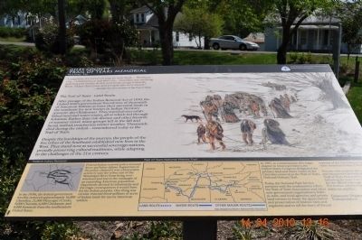
Giles County Trail of Tears Memorial
The Trail of Tears-Land Route
After passage of the Indian Removal Act of 1830, the United States government forced tens of thousands of American Indians to leave their ancestral lands in the southeast for new homes in Indian Territory (present-day-Oklahoma). They traveled over established land and water routes, all of which led through Arkansas. Rather than risk disease and other hazards of summer travel, many groups left in the fall and faced, instead, treacherous winter weather. Thousands died during the ordeal- remembered today as the Trail of Tears.
Despite the hardships of the journey, the people of the five tribes of the Southeast established new lives in the West. They stand now as successful sovereign nations, proudly preserving cultural traditions, while adapting to the challenges of the 21st century.
Federal Indian Removal
In the 1830s, the federal government forcibly removed approximately 16,000 Cherokee, 21,000 Muscogee (Creek), 9,000 Choctaw, 6,000 Chickasaw, and 4,000 Seminole from the southeastern United States.
Federal Indian removal policy aroused fierce and bitter debate. Supporters of the policy claimed it was a benevolent action to save the tribes east of the Mississippi River from being overwhelmed and lost in the onslaught of an expanding American population.
Opponents described its inhumanity and the tragic consequences it would have for the Indian peoples. One thing was certain: removal freed millions of acres of Indian lands for use by American settlers.
In 1987, to commemorate this tragic chapter in American history, the Unites States Congress designated the primary land and water routes of the Cherokee removal as the Trail of Tears National Historic Trail.
Today, the National Park Service partners with the southeastern tribes; the Trail of Tears Association and other non-government organizations; federal, state, and local agencies; private land owners to foster the appreciation and preservation of historic sites and segments and to tell the story of forced removal of the Cherokee people and other American Indian Tribes.
You can visit certified sites, segments, and interpretive facilities along the Trail of Tears Historic Trails following the Auto Tour Route. Look for the official trail logo along the way.
A map of the Trail of Tears National Historic Trail is included at the center bottom of the
marker. It includes the principal land and water routes as well as other major routes. The map was designed by Western National Parks Association.
Erected by Tennessee Department of Transportation.
Topics and series. This historical marker and memorial is listed in these topic lists: Native Americans • Notable Events. In addition, it is included in the Trail of Tears series list. A significant historical year for this entry is 1830.
Location. 35° 11.74′ N, 87° 1.808′ W. Marker is in Pulaski, Tennessee, in Giles County. Marker is on Stadium Street near East College Street (U.S. 64). In front of the Trail of Tears Interpretive Center. Touch for map. Marker is at or near this postal address: 220 Stadium Street, Pulaski TN 38478, United States of America. Touch for directions.
Other nearby markers. At least 8 other markers are within walking distance of this marker. The Bell Route (a few steps from this marker); The Trail of Tears Interpretive Center (a few steps from this marker); The Benge Route (within shouting distance of this marker); Nunahi-Duna-Dlo-Hily-I (within shouting distance of this marker); Trail of Tears (about 300 feet away, measured in a direct line); Count Casimir Pulaski (1747-1779) (about 400 feet away); Giles County Courthouses (about 400 feet away); Native Americans in Giles County (about 400 feet away). Touch for a list and map of all markers in Pulaski.
Also see . . .
1. Trail of Tears National Historic Trail. (Submitted on April 21, 2010, by Sandra Hughes Tidwell of Killen, Alabama, USA.)
2. Video - - "Cherokee Song ..." (Courtesy YouTube)::. (Submitted on July 20, 2012, by Al Wolf of Veedersburg, Indiana.)
Credits. This page was last revised on March 1, 2020. It was originally submitted on April 15, 2010, by Sandra Hughes Tidwell of Killen, Alabama, USA. This page has been viewed 3,001 times since then and 86 times this year. Photos: 1, 2. submitted on April 15, 2010, by Sandra Hughes Tidwell of Killen, Alabama, USA. • Kevin W. was the editor who published this page.

