Newtown Township in Bucks County, Pennsylvania — The American Northeast (Mid-Atlantic)
William Penn's New Town
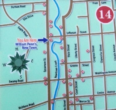
Newtown Heritage Walk No. 14
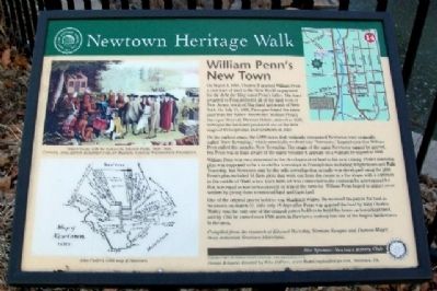
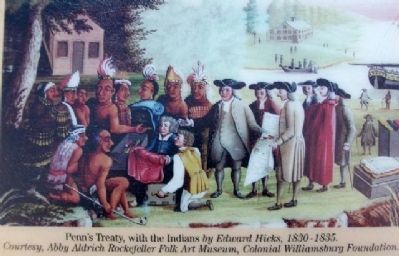
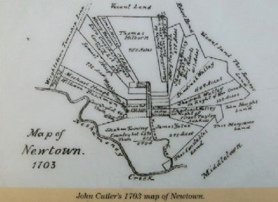
On March 4, 1681, Charles II granted William Penn a vast tract of land in the New World as payment for the debt the King owed Penn's father. The tract awarded to Penn included all of the land west of New Jersey, north of Maryland and south of New York. On July 15, 1682, Penn purchased the same land from the Native Americans. William Penn's Surveyor General, Thomas Holme, arrived in 1682, surveyed the land and produced one of the first maps of Pennsylvania and Newtown in 1687.
On the earliest maps, the 5,000 acres that originally comprised Newtown were originally called “New Township,” which essentially evolved into “Newtown.” Legend says that William Penn called this area his New Township. The origin of the name Newtown cannot be proved, but Penn was at least aware of the name because it appears on a warrant he signed in 1684.
William Penn was very interested in the development of land in his new Colony. Penn's township plan was supposed to be a model for townships in Pennsylvania including Wrightstown and Falls Township, but Newtown may be the only township that actually was developed using the plan. Penn's plan included 16 farm plots that went out from the center in a fan shape with a common in the middle of 30-40 acres. Each farm lot was connected to the common by a townstead lot that was equal in size to ten percent or less of the farm lot. William Penn hoped to attract more settlers by giving them townstead land and farm land.
One of the original patent holders was Shadrach Walley. He received his patent for land in Newtown on March 22, 1681 only 18 days after Penn was granted the land by King Charles. Walley was the only one of the original patent holders to build his home on townstead land, and by 1703 he owned over 1500 acres in Newtown making him one of the largest landowners in the area.
Compiled from the research of Edward Barnsley, Norman Swayne and Thomas Mayer, three dedicated Newtown historians.
Erected 2007 by The Newtown Historical Association and Newtown Rotary Club.
Topics and series. This historical marker is listed in these topic lists: Colonial Era • Exploration • Native Americans • Settlements & Settlers. In addition, it is included in the Rotary International series list. A significant historical date for this entry is March 4, 1681.
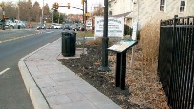
Location. 40° 13.944′ N, 74° 56.273′ W. Marker is near Newtown, Pennsylvania, in Bucks County. It is in Newtown Township. Marker is on Sycamore Street, on the right when traveling north. Marker is about 80 feet south of the intersection of Sycamore and Jefferson Streets. Touch for map. Marker is in this post office area: Newtown PA 18940, United States of America. Touch for directions.
Other nearby markers.
At least 8 other markers are within walking distance of this marker. Randall Double House (within shouting distance of this marker); Old Presbyterian Church (within shouting distance of this marker); Elinor Slack Campbell (within shouting distance of this marker); Brooks House (about 500 feet away, measured in a direct line); Boyd-Yardley House (about 600 feet away); Newtown Common & Creek (approx. 0.2 miles away); Goodnoe Farm & Dairy Bar (approx. 0.2 miles away); Newtown Borough Hall (approx. 0.2 miles away). Touch for a list and map of all markers in Newtown.
Credits. This page was last revised on February 7, 2023. It was originally submitted on April 16, 2010, by William Fischer, Jr. of Scranton, Pennsylvania. This page has been viewed 1,490 times since then and 40 times this year. Photos: 1, 2, 3, 4, 5, 6. submitted on April 16, 2010, by William Fischer, Jr. of Scranton, Pennsylvania.
