Near Rocky Point in Pender County, North Carolina — The American South (South Atlantic)
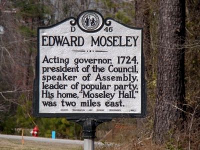
Edward Moseley
Erected 1951 by Archives, Conservation and Highway Departments. (Marker Number D-46.)
Topics and series. This historical marker is listed in this topic list: Colonial Era. In addition, it is included in the North Carolina Division of Archives and History series list. A significant historical year for this entry is 1724.
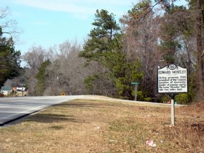
Location. 34° 28.45′ N, 77° 53.233′ W. Marker is near Rocky Point, North Carolina, in Pender County. Marker is on U.S. 117 south of Double Eagle Road, on the right when traveling north. Touch for map. Marker is in this post office area: Rocky Point NC 28457, United States of America. Touch for directions.
Other nearby markers. At least 8 other markers are within 5 miles of this marker, measured as the crow flies. Samuel Ashe (approx. 0.3 miles away); William S. Ashe (approx. 0.3 miles away); General John Ashe (approx. 1.7 miles away); James Moore (approx. 2.3 miles away); Maurice Moore (approx. 2.4 miles away); Alexander Lillington (approx. 2.4 miles away); George Burrington (approx. 4.4 miles away); Stag Park (approx. 4.4 miles away). Touch for a list and map of all markers in Rocky Point.
Also see . . . Edward Moseley. Wikipedia entry. “Edward Moseley (born c. 1682 in England - died 11 July 1749), was the Surveyor General of North Carolina from about 1710 and the first colonial Treasurer of North Carolina starting in 1715. He was responsible (with William Byrd II) for surveying the boundary between North Carolina and Virginia in 1728. He was also Speaker of the North Carolina House of Burgesses (the lower house of the legislature) for several terms, as he was consistently re-elected by the people's party. He briefly acted as Governor of North Carolina while Gov. George Burrington was traveling out of the province.” (Submitted on April 16, 2010.)
Credits. This page was last revised on January 31, 2021. It was originally submitted on April 16, 2010, by J. J. Prats of Powell, Ohio. This page has been viewed 1,305 times since then and 24 times this year. Photos: 1, 2. submitted on April 16, 2010, by J. J. Prats of Powell, Ohio.

