Midtown - Downtown in Columbia in Richland County, South Carolina — The American South (South Atlantic)
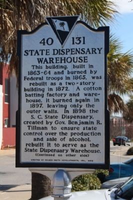
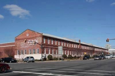
State Dispensary Warehouse
This building, built in 1863-64 and burned by Federal troops in 1865, was rebuilt in 1872 as a cotton batting factory and warehouse. It burned again in 1897, leaving only the outer walls. In 1898 the S.C. State Dispensary, created by Gov. Benjamin R. Tillman to ensure state control over the production and sale of alcohol, rebuilt it as a two-story building to serve as the State Dispensary Warehouse.
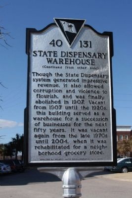
(Reverse text)
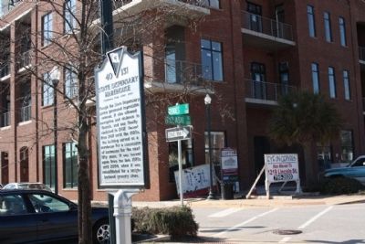
Though the State Dispensary system generated impressive revenue, it also allowed corruption and violence to flourish, and was finally abolished in 1907. Vacant from 1907 until the 1920s, this building served as a warehouse for a succession of businesses for the next fifty years. It was vacant again from the late 1970s until 2004, when it was rehabilitated for a neighborhood grocery store.
Erected 2005 by Holmes Smith Developments, Inc. (Marker Number 40-131.)
Topics. This historical marker is listed in these topic lists: Industry & Commerce • Notable Buildings. A significant historical year for this entry is 1865.
Location. 33° 59.942′ N, 81° 2.62′ W. Marker is in Columbia, South Carolina, in Richland County. It is in Midtown - Downtown. Marker is at the intersection of Geddes Street and Pulaski Street, on the right when traveling east on Geddes Street. Located between Lady and Gervais Streets. Touch for map. Marker is in this post office area: Columbia SC 29201, United States of America. Touch for directions.
Other nearby markers. At least 8 other markers are within walking distance of this marker. Confederate Printing Plant (within shouting distance of this marker); Joseph D. Sapp Memorial Bridge (about 400 feet away, measured in a direct line); Seaboard Air Line Passenger Depot (about 600 feet away); Huger Street (about 700 feet away); Site of Wayside Hospital (approx. 0.2 miles away); Gadsden Street (approx. 0.2 miles away); "The Spirit of the American Doughboy " (approx. 0.2 miles away); USS Columbia CL-56 (approx. 0.2 miles away). Touch for a list and map of all markers in Columbia.
Regarding State Dispensary Warehouse. Prohibition was a major issue in the state's history. Voters endorsed prohibition in 1892 but instead were given the "Dispensary System" of state-owned liquor stores, They soon became symbols of political corruption controlled by Ben Tillman's machine and were shut down in 1907
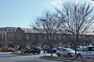
In February of 1865, when General W. T. Sherman’s army occupied Columbia, the building’s contents were seized and the Confederate Printing plant was burned. After the war, the building was eventually repaired. The structure was later used as a liquor warehouse for the South Carolina Dispensary System. During the 1930s, the building was used in conjunction with the U.S. Seed Loan Program. It is a large two-story, commercial Greek Revival brick structure which spans the length of an entire city block. Originally it was a one-story structure with a gable roof. The second story was added after the building was burned in 1865. The southern façade is divided into repetitive bays by molded brick pilasters on both levels. A wide molded brick frieze separates the two stories. Listed in the National Register March 28, 1979. ( Historic Resources of Columbia )
National Register of Historical Places: Confederate Printing Plant Also known as State Dispensary Warehouse *** (added 1979 - Building - #79002393)
Credits. This page was last revised on February 16, 2023. It was originally submitted on April 17, 2010, by Mike Stroud of Bluffton, South Carolina. This page has been viewed 1,105 times since then and 22 times this year. Photos: 1, 2, 3, 4, 5. submitted on April 17, 2010, by Mike Stroud of Bluffton, South Carolina.
