Marker Logo HMdb.org THE HISTORICAL
MARKER DATABASE
“Bite-Size Bits of Local, National, and Global History”
Buxton in Dare County, North Carolina — The American South (South Atlantic)
 

Cape Hatteras Lighthouse


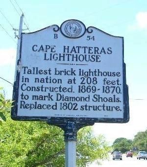
Cape Hatteras Lighthouse Marker image. Click for full size.
Photographed By Kevin W., June 23, 2009
1. Cape Hatteras Lighthouse Marker
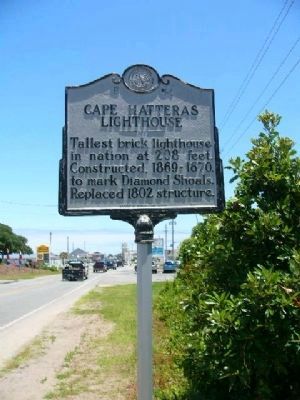
Inscription. Tallest brick lighthouse in nation at 208 feet. Constructed, 1869-1870, to mark Diamond Shoals. Replaced 1802 structure.
 
Erected 1989 by Division of Archives and History. (Marker Number B-54.)
 
Topics and series. This historical marker is listed in these topic lists: CommunicationsMan-Made FeaturesWaterways & Vessels. In addition, it is included in the Lighthouses, the National Historic Landmarks, and the North Carolina Division of Archives and History series lists. A significant historical year for this entry is 1802.
 
Location. 35° 15.899′ N, 75° 31.489′ W. Marker is in Buxton, North Carolina, in Dare County. Marker is at the intersection of State Highway 12 and Lighthouse Road, on the left when traveling south on State Highway 12. Touch for map. Marker is in this post office area: Buxton NC 27920, United States of America. Touch for directions.
 
Other nearby markers. At least 8 other markers are within 6 miles of this marker, measured as the crow flies. Diamond Shoals (approx. ¼ mile away); Radio Milestone (approx. 0.4 miles away); Keepers of the Light (approx. one mile away); Life at the Light (approx. one mile away); Paukenschlag (approx. 1.3 miles away); Welcome to Frisco (approx. 3.7 miles away); Welcome to Kinnakeet...
Paid Advertisement
Click on the ad for more information.
Please report objectionable advertising to the Editor.
Click or scan to see
this page online
(approx. 5.3 miles away); Mitchell Demonstrates Air Power (approx. 6 miles away). Touch for a list and map of all markers in Buxton.
 
Also see . . .  Cape Hatteras Light Station National Historic Landmark Study. (Submitted on April 29, 2010.)
 
Cape Hatteras Lighthouse Marker image. Click for full size.
Photographed By Kevin W., June 23, 2009
2. Cape Hatteras Lighthouse Marker
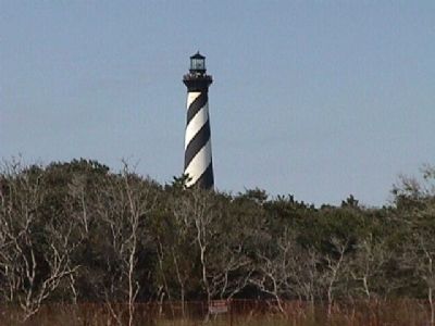
Cape Hatteras Lighthouse image. Click for full size.
Photographed By M. L., September 2000
3. Cape Hatteras Lighthouse
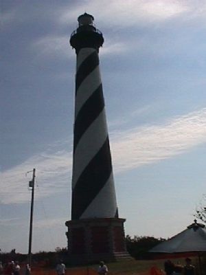
Cape Hatteras Lighthouse image. Click for full size.
Photographed By M. L., September 2000
4. Cape Hatteras Lighthouse
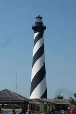
Cape Hatteras Lighthouse, Cape Hatteras National Seashore image. Click for full size.
Photographed By Richard E. Miller, April 16, 2010
5. Cape Hatteras Lighthouse, Cape Hatteras National Seashore
View from National Park Service visitor's center.
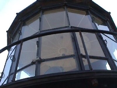
Picture of the light - Cape Hatteras Lighthouse. image. Click for full size.
Photographed By M. L., September 2000
6. Picture of the light - Cape Hatteras Lighthouse.
This picture was taken from the observation platform that surrounds the light. The platform was also used by the tenders to clean and maintain the light.
Inside the Cape Hatteras Lighthouse. image. Click for full size.
Photographed By M. L., September 2000
7. Inside the Cape Hatteras Lighthouse.
This picture is of the mechanism that was used to turn the light.
Stair well inside Cape Hatteras Lighthouse. image. Click for full size.
Photographed By M. L., September 2000
8. Stair well inside Cape Hatteras Lighthouse.
I have forgotten the number of steps to reach the top. There was a plaque at the base that told how many steps there are. I can verify that, what ever the number, they are all there, and it felt like maybe a few extra.
View from the top of Cape Hatteras Lighthouse. image. Click for full size.
Photographed By M. L., September 2000
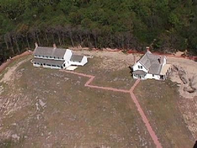
9. View from the top of Cape Hatteras Lighthouse.
The picture is of the lighthouse tender's residence. They were also moved to the present site when the lighthouse was moved.
View from Cape Hatteras Lighthouse looking toward the ocean. image. Click for full size.
Photographed By M. L., September 2000
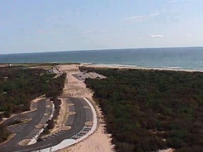
10. View from Cape Hatteras Lighthouse looking toward the ocean.
This view is looking toward the spot that the lighthouse was moved from. The cleared area is where steel plates were laid for the carriage that supported the lighthouse, to ride on.
Ample parking. image. Click for full size.
Photographed By M. L., September 2000
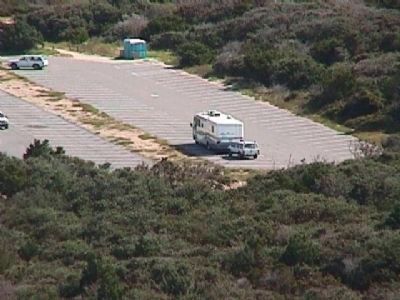
11. Ample parking.
Ample parking, even for the big boys toys.
Camp ground image. Click for full size.
Photographed By M. L., September 2000
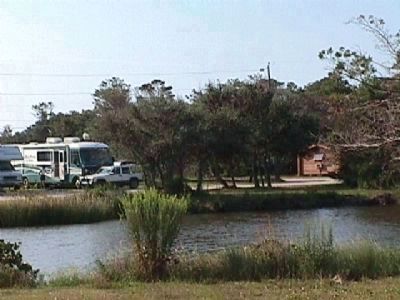
12. Camp ground
There is plenty of camping close to the lighthouse.
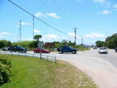
Entrance to Cape Hatteras image. Click for full size.
Photographed By Kevin W., June 23, 2009
13. Entrance to Cape Hatteras
 
 
Credits. This page was last revised on February 1, 2024. It was originally submitted on September 12, 2008, by M. L. 'Mitch' Gambrell of Taylors, South Carolina. This page has been viewed 3,049 times since then and 28 times this year. Last updated on April 20, 2010, by Richard E. Miller of Oxon Hill, Maryland. Photos:   1, 2. submitted on July 1, 2009, by Kevin W. of Stafford, Virginia.   3, 4. submitted on September 13, 2008, by M. L. 'Mitch' Gambrell of Taylors, South Carolina.   5. submitted on April 20, 2010, by Richard E. Miller of Oxon Hill, Maryland.   6, 7, 8, 9, 10, 11, 12. submitted on September 13, 2008, by M. L. 'Mitch' Gambrell of Taylors, South Carolina.   13. submitted on July 1, 2009, by Kevin W. of Stafford, Virginia. • Kevin W. was the editor who published this page.
Share this page.  
Share on Tumblr
m=29950

CeraNet Cloud Computing sponsors the Historical Marker Database.
This website earns income from purchases you make after using our links to Amazon.com. We appreciate your support.
Paid Advertisement
Apr. 24, 2024