Main/Military Plaza in San Antonio in Bexar County, Texas — The American South (West South Central)
Main Plaza Fortifications
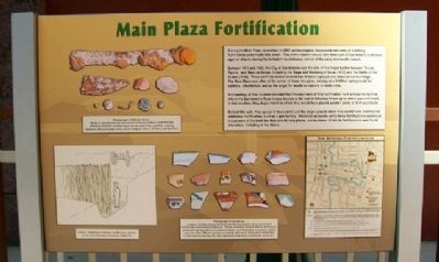
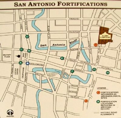
During the Main Plaza renovation in 2007, archaeologists discovered remnants of a military fortification underneath this street. This entrenchment would have been part of San Antonio's defense against attacks during the turbulent revolutionary period of the early nineteenth century.
Between 1835 and 1842, the City of San Antonio was the site of five major battles between Texian, Tejano, and Mexican forces, including the Siege and Storming of Bexar (1835) and the Battle of the Alamo (1836). These conflicts forever altered San Antonio's people and physical surroundings. The Main Plaza was often at the center of these struggles, serving as a fortified campground for soldiers, a battlefield, and as the target for would be captors on both sides.
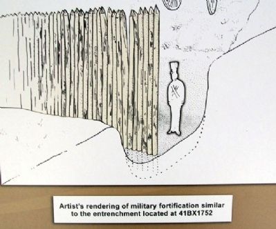
Archaeology at this location revealed that the engineers of this fortification built a slope rising from where the San Antonio River is now located at the end of Dolorosa Street up to where you now stand. In this location, they dug a trench in which they would have placed wooden posts to form a palisade.
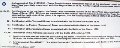
Behind this wall, they appear to have continued the slope upward where they would have constructed additional fortification, such as a gun battery. Historical accounts verify these fortifications existed at the corners of the [sic] both the Main and Military plazas, and evidence of similar fortifications was found elsewhere, including at the Alamo.
Topics. This historical marker is listed in these topic lists: Forts and Castles • Man-Made Features • Military • Notable Events • Patriots & Patriotism • Settlements & Settlers • War, Texas Independence. A significant historical year for this entry is 2007.
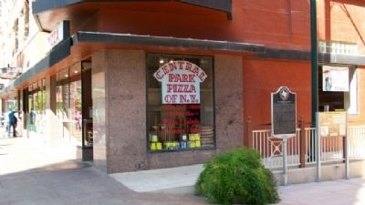
Location. 29° 25.431′ N, 98° 29.593′ W. Marker is in San Antonio, Texas, in Bexar County. It is in Main/Military Plaza. Marker is at the intersection of Dwyer Avenue and Kallison Walk, on the right when traveling north on Dwyer Avenue. Touch for map. Marker is at or near this postal address: 136 E Main Plaza, San Antonio TX 78205, United States of America. Touch for directions.
Other nearby markers. At least 8 other markers are within walking distance of this marker. The Storming of Bexar (here, next to this marker); San Antonio Mutual Aid Association (a few steps from this marker); Justice's Court (a few steps from this marker); San Antonio: The Flavor of Its Past (within shouting distance of this marker); The West Bank (within shouting distance of this marker); The Bexar County Courthouse (within shouting distance of this marker); The Maromeros or Rope Dancers (within shouting distance of this marker); Sell the Courthouse (within shouting distance of this marker). Touch for a list and map of all markers in San Antonio.
Photographed By William Fischer, Jr., March 31, 2010
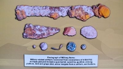
4. Photo of Military Items on Marker
[Caption reads] Military-related artifacts recovered from excavations of 41BX1752. Artifacts pictured include a gun barrel, sword tip, gunflint, striking platform, bird and grape shot, arrow insignia from a uniform, and buttons.

Photographed By William Fischer, Jr., March 31, 2010
5. Main Plaza Ceramics Photo on Marker
[Caption reads] Ceramic sherds recovered from the fill forming the slope up to and behind the entrenchment feature. These ceramics include Native American-produced pottery, Mexican-made ceramics, and European ceramics, which represent the different groups of people who were living and interacting in San Antonio during the late eighteenth and early nineteenth centuries.
Credits. This page was last revised on February 2, 2023. It was originally submitted on April 29, 2010, by William Fischer, Jr. of Scranton, Pennsylvania. This page has been viewed 1,539 times since then and 13 times this year. Photos: 1, 2, 3, 4, 5, 6, 7. submitted on April 29, 2010, by William Fischer, Jr. of Scranton, Pennsylvania.
