Near Pine Springs in Culberson County, Texas — The American South (West South Central)
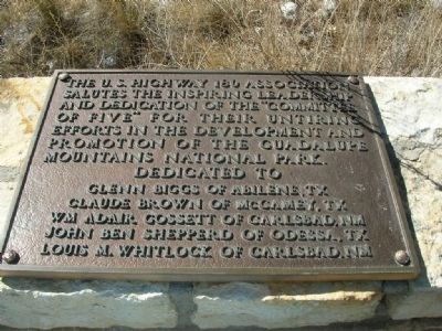
The "Committee of Five"
Dedicated to
Glenn Biggs of Abilene, TX
Claude Brown of McCamey, TX
Wm. Adair Gossett of Carlsbad, NM
John Ben Shepperd of Odessa, TX
Louis M. Whitlock of Carlsbad, NM.
Erected by The U.S. Highway 180 Association.
Topics. This historical marker is listed in this topic list: Charity & Public Work.
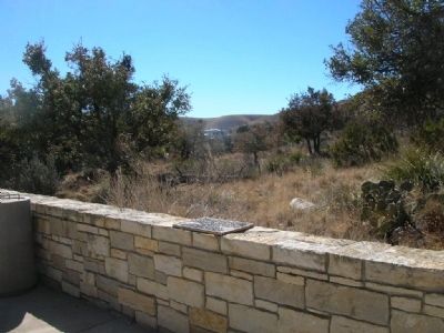
Location. 31° 53.655′ N, 104° 49.325′ W. Marker is near Pine Springs, Texas, in Culberson County. Marker can be reached from County Route 60 near U.S. 180. Marker is set on top of a stone wall near the visitor center. Touch for map. Marker is at or near this postal address: HC 60 Box 400, Salt Flat TX 79847, United States of America. Touch for directions.
Other nearby markers. At least 8 other markers are within 3 miles of this marker, measured as the crow flies. Stephen Tyng Mather (here, next to this marker); Groundbreaking for the Pine Springs Visitor Center (a few steps from this marker); Butterfield Overland Mail (approx. 0.3 miles away); The Airmen (approx. 0.3 miles away); Ruins of "The Pinery" or "Pine Spring" Stage Stand (approx. 0.3 miles away); Frijole Historic Site (approx. 1˝ miles away); Frijole School House (approx. 1˝ miles away); Guadalupe Peak (approx. 3.1 miles away). Touch for a list and map of all markers in Pine Springs.
Credits. This page was last revised on June 16, 2016. It was originally submitted on March 5, 2008, by Julie Szabo of Oldsmar, Florida. This page has been viewed 1,360 times since then and 20 times this year. Last updated on May 4, 2010, by James R. Kuntz of Warrenton, Missouri. Photos: 1, 2, 3. submitted on March 5, 2008, by Julie Szabo of Oldsmar, Florida. • Kevin W. was the editor who published this page.


