Manchester in Richmond, Virginia — The American South (Mid-Atlantic)
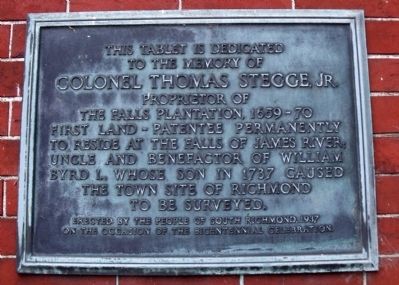
Colonel Thomas Stegge, Jr.
to the memory of
Colonel Thomas Stegge, Jr.
proprietor of
the Falls Plantation, 1659-70
first land-patentee permanently
to reside at the falls of James River;
uncle and benefactor of William
Byrd I., whose son in 1737 caused
the town site of Richmond
to be surveyed.
Erected by the people of south Richmond, 1937
on the occasion of the bicentennial celebration
Erected 1937.
Topics. This historical marker is listed in these topic lists: Agriculture • Colonial Era • Settlements & Settlers • Waterways & Vessels. A significant historical year for this entry is 1737.
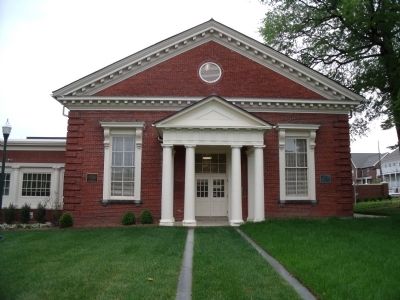
Location. 37° 31.312′ N, 77° 26.521′ W. Marker is in Richmond, Virginia. It is in Manchester. Marker can be reached from the intersection of East 10th Street and Hull Street Road (U.S. 360). This tablet is affixed to the front of the old Manchester Courthouse. Touch for map. Marker is at or near this postal address: 920 Hull Street, Richmond VA 23224, United States of America. Touch for directions.
Other nearby markers. At least 8 other markers are within walking distance of this marker. Manchester Elliott Grays (a few steps from this marker); Dorothy Height (approx. ¼ mile away); Manchester Lodge No. 14 (approx. ¼ mile away); Dr. Dorothy Irene Height (approx. ¼ mile away); The African Church of Manchester (approx. 0.3 miles away); The First Baptist Church of South Richmond (approx. 0.3 miles away); Manchester Canal (approx. half a mile away); Transitions (approx. half a mile away). Touch for a list and map of all markers in Richmond.
Credits. This page was last revised on February 1, 2023. It was originally submitted on May 4, 2010, by Bernard Fisher of Richmond, Virginia. This page has been viewed 1,153 times since then and 40 times this year. Photos: 1, 2, 3. submitted on May 4, 2010, by Bernard Fisher of Richmond, Virginia.


