Dahlonega in Lumpkin County, Georgia — The American South (South Atlantic)
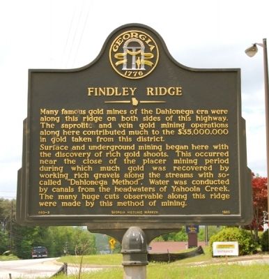
Findley Ridge
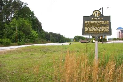
Surface and underground mining began here with the discovery of rich gold shoots. This occurred near the close of the placer mining period during which much gold was recovered by working rich gravels along the streams with so-called “Dahlonega Method”. Water was conducted by canals from the headwaters of Yahoola Creek. The many huge cuts observable along this ridge were made by this method of mining.
Erected 1989 by Georgia Department of Natural Resources. (Marker Number 093-2.)
Topics and series. This historical marker is listed in these topic lists: Industry & Commerce • Natural Resources. In addition, it is included in the Georgia Historical Society series list.
Location. 34° 31.411′ N, 83° 58.438′ W. Marker is in Dahlonega, Georgia, in Lumpkin County. Marker is on U.S. 19, 0.1 miles south of Mountain Drive, on the right when traveling north. Touch for map. Marker is in this post office area: Dahlonega GA 30533, United States of America. Touch for directions.
Other nearby markers. At least 8 other markers are within walking distance of this marker. Madeleine Kiker Anthony (approx. 0.4 miles away); Stamp Mill (approx. 0.4 miles away); Seven Oaks (approx. 0.7 miles away); Dahlonega Stories (approx. 0.8 miles away); a different marker also named Dahlonega Stories (approx. 0.9 miles away); a different marker also named Dahlonega Stories (approx. 0.9 miles away); a different marker also named Dahlonega Stories (approx. 0.9 miles away); Mt. Hope Cemetery (approx. 0.9 miles away). Touch for a list and map of all markers in Dahlonega.
More about this marker. This marker replaced an earlier marker of the same title and text at this location erected by the Georgia Historical Commission.
Additional keywords. gold, mining
Credits. This page was last revised on June 16, 2016. It was originally submitted on May 5, 2010, by David Seibert of Sandy Springs, Georgia. This page has been viewed 1,443 times since then and 25 times this year. Photos: 1, 2, 3. submitted on May 5, 2010, by David Seibert of Sandy Springs, Georgia. • Craig Swain was the editor who published this page.


