Crestwood in Phoenix in Maricopa County, Arizona — The American Mountains (Southwest)
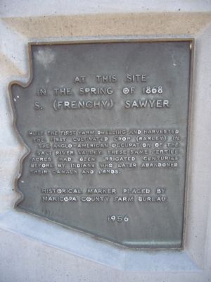
S. (Frenchy) Sawyer
in the Spring of 1868
S. (Frenchy) Sawyer
Erected 1956 by Maricopa County Farm Bureau.
Topics. This historical marker is listed in these topic lists: Agriculture • Native Americans • Settlements & Settlers • Waterways & Vessels. A significant historical year for this entry is 1868.
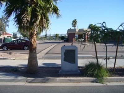
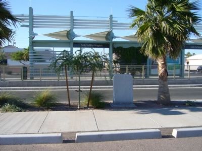
Location. 33° 26.889′ N, 112° 1.759′ W. Marker is in Phoenix, Arizona, in Maricopa County. It is in Crestwood. Marker can be reached from East Washington Street, 0.1 miles east of South 24th Street. Marker is along the south curb of East Washington Street but is hidden by the Metro Station. It is best to park in the lot between Washington Street & Jefferson Street east of 24th Street (see photo #3). Touch for map. Marker is at or near this postal address: 2416 East Washinton Street, Phoenix AZ 85034, United States of America. Touch for directions.
Other nearby markers. At least 8 other markers are within 3 miles of this marker, measured as the crow flies. Eastlake Park (approx. 1.1 miles away); First Latter-day Saint Chapel in Phoenix (approx. 2.1 miles away); The Carriage House (approx. 2.1 miles away); Rosson House (approx. 2.1 miles away); Phoenix Union High School World War I Memorial (approx. 2.1 miles away); Father Edouard Gerard (approx. 2.3 miles away); Pope John Paul II (approx. 2.3 miles away); Saint Mary's Basilica (approx. 2.3 miles away). Touch for a list and map of all markers in Phoenix.
Credits. This page was last revised on February 2, 2023. It was originally submitted on May 6, 2010, by Bill Kirchner of Tucson, Arizona. This page has been viewed 1,289 times since then and 24 times this year. Photos: 1, 2, 3. submitted on May 6, 2010, by Bill Kirchner of Tucson, Arizona. • Syd Whittle was the editor who published this page.


