Near Millboro in Bath County, Virginia — The American South (Mid-Atlantic)
Fort Lewis
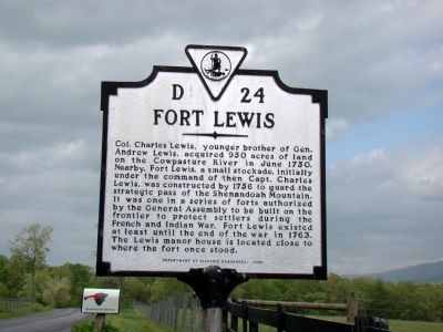
Col. Charles Lewis, younger brother of Gen. Andrew Lewis, acquired 950 acres of land on the Cowpasture River in June 1750. Nearby, Fort Lewis, a small stockade, initially under the command of then Capt. Charles Lewis, was constructed by 1756 to guard the strategic pass of the Shenandoah Mountain. It was one in a series of forts authorized by the General Assembly to be built on the frontier to protect settlers during the French and Indian War. Fort Lewis existed at least until the end of the war in 1763. The Lewis manor house is located close to where the fort once stood.
Erected 2000 by Department of Historic Resources. (Marker Number D-24.)
Topics and series. This historical marker is listed in these topic lists: Colonial Era • Forts and Castles • War, French and Indian. In addition, it is included in the Virginia Department of Historic Resources (DHR) series list. A significant historical month for this entry is June 1750.
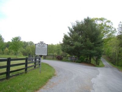
Location. 38° 7.467′ N, 79° 37.25′ W. Marker is near Millboro, Virginia, in Bath County. Marker is at the intersection of Indian Draft (County Route 625) and Fort Lewis Road, on the left when traveling south on Indian Draft. It is at the turnoff for Fort Lewis Lodge Bed and Breakfast. Touch for map. Marker is at or near this postal address: 603 Old Plantation Way, Millboro VA 24460, United States of America. Touch for directions.
Other nearby markers. At least 8 other markers are within 10 miles of this marker, measured as the crow flies. Windy Cove Presbyterian Church (approx. 8˝ miles away); T. C. Walker School (approx. 8.8 miles away); Settlement on Warm Springs Mountain (approx. 9.4 miles away); The Virginia Springs Resorts (approx. 9.4 miles away); The Land and Natural Resources of Bath County (approx. 9.4 miles away); Life at the Tollhouse (approx. 9.4 miles away); The Turnpike Movement in Virginia, 1825-1835 (approx. 9.4 miles away); Camp Mont Shenandoah (approx. 9˝ miles away).
Also see . . . Frontier History. Fort Lewis Lodge and Farm website homepage:
“The richness and sheer beauty of the land led Colonel Charles Lewis to settle here more than two centuries ago. In 1750 he built a small stockade to protect the southern pass of Shenandoah Mountain from Indian raids. Col. Lewis went on to die a hero's death fighting the Shawnee, allies of the British, in the 1774 Battle of Point Pleasant, now widely regarded as the first conflict of the American Revolution. His vast 3,200 acre mountain farm, once known as ‘Fort Lewis Plantation,’ has remained relatively unchanged over its 200 year history. ” (Submitted on May 8, 2010.)
Credits. This page was last revised on March 11, 2022. It was originally submitted on May 8, 2010, by J. J. Prats of Powell, Ohio. This page has been viewed 2,217 times since then and 95 times this year. Photos: 1, 2. submitted on May 8, 2010, by J. J. Prats of Powell, Ohio.
Editor’s want-list for this marker. Photos of the Lewis manor house and lodge grounds. • Can you help?

