Phillipsburg in Warren County, New Jersey — The American Northeast (Mid-Atlantic)
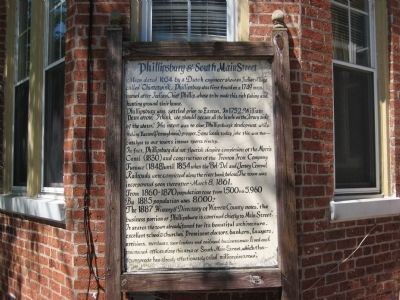
Phillipsburg & South Main Street
Phillipsburg was settled prior to Easton. In 1752, William Penn wrote, "I think we should secure all the lands on the Jersey side of the water". His intent was to slow Phillipsburg's development while making Easton (Pennsylvania) prosper. Some locals today joke this was the catalyst to our town's intense sports rivalry.
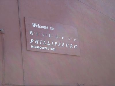
In fact, Phillipsburg did not flourish despite completion of the Morris Canal (1830) and construction of the Trenton Iron Company Furnace (1848) until 1854 when the Bel-Del and Jersey Central Railroads were completed along the river bank below. The town was incorporated soon thereafter - March 8, 1861.
From 1860 - 1870 population rose from 1,500 to 5,960. By 1885 population was 8,000+.
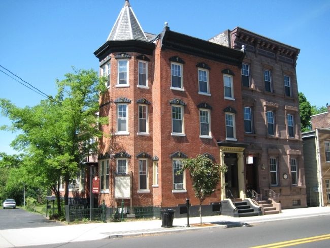
The 1887 History & Directory of Warren County notes, "the business portion of Phillipsburg is confined chiefly to Main Street". It states the town already famed for its beautiful architecture, excellent school & churches. Prominent doctors, bankers, lawyers, artisans, merchants, town leaders and railroad businessmen lived and maintained offices along this area of South Main Street, which the townspeople has already affectionately called "millionaire's row".
Topics. This historical marker is listed in this topic list: Settlements & Settlers. A significant historical month for this entry is March 1910.
Location. 40° 41.371′ N, 75° 12.064′ W. Marker is in Phillipsburg, New Jersey, in Warren County. Marker is at the intersection of South Main Street and Elizabeth Street, on the left when traveling north on South Main Street. Touch for map. Marker is in this post office area: Phillipsburg NJ 08865, United States of America. Touch for directions.
Other nearby markers. At least 8 other markers are within walking distance of this marker. Stites-Lander Townhouse (here, next to this marker); Lander-Stewart Mansion (a few steps from this marker); Dale Estate (within shouting distance of this marker); Bluestone Sidewalks (within shouting distance of this marker); Stites - Thomas Store (within shouting distance of this marker); Winter & Co. (within shouting distance of this marker); S.A. Comstock Building (within shouting distance of this marker); Presbyterian Manse (within shouting distance of this marker). Touch for a list and map of all markers in Phillipsburg.
Credits. This page was last revised on June 16, 2016. It was originally submitted on May 9, 2010, by Alan Edelson of Union Twsp., New Jersey. This page has been viewed 1,124 times since then and 52 times this year. Photos: 1, 2, 3. submitted on May 9, 2010, by Alan Edelson of Union Twsp., New Jersey. • Kevin W. was the editor who published this page.


