Near San Augustine in San Augustine County, Texas — The American South (West South Central)
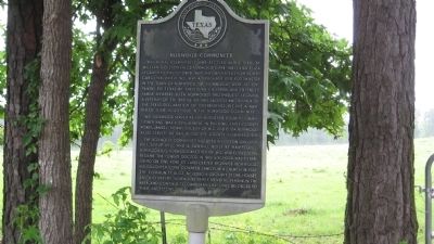
Norwood Community
This rural community was settled in the 1840s by William Coleson (W.C.) Norwood (1794-1885) and Eliza LeGrand Norwood (1808-1859). They migrated from North Carolina, where W.C. was a merchant and postmaster in the town of Norwood. The Norwoods were accompanied to Texas by their nine children and extended family members. Eliza Norwood's brother, E.O. LeGrand, a veteran of the Battle of San Jacinto and signer of the Texas Declaration of Independence, became a member of their household in the Norwood community.
W.C. Norwood served as San Augustine County commissioner and was instrumental in building early county roads. James L. Norwood, son of W.C. and Eliza Norwood, also served as San Augustine County commissioner.
The Norwood community included a cotton gin, grist mill, syrup mill, and a sawmill built by Hampton L. Norwood. E.O. Norwood, another of W.C. and Eliza's sons, became the town's doctor. In 1892 a school was established on one acre of land deeded by James Norwood. His daughter Cora donated land for a church in 1926. The community also included a grocery store, houses, and a cemetery. Norwood family members remain in the area, and continue to own land once belonged to their ancestors.
Erected 1997 by Texas Historical Commission. (Marker Number 7629.)
Topics. This historical marker is listed in this topic list: Settlements & Settlers. A significant historical year for this entry is 1892.
Location. 31° 23.64′ N, 94° 11.766′ W. Marker is near San Augustine, Texas, in San Augustine County. Marker is on State Highway 103, half a mile west of State Highway 147, on the left when traveling west. Touch for map. Marker is in this post office area: San Augustine TX 75972, United States of America. Touch for directions.
Other nearby markers. At least 8 other markers are within 11 miles of this marker, measured as the crow flies. Location of the First Presbyterian Church in Texas (approx. 8.9 miles away); Kings Highway Camino Real — Old San Antonio Road (approx. 8.9 miles away); a different marker also named Kings Highway Camino Real — Old San Antonio Road (approx. 9.1 miles away); a different marker also named Kings Highway Camino Real — Old San Antonio Road (approx. 10.1 miles away); Site of Mission Nuestra Señora de Los Dolores de Los Ais (approx. 10.1 miles away); a different marker also named Kings Highway Camino Real — Old San Antonio Road (approx. 10.1 miles away); James Pinckney Henderson (approx. 10.4 miles away); Space Shuttle Columbia Memorial (approx. 10.6 miles away). Touch for a list and map of all markers in San Augustine.
Credits. This page was last revised on August 14, 2021. It was originally submitted on May 10, 2010, by Steve Gustafson of Lufkin, Texas. This page has been viewed 1,277 times since then and 96 times this year. Photo 1. submitted on May 10, 2010, by Steve Gustafson of Lufkin, Texas. • Bill Pfingsten was the editor who published this page.
Editor’s want-list for this marker. A photo of the marker and the surrounding area in context. • Can you help?
