Gurley in Madison County, Alabama — The American South (East South Central)
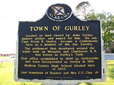
Town of Gurley
Erected 1986 by Alabama Historical Association.
Topics and series. This historical marker is listed in these topic lists: Education • Railroads & Streetcars • Settlements & Settlers • War, US Civil. In addition, it is included in the Alabama Historical Association series list. A significant historical year for this entry is 1866.
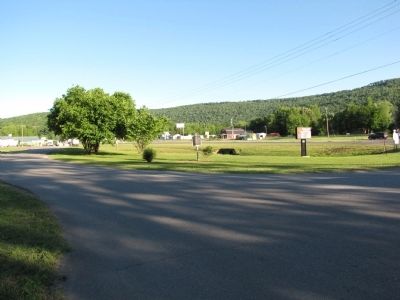
Location. 34° 41.832′ N, 86° 22.649′ W. Marker is in Gurley, Alabama, in Madison County. Marker is at the intersection of Lee Highway/John T Reid Parkway (U.S. 72) and Gurley Pike, on the right when traveling west on Lee Highway/John T Reid Parkway. Touch for map. Marker is in this post office area: Gurley AL 35748, United States of America. Touch for directions.
Other nearby markers. At least 8 other markers are within 8 miles of this marker, measured as the crow flies. "Wildwood" (approx. one mile away); The History of Paint Rock, Alabama / Paint Rock Arrests in 1931 Began 'Scottsboro Boys' Cases (approx. 3˝ miles away); Trail of Tears (approx. 4 miles away); Bethel Cemetery (approx. 6 miles away); Central High School/Central Junior High School (approx. 6˝ miles away); Flint River Primitive Baptist Church (approx. 6˝ miles away); a different marker also named Flint River Primitive Baptist Church (approx. 6˝ miles away); Shiloh United Methodist Church (approx. 7˝ miles away).
Credits. This page was last revised on June 16, 2016. It was originally submitted on May 10, 2010, by Lee Hattabaugh of Capshaw, Alabama. This page has been viewed 1,763 times since then and 57 times this year. Photos: 1, 2. submitted on May 10, 2010, by Lee Hattabaugh of Capshaw, Alabama. • Craig Swain was the editor who published this page.

