Pine Bluff in Jefferson County, Arkansas — The American South (West South Central)
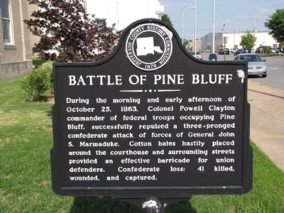
Battle of Pine Bluff
Erected 1976 by Jefferson County History Commission.
Topics. This historical marker is listed in this topic list: War, US Civil. A significant historical date for this entry is October 25, 1824.
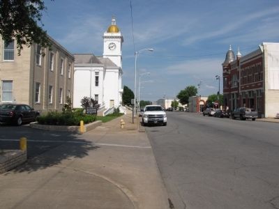
Location. 34° 13.773′ N, 92° 0.207′ W. Marker is in Pine Bluff, Arkansas, in Jefferson County. Marker is on West Barraque Street just west of North Main Street, on the right when traveling west. Marker is on the grounds of the courthouse near the West end of building. Touch for map. Marker is in this post office area: Pine Bluff AR 71601, United States of America. Touch for directions.
Other nearby markers. At least 8 other markers are within 4 miles of this marker, measured as the crow flies. Auguste La noir de Serville (a few steps from this marker); A Memorial to the War that United the North and South (within shouting distance of this marker); Jefferson County First Court House (within shouting distance of this marker); Barraque Street (about 300 feet away, measured in a direct line); Joseph Bonne Cabin (about 500 feet away); Boone-Murphy House / Union Strategy and Pine Bluff (approx. half a mile away); Joseph Carter Corbin (approx. 1.2 miles away); Bayou Bartholomew (approx. 3.6 miles away). Touch for a list and map of all markers in Pine Bluff.
Credits. This page was last revised on June 16, 2016. It was originally submitted on May 10, 2010, by Lee Hattabaugh of Capshaw, Alabama. This page has been viewed 2,165 times since then and 69 times this year. Photos: 1, 2. submitted on May 10, 2010, by Lee Hattabaugh of Capshaw, Alabama. • Craig Swain was the editor who published this page.

