Downtown in San Antonio in Bexar County, Texas — The American South (West South Central)
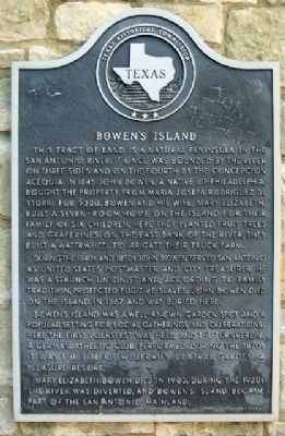
Bowen's Island
During the 1840s and 1850s John Bowen served San Antonio as United States Postmaster and City Treasurer. He was a staunch Unionist and, according to family tradition, protected fugitive slaves. John Bowen died on the island in 1867 and was buried here.
Bowen's Island was a well-known garden spot and a popular setting for social gatherings and celebrations. Here the first Volkfest was held, and the Turnverein, a German athletic club, performed. During the 1870s it was the site of Wolfram's Central Garden, a pleasure resort.
Mary Elizabeth Bowen died in 1903. During the 1920s the river was diverted, and Bowen's Island became part of the San Antonio mainland.
Erected 1985 by Texas Historical Commission. (Marker Number 474.)
Topics. This historical marker is listed in these topic lists: Abolition & Underground RR • Industry & Commerce • Settlements & Settlers • Waterways & Vessels. A significant historical year for this entry is 1845.
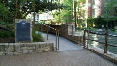
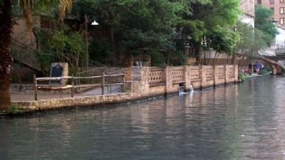
Location. 29° 25.385′ N, 98° 29.452′ W. Marker is in San Antonio, Texas, in Bexar County. It is in Downtown. Marker can be reached from 145 Navarro Street. Marker is along the River Walk, about 200 feet west of the Navarro Street Bridge, and near the City Public Service and Tower Life Buildings. Touch for map. Marker is in this post office area: San Antonio TX 78205, United States of America. Touch for directions.
Other nearby markers. At least 8 other markers are within walking distance of this marker. A different marker also named Bowen's Island (within shouting distance of this marker); Old Mill Crossing (within shouting distance of this marker); Padre Damian Massanet's Table (about 300 feet away, measured in a direct line); Presa Street Crossing (about 400 feet away); The Pajalache Acequia (Ditch) (about 400 feet away); Old San Antonio National Bank Building (about 500 feet away); Address by President Lincoln (about 500 feet away); Site of the Old Adobe (about 600 feet away). Touch for a list and map of all markers in San Antonio.
Credits. This page was last revised on February 2, 2023. It was originally submitted on May 19, 2010, by William Fischer, Jr. of Scranton, Pennsylvania. This page has been viewed 2,000 times since then and 87 times this year. Photos: 1, 2, 3. submitted on May 19, 2010, by William Fischer, Jr. of Scranton, Pennsylvania.


