Halifax in Halifax County, Virginia — The American South (Mid-Atlantic)
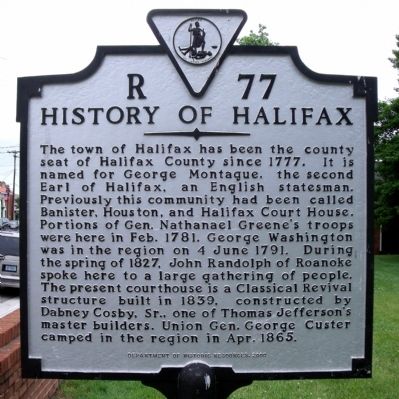
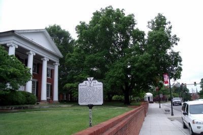
History of Halifax
Erected 2000 by Department of Historic Resources. (Marker Number R-77.)
Topics and series. This historical marker is listed in these topic lists: Architecture • Notable Buildings • Settlements & Settlers • War, US Civil • War, US Revolutionary. In addition, it is included in the Former U.S. Presidents: #03 Thomas Jefferson, and the Virginia Department of Historic Resources (DHR) series lists. A significant historical date for this entry is June 4, 1791.
Location. 36° 45.937′ N, 78° 55.732′ W. Marker is in Halifax, Virginia, in Halifax County. Marker is at the intersection of South Main Street (U.S. 501) and Edmunds Boulevard (Virginia Route 349), on the left when traveling north on South Main Street. Touch for map. Marker is in this post office area: Halifax VA 24558, United States of America. Touch for directions.
Other nearby markers. At least 8 other markers are within 3 miles of this marker, measured as the crow flies. Halifax County Confederate Monument (within shouting distance of this marker); Frank Eubank Booker, Jr. (within shouting distance of this marker); Halifax County War Memorial (about 300 feet away, measured in a direct line); Halifax Court House (about 300 feet away); Mary M. Bethune High School (approx. 0.4 miles away); Green's Folly (approx. 1.7 miles away); Minister Who Married Lincoln (approx. 1.7 miles away); L.E. Coleman African American Museum (approx. 2.6 miles away). Touch for a list and map of all markers in Halifax.
Also see . . . The History of Halifax County. (Submitted on May 20, 2010, by Bernard Fisher of Richmond, Virginia.)
Credits. This page was last revised on February 3, 2020. It was originally submitted on May 20, 2010, by Bernard Fisher of Richmond, Virginia. This page has been viewed 1,097 times since then and 40 times this year. Photos: 1, 2, 3, 4. submitted on May 20, 2010, by Bernard Fisher of Richmond, Virginia.


