Washington Township near Blue Ridge Summit in Franklin County, Pennsylvania — The American Northeast (Mid-Atlantic)
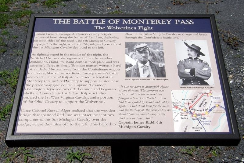
The Battle of Monterey Pass
Inscription.
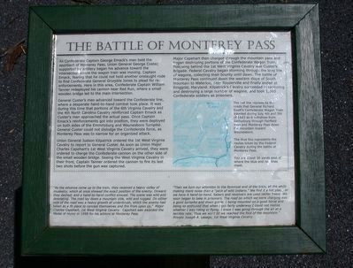
As Confederate Captain George Emack's men held the approach of Monterey Pass, Union General George Custer, supported by artillery began his attack toward the intersection where the wagon train was retreating. Captain Emack, fearing that he could not hold another onslaught rode to find Confederate General Grumble Jones and plead for reinforcements. Here in this pass Confederate Captain William Tanner redeployed his cannon near the road where a small wooden bridge led to the main intersection.
General Custer's men advanced toward the Confederate line where a desperate hand-to-hand combat took place. It was during this time that portions of the 6th Virginia Cavalry and the 4th North Carolina Cavalry reinforced Captain Emack as Custer's men approached the actual pass. Once Captain Emack's reinforcements got into position, they were deployed on both sides of the Emmitsburg and Waynesboro Turnpike. General Custer could not dislodge the Confederate force, as Monterey Pass was too narrow for an organized attack.
Union General Judson Kilpatrick ordered the 1st West Virginia Cavalry to report to General Custer. As soon as Union Major Charles Capehart's 1st West Virginia Cavalry arrived, they were ordered to charge the Confederate cannon on the other side of the small wooden bridge. Seeing the West Virginia Cavalry in their front, Captain Tanner ordered the cannon to fire its last two shots before the gun was captured.
Major Capehart then charged through the mountain pass and began destroying portions of the Confederate Wagon Train. Following behind the 1st West Virgina Cavalry was Custer's Brigade. Federal Cavalry began storming through the long line of wagons, collecting their bounty until dawn. The battle of Monterey Pass continued down the western slope of South Mountain to Waterloo, near Rouzerville and finally ended at Ringgold, Maryland. Kilpatrick's Cavalry succeeded in capturing and destroying a large number of wagons, and took 1,360 Confederate soldiers as prisoners.
"As the advance came up to the train, they received a heavy volley of musketry, which at once showed the exact position of the enemy. Onward they dashed, and a hand-to-hand conflict ensued. The scene was wild and desolating. The road lay down a mountain side, wild and rugged. On either side of the road was a heavy growth of underbrush, which the enemy had taken as a fit place to conceal themselves and fire from upon us." Major Charles Capehart, 1st West Virginia Cavalry. Capehart was awarded the Medal of Honor in 1898 for his actions at Monterey Pass.
"Then we turn our attention to the foremost end of the train, all the while making more noise than a "pack of wild Indians." We find it a hot place, as we have it
hand-to-hand. Sabers and revolvers are used rather freely. We soon began to take in prisoners. The road on which we were charging was a good turnpike and down grade. I being mounted on a good horse and being so enthused that when I got fairly underway I could not realize whether I was riding or flying. I knew I was going through the air at a terrible rate. Thus we went till we reached the foot of the mountain." Private Joseph A. Lesage, 1st West Virginia Cavalry
Topics. This historical marker is listed in this topic list: War, US Civil. A significant historical year for this entry is 1898.
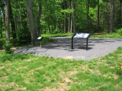
Location. 39° 44.308′ N, 77° 28.711′ W. Marker is near Blue Ridge Summit, Pennsylvania, in Franklin County. It is in Washington Township. Marker is on Charmian Road, on the right when traveling west. Located at the Rolando Woods Lions Club Memorial Park. Touch for map. Marker is at or near this postal address: 14306 Charmian Rd, Waynesboro PA 17268, United States of America. Touch for directions.
Other nearby markers. At least 8 other markers are within walking distance of this marker. 10,000 Soldiers Fight at Monterey Pass (a few steps from this marker); a different marker also named The Battle of Monterey Pass (a few steps from this marker); The Retreat From Gettysburg (within shouting distance of this marker); a different marker also named The Battle of Monterey Pass (within shouting distance of this marker); Brown's Spring (within shouting distance of this marker); a different marker also named The Battle of Monterey Pass (within shouting distance of this marker); Before The Battle Of Gettysburg (about 300 feet away, measured in a direct line); South Mountain (about 300 feet away). Touch for a list and map of all markers in Blue Ridge Summit.
More about this marker. In the lower left is a map of the area. The red line represents the roads that General Richard Ewell's Confederate Wagon Train traveled during July 4th and 5th of 1863 as it withdrew from Gettysburg through Fairfield Pass and Monterey Pass down the mountain twoard Waynesboro.
The blue line represents the routes taken by the Federal Cavalry during the battle of Monterey Pass.
You are about 30 yards east of where the blue and red lines meet.
Also see . . . Monterey Pass Battlefield Park and Museum. Franklin County website entry (Submitted on February 22, 2022, by Larry Gertner of New York, New York.)
Credits. This page was last revised on February 7, 2023. It was originally submitted on May 23, 2010, by Craig Swain of Leesburg, Virginia. This page has been viewed 1,711 times since then and 20 times this year. Photos: 1. submitted on July 2, 2016, by David Graff of Halifax, Nova Scotia. 2. submitted on November 14, 2016, by Larry Gertner of New York, New York. 3. submitted on May 23, 2010, by Craig Swain of Leesburg, Virginia.


