Cumberland Township near Gettysburg in Adams County, Pennsylvania — The American Northeast (Mid-Atlantic)
The Brian Farm
"His property … was thus under fire of the enemy and the very midst and thickest of the battle"
-damage claim of Abraham Brian
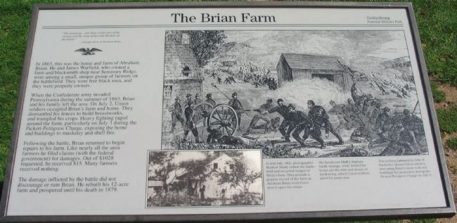
In 1863, this was the home and farm of Abraham Brian. He and James Warfield, who owned a farm and blacksmith shop near Seminary Ridge, were among a small, unique group of farmers on the battlefield. They were free black men, and they were property owners.
When the Confederate army invaded Pennsylvania during the summer of 1863, Brian and his family left the area. On July 2, Union soldiers occupied Brian's farm and home. They dismantled his fences to build breastworks, and trampled his crops. Heavy fighting raged around the farm, particularly on July 3 during the Pickett-Pettigrew Charge, exposing the home and buildings to musketry and shell fire.
Following the battle, Brian returned to begin repairs on his farm. Like nearly all the area farmers he filed claims (with the federal government) for damages. Out of $1028 requested, he received $15. Many farmers received nothing.
The damage inflicted by the battle did not discourage or ruin Brian. He rebuilt his 12-acre farm and prospered until his death in 1879.
Erected by Gettysburg National Military Park.
Topics. This historical marker is listed in these topic lists: African Americans • Agriculture • War, US Civil. A significant historical month for this entry is July 1867.
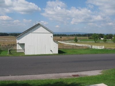
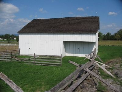
Location. 39° 48.928′ N, 77° 14.11′ W. Marker is near Gettysburg, Pennsylvania, in Adams County. It is in Cumberland Township. Marker is on Hancock Avenue, on the right when traveling north. Located next to the Brian Farm Buildings on Cemetery Ridge, at Gettysburg National Military Park. Touch for map. Marker is in this post office area: Gettysburg PA 17325, United States of America. Touch for directions.
Other nearby markers. At least 8 other markers are within walking distance of this marker. Abraham Brian Farm (a few steps from this marker); 111th New York Infantry (a few steps from this marker); Third Brigade (a few steps from this marker); 11th Mississippi Infantry Regiment (within shouting distance of this marker); 107th Regiment Pennsylvania Infantry (within shouting distance of this marker); Third Division (within shouting distance of this marker); 12th Regiment New Jersey Volunteers (within shouting distance of this marker); High Water Mark Walking Tour (within shouting distance of this marker). Touch for a list and map of all markers in Gettysburg.
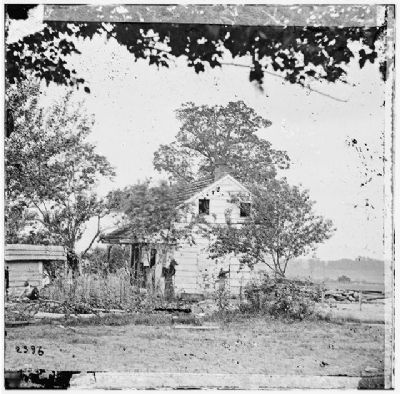
More about this marker. A wartime photo and a drawing on the right side of the marker further discuss the farm's history. In mid-July, 1863 photographer Mathew Brady
Photographed By Craig Swain, September 17, 2008
2. The Brian Farm House
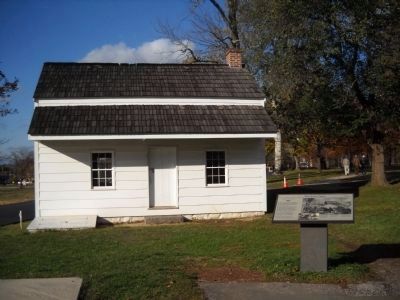
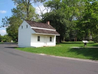
The marker stands to the right, in front of the farm house. After the battle, many visitors confused the Brian house with the nearby Leister House, the site of Meade's headquarters. Instead General Alexander Hays, of 3rd Division, II Corps, posted his headquarters in this vicinity. Much altered after the war, the house was rebuilt to its wartime appearance by the Park Service in the 20th century.
His farmhouse (left) displays battle damage, while behind the house are the rails and stones of his fencing, which Union soldiers piled for protection.
This etching (above) by John B. Bachelder shows Union infantry men using Brian's stone wall and buildings for protection during the Pickett-Pettigrew Charge on July 3.
Related markers. Click here for a list of markers that are related to this marker. Markers, Tablets and Monuments at the Brian Farm.
Also see . . .
1. Brian Farm. Sometimes spelled Bryan, Abraham was an African-American who worked a small plot here south of Gettysburg. (Submitted on December 21, 2008, by Craig Swain of Leesburg, Virginia.)
2. Abraham Bryan. Abraham Brian (or 'Bryan') apparently married the storied Catherine (or 'Katherine') "Kitty" Payne in late 1847 - the second marriage for both. (Submitted on May 26, 2010, by Richard E. Miller of Oxon Hill, Maryland.)
Additional keywords. Katherine "Kitty" Payne; Lincoln Cemetery.
Credits. This page was last revised on February 7, 2023. It was originally submitted on December 21, 2008, by Craig Swain of Leesburg, Virginia. This page has been viewed 2,669 times since then and 54 times this year. Last updated on May 26, 2010, by Richard E. Miller of Oxon Hill, Maryland. Photos: 1, 2. submitted on December 21, 2008, by Craig Swain of Leesburg, Virginia. 3. submitted on November 14, 2010, by Bill Coughlin of Woodland Park, New Jersey. 4, 5, 6. submitted on December 21, 2008, by Craig Swain of Leesburg, Virginia.
