Riverton in Barkhamsted in Litchfield County, Connecticut — The American Northeast (New England)
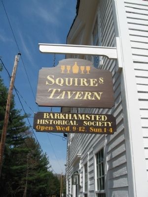
Squire's Tavern
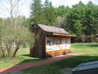
[ panel 1 ]
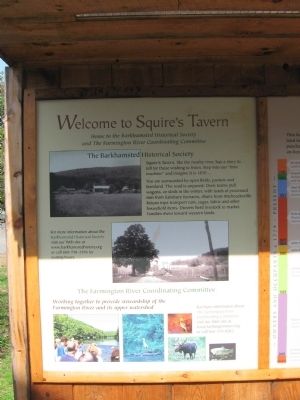
Welcome to Squire's Tavern
Home to the Barkhamsted Historical Society
and the Farmington River Coordinating Committee
The Barkhamsted Historical Society
Squire's Tavern, like the nearby river, has a story to tell for those wishing to listen. Step into our "time machine" and imagine it is 1830 . . .
You are surrounded by open fields, pasture and farmland. The road is unpaved. Oxen teams pull wagons, or sleds in the winter, with loads of processed iron from Salisbury furnaces, chairs from Hitchcocksville. Return trips transport rum, sugar, fabric and other household items. Drovers herd livestock to market. Families move toward western lands.
The Farmington River Coordinating Committee
Working together to provide stewardship of the Farmington River and its upper watershed.
[ panel 2 ]
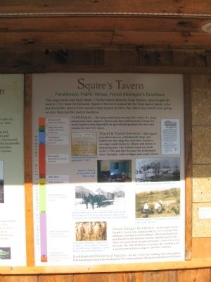
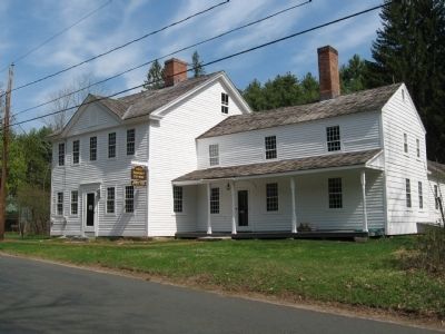
Squire's Tavern
Farmhouse, Public House, Forest Manager's Residence
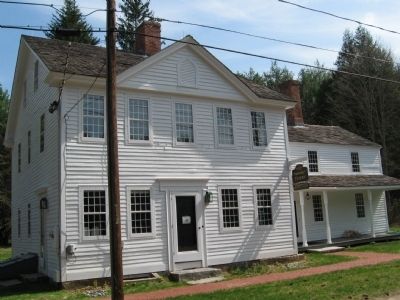
This large home was built about 1796 by Daniel Bennett, from Weston, who bought the land in 1795 from Eli Holcomb. Squire's Tavern is named for the Bela Squire family, who purchased the tavern from taverner Saul Upson in 1821. But there was much more going on here than just the Tavern business.
Farmhouse – The house and barns became the center of a large, prosperous farm. Squire's Tavern was first and foremost a home for many families who depended on agricultural products for food and income for over 125 years.
Travel & Travel Services – Bela Squire provided a tavern, a blacksmith shop, and stables for the stage line and other travelers on stage coach routes to Albany and points in Massachusetts. The Wolcott Road was built in the 1770s and later became the Farmington River Turnpike, with a tollgate just south of here.
Forest Ranger Residence – In the mid-1920s People's Forest was formed and by 1929 included the Ullmann farmland and buildings. This farm had been purchased by the Matthies family and donated to the State of Connecticut as part of the People's Forest. For over 60 years the old farmhouse served as the residence for a succession of forest rangers and their families.
Barkhamsted Historical Society – By the 1990s the building was unoccupied. BHS leased and restored the building that has witnessed over 200 years of Barkhamsted history.
[ panel 3 ]
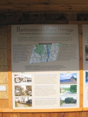
Barkhamsted's Rural Heritage
From Farms and Forests to Neighborhoods and Villages
A "Windsor" Town – The land comprising Barkhamsted was originally granted to the town of Windsor by the Colony of Connecticut. Starting in the 1730s, Barkhamsted was divided among 108 Windsor taxpayers, but few people settled here until after 1750. The town was incorporated in 1779.
Early Settlers – Barkhamsted was one of the last areas of Connecticut to be settled because it was located far from the seacoast and navigable rivers, and had poor land for farming. In addition to European immigrants, a group of multi-racial, multi-ethnic people settled an area that became known as the "Lighthouse Community."
Farming – Early settlers concentrated on subsistence farming. Money was scarce and transportation tenuous. Corn, oats, barley, rye, and flax were grown for home consumption. Hogs, cattle, cheese, butter and cider were sold to bring in income. Forested land provided firewood, lumber, and the resources for potash and charcoal production.
Population Decline – Like many rural New England hill towns, Barkhamsted's population experienced a steady decline starting in the early 19th century as industrialized cities and western lands beckoned.
[ panel 4 ]
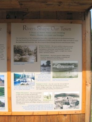
Rivers Shape Our Town
A Story of Water Power and Drinking
Water, Floods, Ice Jams and Bridges
The two branches of the Farmington River play a significant role in Barkhamsted history. The East Branch flowed through Barkhamsted Hollow until the Saville Dam was built to create the Barkhamsted Reservoir. The West Branch flows through Riverton and Pleasant Valley.
Water Power – The rivers and their tributaries turned the wheels of numerous mills for grinding grain, powering trip hammers, sawing logs, and producing a variety of products including chairs, wagons, wrought iron, window sashes, and house shutters.
Recreation – The rivers provide wildlife habitat as well as opportunities for fishing, swimming and canoeing, seen here on the West Branch. Nature's Fury – Over the years the rivers produced serious floods and ice jams causing damage to mills, houses, bridges, and roads. This impeded transportation and required bridge building and maintenance.
Water resource – the rivers provided a ready source of water for farms and businesses, and for harvesting ice before the days of refrigerators. When the Saville Dam was built in the 1930s, the Hartford area gained a major source of high quality water, although several farms and villages along the East Branch were displaced.
Topics. This historical marker is listed in these topic lists: Landmarks • Notable Buildings. A significant historical year for this entry is 1830.
Location. 41° 55.435′ N, 72° 59.803′ W. Marker is in Barkhamsted, Connecticut, in Litchfield County. It is in Riverton. Marker is on East River Road, one mile north of Ripley Hill Road (Connecticut Route 318), on the right when traveling north. Located in the People's State Forest. Touch for map. Marker is at or near this postal address: 100 East River Road, Barkhamsted CT 06063, United States of America. Touch for directions.
Other nearby markers. At least 8 other markers are within 2 miles of this marker, measured as the crow flies. Demonstration Charcoal Mound (about 700 feet away, measured in a direct line); The Charcoal Industry (about 700 feet away); Austin Hawes Memorial Campground (approx. 0.8 miles away); Camp White (approx. 1.2 miles away); Barkhamsted Lighthouse Village Cellar Holes (approx. 1.4 miles away); Barkhamsted Lighthouse Village Grind Stone (approx. 1.4 miles away); Barkhamsted Lighthouse Village Stone Quarry (approx. 1.4 miles away); Barkhamsted Lighthouse Village Cemetery (approx. 1.4 miles away). Touch for a list and map of all markers in Barkhamsted.
Regarding Squire's Tavern. Squire's Tavern is the home of the Barkhamsted Historical Society.
Also see . . . Barkhamsted Historical Society. Farmington Valley CT Heritage Network website homepage (Submitted on November 2, 2022, by Larry Gertner of New York, New York.)
Credits. This page was last revised on February 10, 2023. It was originally submitted on May 26, 2010, by Michael Herrick of Southbury, Connecticut. This page has been viewed 1,141 times since then and 34 times this year. Photos: 1, 2, 3, 4, 5, 6, 7, 8. submitted on May 26, 2010, by Michael Herrick of Southbury, Connecticut.
