Atlantic Beach in Carteret County, North Carolina — The American South (South Atlantic)
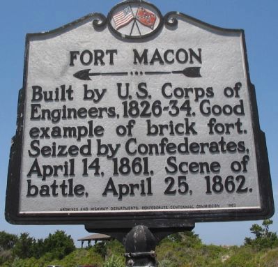
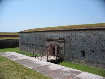
Fort Macon
Erected 1962 by Archives and Highway Departments and Confederate Centennial Commission. (Marker Number CCC-1.)
Topics and series. This historical marker is listed in these topic lists: Forts and Castles • War, US Civil. In addition, it is included in the Battlefield Trails - Civil War, and the North Carolina Division of Archives and History series lists. A significant historical date for this entry is April 14, 1846.
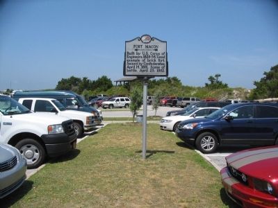
Location. 34° 41.851′ N, 76° 40.669′ W. Marker is in Atlantic Beach, North Carolina, in Carteret County. Marker is on East Fort Macon Road, in the median. Located in the parking lot at Fort Macon State Park. Touch for map. Marker is in this post office area: Atlantic Beach NC 28512, United States of America. Touch for directions.
Other nearby markers. At least 8 other markers are within walking distance of this marker. A different marker also named Fort Macon (within shouting distance of this marker); Queens Anne's Revenge (within shouting distance of this marker); Fort Macon Coast Guard Station (within shouting distance of this marker); World War II Defenses (within shouting distance of this marker); Fort Macon in the 1920s and 1930s (about 300 feet away, measured in a direct line); Bogue Banks Lighthouse (about 300 feet away); Officers Quarters at Fort Macon (about 300 feet away); The Military Post of Fort Macon in the Nineteenth Century (about 300 feet away). Touch for a list and map of all markers in Atlantic Beach.
Related markers. Click here for a list of markers that are related to this marker. Fort Macon, including siege operations in March-April 1862, by markers.
Also see . . . Fort Macon State Park. A history of the fort. (Submitted on May 29, 2010, by Craig Swain of Leesburg, Virginia.)
Credits. This page was last revised on June 12, 2023. It was originally submitted on May 29, 2010, by Craig Swain of Leesburg, Virginia. This page has been viewed 1,119 times since then and 9 times this year. Photos: 1, 2, 3. submitted on May 29, 2010, by Craig Swain of Leesburg, Virginia.


