Society Hill in Philadelphia in Philadelphia County, Pennsylvania — The American Northeast (Mid-Atlantic)
Society Hill / The New Market and Head House
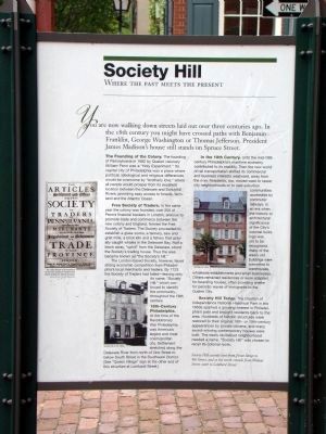
SOCIETY HILL. Where the past meets the present. You are now walking down streets laid out over three centuries ago. In the 18th century you might have crossed paths with Benjamin Franklin, George Washington or Thomas Jefferson. President James Madison’s house still stands on Spruce Street.
The Founding of the Colony. The founding of Pennsylvania in 1682 by Quaker visionary William Penn was a “Holy Experiment.” Its capital city of Philadelphia was a place where political, ideological and religious differences would be overcome by “brotherly love,” where all people would prosper from its excellent location between the Delaware and Schuylkill Rivers, providing easy access to forests, farmland and the Atlantic Ocean.
Free Society of Traders. In the same year the colony was founded, over 200 of Penn’s financial backers in London, anxious to promote trade and commerce between the new colony and England, formed the Free Society of Traders. The Society proceeded to establish a glass works, a tannery, saw and grist mills, a brick kiln and a fishery that actually caught whales in the Delaware Bay. Half a block away, “uphill” from the Delaware, stood the Society’s trading house. Thus the area became known as “the Society’s hill.”
The London-based Society, however, faced strong economic competition from Philadelphia’s local merchants and traders. By 1723 the Society of Traders had failed—leaving only its name, “Society Hill,” which continued to identify the community throughout the 18th century.
18th-Century Philadelphia. At the time of the Revolutionary War Philadelphia was America’s largest and most cosmopolitan city. Settlement stretched along the Delaware River from north of Vine Street to below South Street in the Southwark District. [See “Queen Village” sign at the other end of this structure at Lombard Street.]
In the 19th Century. Until the mid-19th century Philadelphia’s maritime economy contributed to its stability. Then the new world of rail transportation shifted its commercial and business interests westward, away from the river. Residents, too, moved west to newer city neighborhoods or to new suburban communities accessible by commuter railways. In an era when the historic or architectural significance of the City’s colonial build- ings was yet to be recognized, many of the area’s old buildings were converted to warehouses, wholesale establishments and small businesses. Others remained residences or were adapted for boarding houses, often providing shelter for periodic waves of immigrants to the Quaker City.
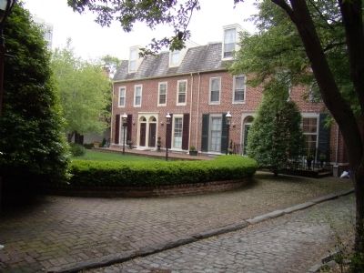
Society Hill Today. The creation of Independence National Historical Park in the 1950s sparked a growing interest in Philadelphia’s past and brought residents back to the area. Hundreds of historic structures were restored to their original 18th- or 19th-century appearances by private citizens, and many award-winning contemporary houses were built. The newly revitalized neighborhood needed a name. “Society Hill” was chosen to recall its colonial roots.
Society Hill extends west from Front Street to 8th Street, and at the north extends from Walnut Street south to Lombard Street.
(sidebar) Cover page of the 1682 Articles of incorporation for the Free Society of Traders from which Society Hill derives its name. It reads “The Articles of Settlement and Offices of the Free Society of Traders in Pennsilvania: Agreed upon by divers Merchants and Others for the better Improvement and Government of Trade in that Province.” “London, Printed for Benjamin Clark in George-Tard in Lombard-street, Printer to the Society of Pennsilvania,
MDCLXXXII.”
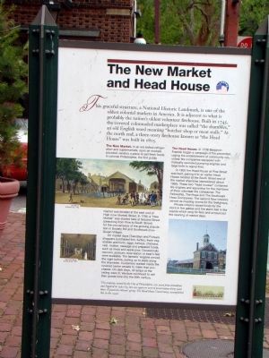
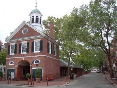
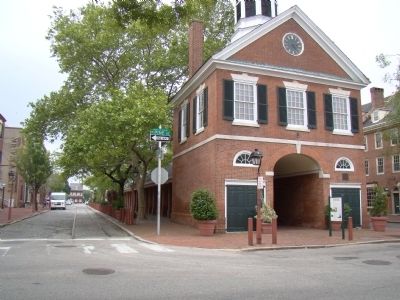
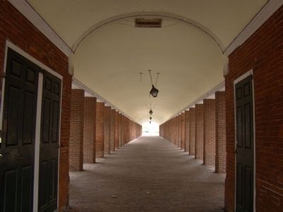
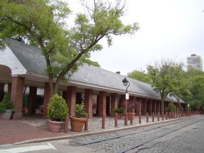
THE NEW MARKET AND HEAD HOUSE. This graceful structure, a National Historic Landmark, is one of the oldest colonial markets in America. It is adjacent to what is probably the nation’s oldest volunteer firehouse. Built in 1745, the covered colonnaded marketplace was called “the shambles,” an old English word meaning “butcher shop or meat stalls.” At the north end, a three-story firehouse known as “the Head House” was built in 1805.
The New Market. In an era before refrigeration and supermarkets, open air markets provided vendors a place to sell fresh foods. In colonial Philadelphia, the first public market was located at the east end of High (now Market) Street. In 1745, a “New Market” was started here at Second Street (stretching from Pine to South Street) for the convenience of the growing population in Society Hill and Southwark (now Queen Village).
On market days (Tuesdays and Fridays) shoppers purchased fish, turtles, fresh vegetables and fruits, eggs, turkeys, chickens, veal, mutton, sausage and prepared foods, such as meat and apple pies. Occasionally raccoon, possum, bear-bacon or bear’s feet were available. The farmers’ wagons arrived the night before,
pulling up to stalls along the shambles. Customers walked inside the covered center arcade to make their purchases. On dark days, oil lamps at the ceiling were lit. Vendors continued to sell their goods here into the 20th century.
The Head House. In 1736 Benjamin Franklin began a campaign of fire prevention, urging the establishment of community volunteer fire companies equipped with manually operated pumping engines and large bells to signal fires.
In 1805 the Head House at Pine Street was built, pairing it to an earlier Head House located at the South Street end of the market shambles (demolished about 1860). These two “head houses” contained fire engines and apparatus for the members of three volunteer fire companies: The Fellowship, The Hope and The Southwark Hose Companies. The second floor interiors served as meeting rooms for the firefighters.
Private citizens raised funds for the clock in the gables and the alarm bell in the cupola which rang for fires and announced the opening of market days.
This property, owned by the City of Philadelphia, was saved from demolition and repaired in 1962-63, but was again in need of preservation thirty years later A grassroots citizens’ group, The Head House Conservancy, accomplished
this in the 1990s.
Topics and series. This historical marker is listed in this topic list: Colonial Era. In addition, it is included in the Former U.S. Presidents: #04 James Madison, and the National Historic Landmarks series lists. A significant historical year for this entry is 1682.
Location. 39° 56.582′ N, 75° 8.717′ W. Marker is in Philadelphia, Pennsylvania, in Philadelphia County. It is in Society Hill. Marker is at the intersection of Pine Street and South 2nd Street, on the right when traveling east on Pine Street. It is at the north entrance to the New Market building. Touch for map. Marker is in this post office area: Philadelphia PA 19106, United States of America. Touch for directions.
Other nearby markers. At least 10 other markers are within walking distance of this marker. Queen Village / The New Market and Head House (about 300 feet away, measured in a direct line); Capt. Charles Massey House (about 400 feet away); “A Man Full of Trouble” Tavern (about 600 feet away); Thaddeus Kosciuszko (about 600 feet away); a different marker also named Thaddeus Kosciuszko (about 600 feet away); Davis-Lenox House (about 600 feet away); Corporal Michael J. Crescenz (about 700 feet away); POW★MIA
(about 700 feet away); St. Peter's (about 700 feet away); Tracings from the National Vietnam Veterans Memorial (about 700 feet away). Touch for a list and map of all markers in Philadelphia.
More about this marker. In addition to the reproduction of the cover page of the Free Society of Traders Articles of incorporation on the left, the Society Hill face of the marker also shows two photographs: A black-and-white photo of a townhouse captioned “Society Hill in the 1950s” and color photograph of what appears to be the same townhouse, now restored, captioned “Society Hill today.”
The New Market and Head House face of the marker has three images. The largest (center-left) is a color illustration of the market shown from Lonbard Street captioned “New Market, W. Birch & Son, 1799.”. Below it on the left is a smaller illustration of the inside of the arcade with the same caption. On the bottom right is a color photograph captioned “Head House in the late 1950s.” The logotype of the Head House Conservancy is on the marker’s lower right.
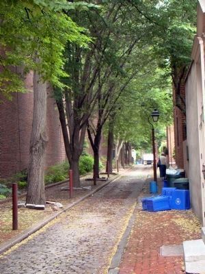
Photographed By J. J. Prats, May 14, 2010
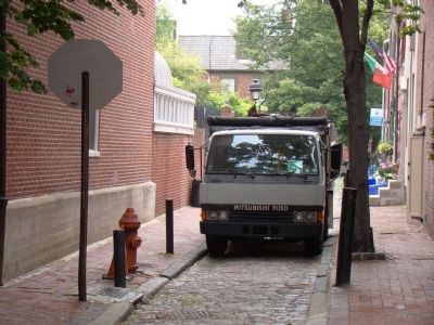
7. Stamper Street, Society Hill
This view is from 2nd Street at the New Market. Stamper street stretches from 2nd Street to St. Peter’s Church churchyard, beyond the treecover in the distance. The bright spot just beyond the pedestrian where the court in Photograph 8 opens to Stamper Street.
Related marker. Click here for another marker that is related to this marker. It is the Queen Village marker at the south end of the New Market.
Also see . . . Wikipedia Entry for Society Hill. “Society Hill is an affluent neighborhood in the Center City section of Philadelphia, Pennsylvania, United States. The neighborhood, loosely defined as bounded by Walnut, Lombard, Front and 7th Streets, contains the largest concentration of original 18th- and early 19th-century architecture of any place in the United States. Much like Beacon Hill in Boston, Society Hill is noted as a charming district with cobblestone streets bordered by brick rowhouses in Federal and Georgian style.” (Submitted on May 30, 2010.)
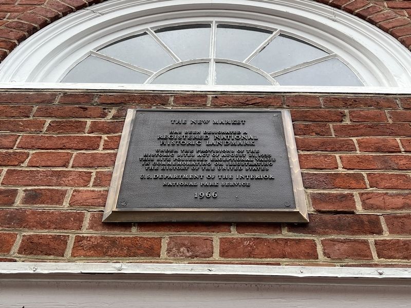
Photographed By Devry Becker Jones (CC0), January 13, 2023
10. National Historic Landmark Plaque for the New Market
Credits. This page was last revised on February 2, 2023. It was originally submitted on May 30, 2010, by J. J. Prats of Powell, Ohio. This page has been viewed 1,432 times since then and 45 times this year. Photos: 1, 2, 3, 4, 5, 6, 7, 8, 9. submitted on May 30, 2010, by J. J. Prats of Powell, Ohio. 10. submitted on January 16, 2023, by Devry Becker Jones of Washington, District of Columbia.
