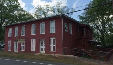
Loachapoka in Lee County, Alabama — The American South (East South Central)
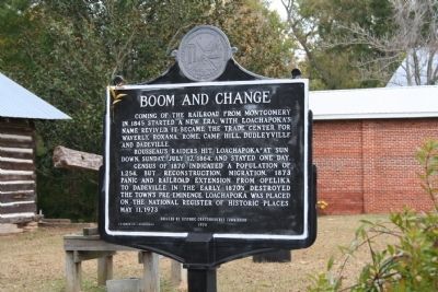
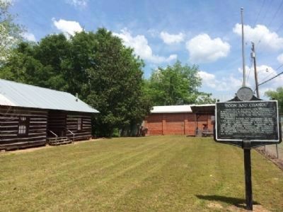
Boom and Change
Rousseau's Raiders hit Loachapoka at sun down, Sunday, July 17, 1864, and stayed one day.
Census of 1870 indicated a population of 1,254, but reconstruction, migration, 1873 panic and railroad extension from Opelika to Dadeville in the early 1870's destroyed the town's pre-eminence, Loachapoka was placed on the National Register of historic places May 11, 1973.
Erected 1978 by Historic Chattahoochee Commission.
Topics. This historical marker is listed in this topic list: Notable Events. A significant historical date for this entry is May 11, 1745.
Location. 32° 36.266′ N, 85° 35.903′ W. Marker is in Loachapoka, Alabama, in Lee County. Marker is on Stage Road. Touch for map. Marker is in this post office area: Loachapoka AL 36865, United States of America. Touch for directions.
Other nearby markers. At least 8 other markers are within 7 miles of this marker, measured as the crow flies. Dr. Alexander Nunn / Lee County Historical Society (here, next to this marker); Loachapoka Historic District (a few steps from this marker); First Rosenwald School (approx. 0.4 miles away); Birthplace of Zora Neale Hurston (approx. 4.8 miles away); Bethlehem (approx. 5.7 miles away); J. F. Drake High School / Alma Mater (approx. 6.1 miles away); Sigma Alpha Epsilon (approx. 6.2 miles away); Max Adams Morris / Max Adams Morris Drill Field (approx. 6.3 miles away). Touch for a list and map of all markers in Loachapoka.
Credits. This page was last revised on June 16, 2016. It was originally submitted on May 31, 2010, by L Stanford of Auburn, United States. This page has been viewed 1,430 times since then and 64 times this year. Photos: 1. submitted on May 31, 2010, by L Stanford of Auburn, United States. 2, 3, 4, 5. submitted on May 9, 2014, by Mark Hilton of Montgomery, Alabama. • Kevin W. was the editor who published this page.
