Twin Falls in Twin Falls County, Idaho — The American West (Mountains)
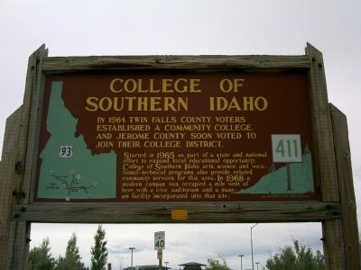
College of Southern Idaho
Started in 1965 as part of a state and national effort to expand local educational opportunity, College of Southern Idaho arts, science, and vocational-technical programs also provide related community services for this area. In 1968, a modern campus was occupied a mile west of here, with a civic auditorium and a museum facility incorporated into that site.
Erected by Idaho Historical Society. (Marker Number 411.)
Topics and series. This historical marker is listed in this topic list: Education. In addition, it is included in the Idaho State Historical Society series list. A significant historical year for this entry is 1964.
Location. 42° 35.912′ N, 114° 27.282′ W. Marker is in Twin Falls, Idaho, in Twin Falls County. Marker is on U.S. 93 at milepost 50,, 0.1 miles north of Bridgeview Road, on the right when traveling south. Marker is located next to the Perrine Bridge in Twin Falls close to the Visitor's Center. Touch for map. Marker is in this post office area: Twin Falls ID 83301, United States of America. Touch for directions.
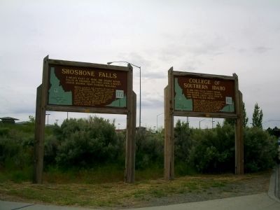
Other nearby markers. At least 8 other markers are within 3 miles of this marker, measured as the crow flies. Robert Evel Knievel (here, next to this marker); Ira Burton Perrine (here, next to this marker); Shoshone Falls (here, next to this marker); Emigrant Road (approx. 1˝ miles away); Shoshone Falls Project (approx. 2.6 miles away); a different marker also named Shoshone Falls (approx. 2.7 miles away); Clarence Bisbee (approx. 2.7 miles away); a different marker also named Shoshone Falls (approx. 2.7 miles away). Touch for a list and map of all markers in Twin Falls.
Credits. This page was last revised on June 16, 2016. It was originally submitted on June 4, 2010, by Rebecca Maxwell of Boise, Idaho. This page has been viewed 1,395 times since then and 10 times this year. Photos: 1, 2, 3. submitted on June 4, 2010, by Rebecca Maxwell of Boise, Idaho. • Craig Swain was the editor who published this page.


