Midlothian in Chesterfield County, Virginia — The American South (Mid-Atlantic)
Mid-Lothian Mines and Rail Roads
The Mid-Lothian African Church
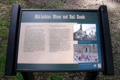
Near the Grove Shaft, 54 free blacks, slaves and six white males at the Mid-Lothian Coal Mining Company started the Mid-Lothian African Church on February 8, 1846. Assisted by the company the 60 member congregation built a log meetinghouse at the pits. Many slaves were rented yearly by the company. The Reverend Jordan Martin, pastor of nearby Tomahawk Baptist Church, became their first pastor. The Mid-Lothian Coal Mining Company contributed one percent of the money received from the sale of hard coal toward the expenses of the church. Later, the congregation moved to its Winterfield tract and today is the thriving First Baptist Church of Midlothian.
The Grove Shaft Ruins
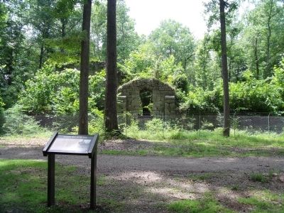
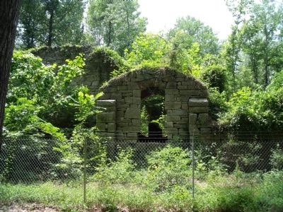
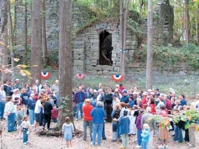
A final effort in the 1920s by the Murphy Coal Corporation to pump out and reopen the Grove Shaft proved unprofitable and led to its close. The stone structure, once the company’s main building, housed workings such as ventilating fans, steam boilers, pumps and hoisting equipment. Today the two-story granite ruins of the Grove Shaft stand as the sole architectural remnant of a once dominating local enterprise connected to coal mining in the Richmond Coal Basin. They serve as a reminder of the Mid-Lothian Coal Mining Company and of other area collieries that once supported a flourishing local industry, North America’s first commercial coal mining venture.
Erected 2009 by Chesterfield Heritage Alliance, Chesterfield County Parks & Recreation.
Topics. This historical marker is listed in these topic lists: African Americans • Churches & Religion • Industry & Commerce • Natural Resources. A significant historical month for this entry is February 1882.
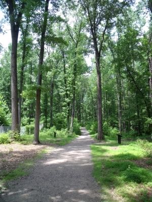
Location. 37° 29.416′ N, 77° 38.602′ W. Marker is in Midlothian, Virginia, in Chesterfield County. Marker can be reached from North Woolridge Road, 0.3 miles south of Walton Park Road. This marker is located along the multi-use trail in the Mid-Lothian Mines Park. Touch for map. Marker is at or near this postal address: 13301 North Woolridge Road, Midlothian VA 23114, United States of America. Touch for directions.
Other nearby markers. At least 8 other markers are within walking distance of this marker. A different marker also named Mid-Lothian Mines and Rail Roads (a few steps from this marker); a different marker also named Mid-Lothian Mines and Rail Roads (about 500 feet away, measured in a direct line); a different marker also named Mid-Lothian Mines and Rail Roads (about 700 feet away); a different marker also named Mid-Lothian Mines and Rail Roads (approx. 0.3 miles away); Headstock (approx. 0.4 miles away); The Bermuda Hundred Campaign (approx. 0.4 miles away); From Mines to Market (approx. 0.4 miles away); Midlothian Coal Mines (approx. 0.9 miles away). Touch for a list and map of all markers in Midlothian.
More about this marker. On the upper right is a photo of "Grove Shaft 1911, Murphy Coal Corp. Photograph courtesty of Diane Reams."
On the lower right is a photo of the "Mid-Lothian Mines Park opening 2004."
Also see . . . Mid-Lothian Mines Park. Park website homepage (Submitted on October 10, 2022, by Larry Gertner of New York, New York.)
Credits. This page was last revised on October 10, 2022. It was originally submitted on June 6, 2010, by Bernard Fisher of Richmond, Virginia. This page has been viewed 947 times since then and 26 times this year. Photos: 1, 2, 3, 4, 5. submitted on June 6, 2010, by Bernard Fisher of Richmond, Virginia.
