Near Erwin in Harnett County, North Carolina — The American South (South Atlantic)
Smiley's Falls
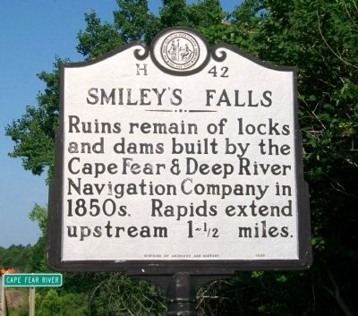
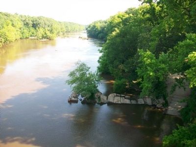
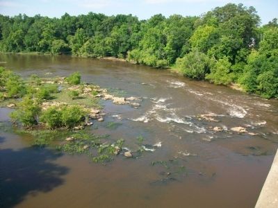
Ruins remain of locks and dams built by the Cape Fear & Deep River Navigation Company in 1850s. Rapids extend upstream 1-˝ miles.
Erected 1996 by NC Division of Archives and History. (Marker Number H-42.)
Topics and series. This historical marker is listed in this topic list: Waterways & Vessels. In addition, it is included in the North Carolina Division of Archives and History series list.
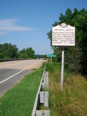
Location. 35° 18.743′ N, 78° 41.47′ W. Marker is near Erwin, North Carolina, in Harnett County. Marker is on South 13th Street (State Highway 217) one mile south of Erwin City Street (State Highway 82), on the right when traveling south. NC Hwy 217 bridge over Cape Fear River at Erwin. Touch for map. Marker is at or near this postal address: 2130 North Carolina 217, Erwin NC 28339, United States of America. Touch for directions.
Other nearby markers. At least 8 other markers are within 4 miles of this marker, measured as the crow flies. "Lebanon" (approx. 3.1 miles away); Averasboro Battlefield Museum (approx. 3.3 miles away); North Carolina (approx. 3.4 miles away); Battle of Averasboro (approx. 3.4 miles away); Model 1841 6-pounder Gun (approx. 3.4 miles away); Union Headquarters (approx. 3˝ miles away); Chicora Cemetery (approx. 3˝ miles away); Men of South Carolina (approx. 3˝ miles away).
More about this marker. Marker is located on northeast side of bridge.
Also see . . .
1. Cape Fear Navigation Company. North Carolina History Project website entry (Submitted on June 7, 2010, by Cleo Robertson of Fort Lauderdale, Florida.)
2. Acts of the General Assembly of North Carolina. GoogleBooks website entry:
Extracts of "A new digested manual of the acts of the General Assembly of North Carolina" pertaining to the Cape Fear & Deep River Navigation Company. (Submitted on June 7, 2010, by Cleo Robertson of Fort Lauderdale, Florida.)
Additional commentary.
1. Cape Fear Navigation Company
Repeated attempts were made during the antebellum era to extend the navigable waters of the Cape Fear River above Fayetteville. Smiley’s Falls, in southern Harnett County near Erwin, proved to be the “greatest obstacle to the opening of navigation” on that stretch of the river, according to an 1848 report.
The Cape Fear Navigation Company, chartered by the legislature in 1816, made the initial effort. Using slave labor, the company began construction that same year on canals to bypass Smiley’s Falls and Buckhorn Falls in the northern part of the county. The impregnable rock, part of the fall line, stopped the canal work. That same rock constitutes the falls themselves, where
in a succession of ledges the water falls on average six to eighteen inches and in places as much as five feet. The water is funneled at Narrow Gap into a thirty-foot wide gap in the bedrock, resulting in a fast and treacherous current. The falls take their name from two settlers of the area, brothers Matthew and Nathaniel Smiley (also spelled Smylie).
Renewed effort to improve river navigation came in the 1852 when the Cape Fear and Deep River Navigation Company, following the recommendation of an engineering study conducted by state engineer Hamilton Fulton in 1819, built a series of locks and dams along the length of the Cape Fear through Harnett County. On the eve of the Civil War flooding destroyed the greater part of the locks and dams. Remains can be seen to this day.
References:
(1) Cape Fear and Deep River Navigation Company, Report of the Chief Engineer (1850)
(2) Cape Fear and Deep River Navigation Company, Report on the Cape Fear River and Deep Rivers (1848)
(3) Hamilton Fulton, Report to the Board of Internal Improvements (1819)
(4) Malcolm Fowler, They Passed This Way: A Personal Narrative of Harnett County History (1955)
(5) Heritage of Harnett County (1993)
— Submitted June 12, 2010, by Cleo Robertson of Fort Lauderdale, Florida.
Credits. This page was last revised on April 18, 2024. It was originally submitted on June 6, 2010, by Cleo Robertson of Fort Lauderdale, Florida. This page has been viewed 2,340 times since then and 94 times this year. Photos: 1, 2, 3, 4. submitted on June 6, 2010, by Cleo Robertson of Fort Lauderdale, Florida. • Craig Swain was the editor who published this page.


