Linthicum Heights in Anne Arundel County, Maryland — The American Northeast (Mid-Atlantic)
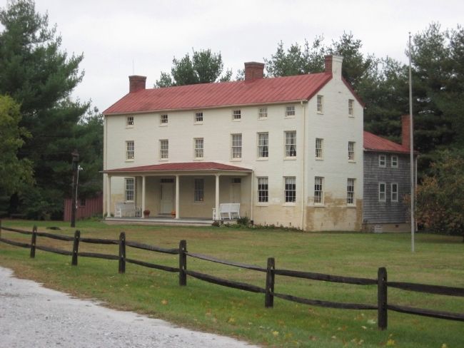
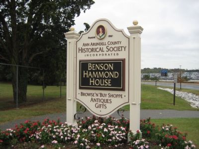
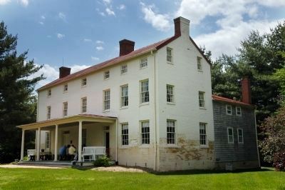
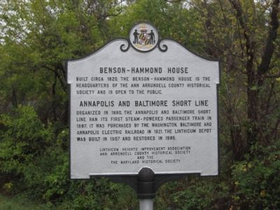
Benson-Hammond House
Built circa 1820, the Benson-Hammond House is the headquarters of the Ann Arundell County Historical Society and is open to the public.
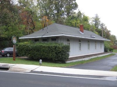
Annapolis and Baltimore Short Line
Organized in 1880, the Annapolis and Baltimore Short Line ran its first steam-powered passenger train in 1887. It was purchased by the Washington, Baltimore and Annapolis Electric Railroad in 1921. The Linthicum Depot was built in 1907 and restored in 1985.
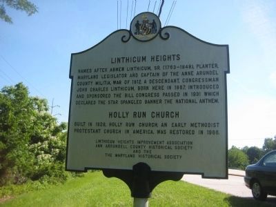
Linthicum Heights
Named after Abner Linthicum, Sr. (1763-1848), planter, Maryland legislator and captain of the Anne Arundel County Militia, War of 1812. A descendant, Congressman John Charles Linthicum, born here in 1867, introduced and sponsored the bill congress passed in 1931 which declared the Star Spangled Banner the National Anthem.
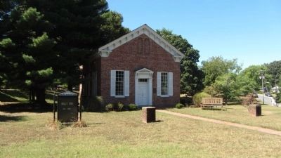
Holly Run Church
Built in 1828, Holly Run Church, an early Methodist Protestant Church in America, was restored in 1966.
Erected by Linthicum Heights Improvement Association, Ann Arundell County Historical Society, Maryland Historical Society.
Topics. This historical marker is listed in these topic lists: Churches & Religion • Railroads & Streetcars • Settlements & Settlers • War of 1812. A significant historical year for this entry is 1820.
Location. 39° 12.416′ N, 76° 39.15′ W. Marker is in Linthicum Heights, Maryland, in Anne Arundel County. Marker is on N. Camp Meade Rd (Maryland Route 170) 0.1 miles north of Maple Road. Touch for map. Marker is at or near this postal address: 208 Valley Rd, Linthicum Heights MD 21090, United States of America. Touch for directions.
Other nearby markers. At least 8 other markers are within 2 miles of this marker, measured as the crow flies. In Honor of Those Who Served (about 600 feet away, measured in a direct line); Linthicum Heights (about 600 feet away); The Heart Spoke (approx. 0.2 miles away); Holly Run Church (approx. ¼ mile away); The Freedom Tree (approx. half a mile away); Donald Emerson Shay, Jr. (approx. half a mile away); Pumphrey Elementary School (approx. one mile away); Pumphrey (approx. 1.2 miles away). Touch for a list and map of all markers in Linthicum Heights.
Also see . . .
1. The Ann Arrundell County Historical Society. “The Ann Arrundell County Historical Society seeks to encourage and inspire present and future generations to preserve and explore the County’s history to foster a greater appreciation for our shared legacy.” (Submitted on May 20, 2008, by Tabitha Preast of Hanover, Maryland.)
2. Linthicum Heights United Methodist Church. The Benson and Hammond families were among the founders and early members of the Holly Run Church. Their descendants continue to be active members of the Linthicum Heights United Methodist Church. (Submitted on May 20, 2008, by Tabitha Preast of Hanover, Maryland.)
Photographed By F. Robby, October 25, 2007
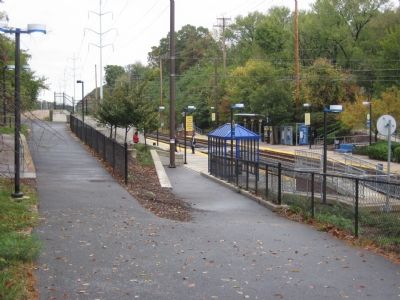
9. Linthicum Light Rail Station
This Light Rail station serves the community of Linthicum, located .2 miles south of the historic marker. The Light Rail line was built on the right-of-way of the Annapolis and Baltimore Short Line as it wends through Linthicum.
Photographed By Tabitha Preast, May 18, 2008
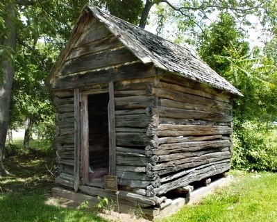
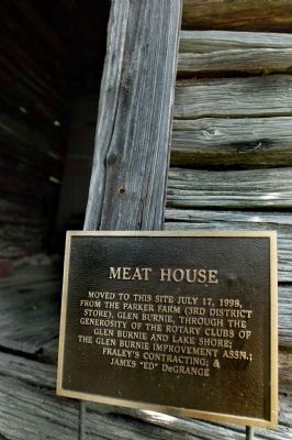
11. Meat House
Moved to this site July 17, 1998, from the Parker Farm (3rd District Store), Glen Burnie, through the generosity of the Rotary Clubs of Glen Burnie and Lake Shore; the Glen Burnie Improvement Assn.; Fraley's Contracting; & James "Ed" DeGrange
Credits. This page was last revised on December 28, 2020. It was originally submitted on October 26, 2007, by F. Robby of Baltimore, Maryland. This page has been viewed 5,455 times since then and 77 times this year. Photos: 1. submitted on October 26, 2007, by F. Robby of Baltimore, Maryland. 2. submitted on June 13, 2008, by F. Robby of Baltimore, Maryland. 3. submitted on May 20, 2008, by Tabitha Preast of Hanover, Maryland. 4, 5. submitted on October 26, 2007, by F. Robby of Baltimore, Maryland. 6. submitted on May 20, 2008, by Tabitha Preast of Hanover, Maryland. 7. submitted on September 4, 2013, by F. Robby of Baltimore, Maryland. 8, 9. submitted on October 26, 2007, by F. Robby of Baltimore, Maryland. 10, 11. submitted on May 20, 2008, by Tabitha Preast of Hanover, Maryland. • Kevin W. was the editor who published this page.
![Benson-Hammond House Marker</b> [in Front Yard Garden Bed]. Click for full size. Benson-Hammond House Marker</b> [in Front Yard Garden Bed] image. Click for full size.](Photos/23/Photo23888.jpg?11252005)
