Near Richmond in Madison County, Kentucky — The American South (East South Central)
Slavery at Pleasant View Farm
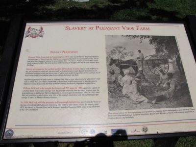
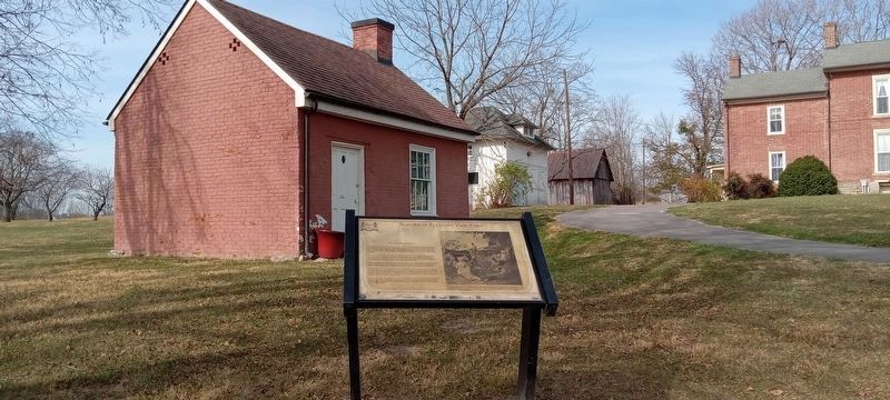
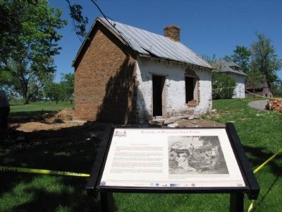
Pleasant View Farm had its beginnings in 1801 when Joseph Barnett bought 578 acres on the Hayes Fork of Silver Creek. By 1824 he had constructed the brick house that stands today. About the same time, Barnett is believed to have built the three slave houses that are known to have stood on the property in 1850. The brick portion of this building is thought to be one of those original slave dwellings.
Slaves accompanied the earliest settlers to Madison County. Slaves were property, labor, and a source of wealth and, like most well-to-do landowners, Joseph Barnett owned slaves. In 1820 Barnett owned twenty-one slaves, nine of whom were under the age of ten. Some, perhaps all, of those slaves lived in this and the other two dwellings that stood near here.
Barnett was probably the only owner of Pleasant View farm to grow labor-intensive "plantation" crops such as hemp, flax, and tobacco. Production of these crops, which were grown by most prosperous Madison County farms in the first half of the 19th century, was heavily dependent on slave labor.
William McCord, who bought the house and 200 acres in 1846, operated a typical, diversified family farm. Cattle and hogs were the principal livestock; corn and sweet potatoes were the principal crops. Like Barnett, McCord depended on slaves to provide the farm's labor. In 1850, when McCord owned seven adult slaves, over 34% of the county's population were slaves, the largest percentage of slaves in Madison County's history.
In 1856 McCord sold the property to Kavenaugh Armstrong, who lived in the house at the time of the Battle of Richmond. Armstrong, who had two adult slaves, owned the property until 1875, but slavery at Pleasant View and in Kentucky ended in December 1865, when it was abolished by the 13th Amendment.
Erected by Civil War Discovery Trail.
Topics. This historical marker is listed in this topic list: War, US Civil. A significant historical month for this entry is December 1865.
Location. 37° 39.844′ N, 84° 15.063′ W. Marker is near Richmond, Kentucky, in Madison County. Marker can be reached from Battlefield Memorial Highway (U.S. 421), on the right when traveling south. Marker is located on the grounds of the Pleasant View Farm; the Battle of Richmond battlefield park. Touch for map. Marker is in this post office area: Richmond KY 40475, United States of America. Touch for directions.
Other nearby markers. At least 8 other markers are within walking distance of this marker. Battle of Richmond (here, next to this marker); a different marker also named The Battle of Richmond (here, next to this marker); In Honor and Remembrance (a few steps from this marker); General Thomas Churchill

Photographed By Lee Hattabaugh, May 6, 2010
2. Slavery at Pleasant View Farm Marker
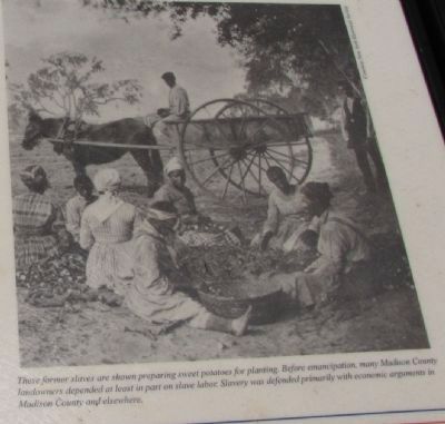
These former slaves are shown preparing sweet potatoes for planting. Before emancipation, many Madison County landowners depended at least in part on slave labor. Slavery was defended primarily with economic arguments in Madison County and elsewhere.
Additional commentary.
1. Archaeology at Pleasant View
At the time of my visit in May, archaeologists from the Commonwealth of Kentucky were on-site conducting a dig of the area surrounding the remaining slave house. Several interesting items (buttons, glass, et c.) were found while I was there.
— Submitted June 7, 2010, by Lee Hattabaugh of Capshaw, Alabama.
Credits. This page was last revised on December 2, 2022. It was originally submitted on June 7, 2010, by Lee Hattabaugh of Capshaw, Alabama. This page has been viewed 1,725 times since then and 52 times this year. Photos: 1, 2. submitted on June 7, 2010, by Lee Hattabaugh of Capshaw, Alabama. 3. submitted on November 15, 2022, by Craig Doda of Napoleon, Ohio. 4. submitted on June 7, 2010, by Lee Hattabaugh of Capshaw, Alabama. • Craig Swain was the editor who published this page.


